Below is what I have written so far in my history of Fullerton. You can support this independent research and writing project on Patreon.
Introduction
In researching the history of my hometown (Fullerton, California), I have encountered two basic types of history books.
The first is what I would call “nostalgic” books. These books treat the past in a rather idealized way. A good example of this is Ostrich Eggs for Breakfast, which is the history of Fullerton I had to read in third grade. An adult example is Fullerton: A Pictorial History by Bob Ziebell. Books like this, usually written by amateur historians (like me!), tend to gloss over or ignore completely the more unpleasant aspects of history, like racism and discrimination. These books tend to avoid critical thinking, preferring to celebrate local politicians, businesses, and cultural traditions. This is their main flaw, in my opinion.
The second type of history book I’ve found are “academic” ones. While there are no academic books I’ve found that focus exclusively on Fullerton, there are a handful of academic books and articles on Orange County, and they sometimes discuss Fullerton. These books usually do not ignore the unpleasant aspects of history, but dive deeply into them. A good example of a book like this is Postsuburban California: The Transformation of Orange County Since WWII. This book is a collection of articles by university professors on a wide range of social, economic, political, and cultural issues in Orange County over the past 50 years. The problem with books like this, however, is that they are written for a very small (i.e. academic) audience and are quite inaccessible to the average reader. Writers will use terms like “decentralized multinucleated metropolitan region” and expect their readers will know what they’re talking about. These books and articles may offer fantastic insights into history, but if only a handful of highly educated readers can understand them, what’s the point?
In writing my local history, I have sought a third path. I want to write about the past with honesty and critical thinking, AND I want the average reader to be able to read, understand, and enjoy my book. I take as my inspiration historians like Howard Zinn who, in his People’s History of the United States, writes about the past in a way that promotes serious reflection AND is quite accessible to a wide audience. That is my goal.
The Ground Beneath Our Feet
Professor Richard (Rick) Lozinsky has taught geology at Fullerton College for the past 30 years. He recently published the third edition of his book Our Backyard Geology, which is about the geology of Orange County (including Fullerton).
I sat down with Lozinsky to learn more about the geologic history of this area and why it matters.
JL: I recently read your book Our Backyard Geology (which is about geology in Orange County), and I found it fascinating. I think it’s important for people to understand the geology of the area where they live. Could you briefly explain the geology of Fullerton?
RL: Here in Fullerton we live on an interesting spot at the edge of the Coyote Hills. There are some active faults in our area, like the Whittier Fault. Because of the faulting, we’re susceptible to earthquake hazards—liquefaction, landslides, fires. In fact, today is the day of the Great Shake-Out [a statewide campus earthquake preparedness drill].
JL: What can you tell me about the geologic history of Fullerton?
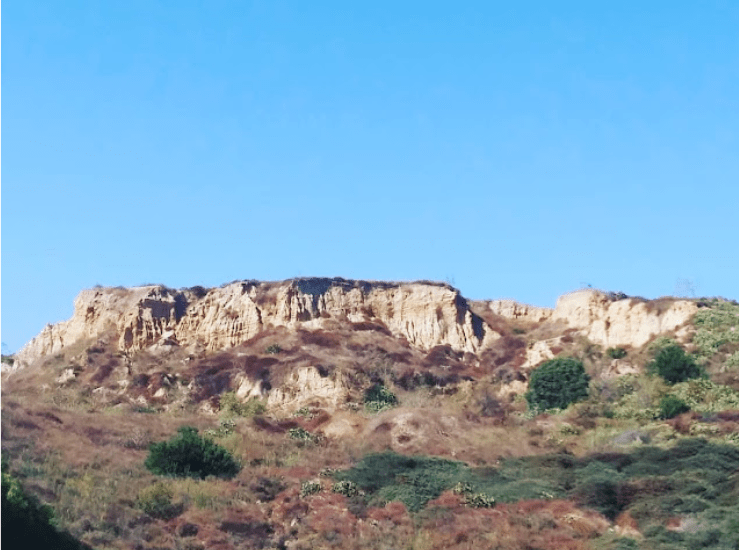
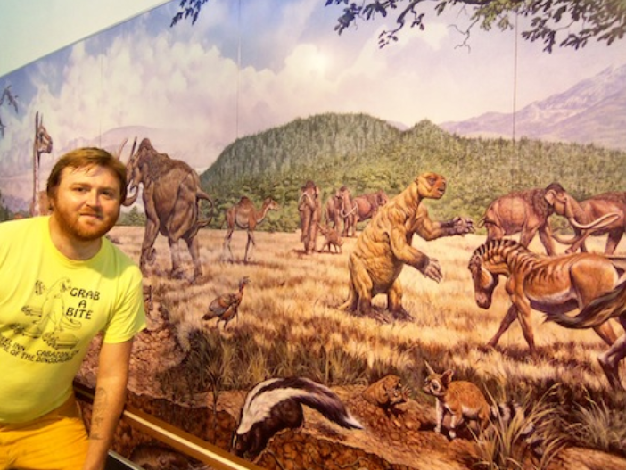
RL: Our geology is fairly young. Up until recently [geologically speaking], Orange County was part of the ocean. If you go to places like Ralph Clark Regional Park, you can actually see some of the fossil evidence of when we were part of the ocean, and then afterwards when we were dry land and had giant mammoths, mastodons, and sabre-tooth cats roaming around.
JL: How old are the rocks here?
RL: The oldest rocks we have in the Fullerton area are up in the Coyote Hills, and they only go back a few million years. If you go into the Santa Ana Mountains, like Silverado Canyon, you find some rocks that are 180 million years old. But, from a geologic standpoint, that’s still not that old.
JL: Why are the rocks so “young” here?
RL: Basically, because we were mainly ocean, and not a lot of deposition was occurring at that time. But you can go to other areas where there was mountainbuilding. There were actually times when we had exploding volcanoes in the area.
JL: When was that?
RL: About 100-150 million years ago. We had a different kind of plate boundary then, more like Oregon and Washington, and had volcanoes like Mount St. Helens around here.
JL: I find it interesting that here in California, we’re on the Pacific tectonic plate, and basically the rest of the country is on the North American tectonic plate.
RL: I tell my classes that, being west of the San Andreas fault (which is the boundary between the Pacific and North American plates), we’re on an Alaska cruise. We’re slowly, by about an inch a year, heading up toward Alaska.
JL: And that’s also why we’re more susceptible to earthquakes?
RL: Right, if you’re on a plate boundary, you’re going to have more big earthquakes.
JL: What are some of the kinds of rocks and formations that are unique to this area?
RL: A lot of sedimentary rocks: sandstone, shale, conglomerate. There’s a big bend in the San Andreas Fault that formed the San Gabriel and San Bernadino Mountains. That compression creates the rippling of the hills around us, and the LA Basin. We live in a hole that’s about 4-5 miles deep, which is filled full of sediments.
JL: I know that, historically, this was a very oil-rich area. Aside from oranges, oil was the main product of Fullerton and Brea. How does this relate to our local geology?
RL: Brea Canyon is an interesting place, because that’s where the Whittier Fault goes through. The reason the oil wells are there is because the fault is acting as a trapping mechanism. It also has to do with the fact that we used to be part of the ocean. Petroleum is formed when millions of marine organisms settle on the ocean floor, get buried at just the right depth and temperature, and it changes to petroleum.
JL: Aside from just increasing one’s knowledge, why do you think it’s important for people to understand their local geology?
RL: Well, because some people fear where they live. They fear an earthquake, they fear a flood. We have been flooded here before in Fullerton. Back in 1938, we had a major flood, where you couldn’t get to Fullerton College by street because Chapman Ave. was under a couple feet of water—students were coming by canoe. So, I think it’s better to understand your local geologic setting to get an idea of how safe it is, and things you can do to make it safer.
JL: How safe are we?
RL: From an earthquake standpoint, I think overall we’re probably fairly safe if we take precautions. It’s important to stabilize objects where you live because it’s not usually earthquakes that hurt you—it’s things that fall on you. So, if we can stabilize things that would fall on us, we can almost look forward to the next earthquake.
JL: What are some local geology groups or societies?
RL: We have the South Coast Geological Society, which is kind of the Orange County geology group. There’s a National Association of Geoscience Teachers, the far western section, which includes California. There are periodic meetings where we go and hear presentations on research that people are doing locally or internationally.
JL: Are there any current discoveries being made that you find particularly interesting?
RL: They’re trying to develop an Early Warning System for earthquakes here in California, particularly in LA. That’s pretty exciting.
JL: What do you love about geology?
RL: Geology is my life. It’s not just a job. I travel to see geology, not only locally but worldwide. I enjoy taking students out and opening their eyes to geology, particularly outside the classroom because that’s when things really can open up. I’ve been teaching here for close to 30 years, and still enjoy it quite a bit. And my roots are here in Southern California, so kind of fun to see the changes that have happened.
Early Wildlife
We learned From Fullerton College geology professor Rick Lozinsky about the geologic history of Fullerton. Next, I would like to discuss some of the natural history of this area–its early plant and animal life.
As Lozinsky pointed out, for most of earth’s history, the lands that would be Fullerton were part of the ocean and its animal life included prehistoric sea creatures–large sharks, dolphins, and other marine life.
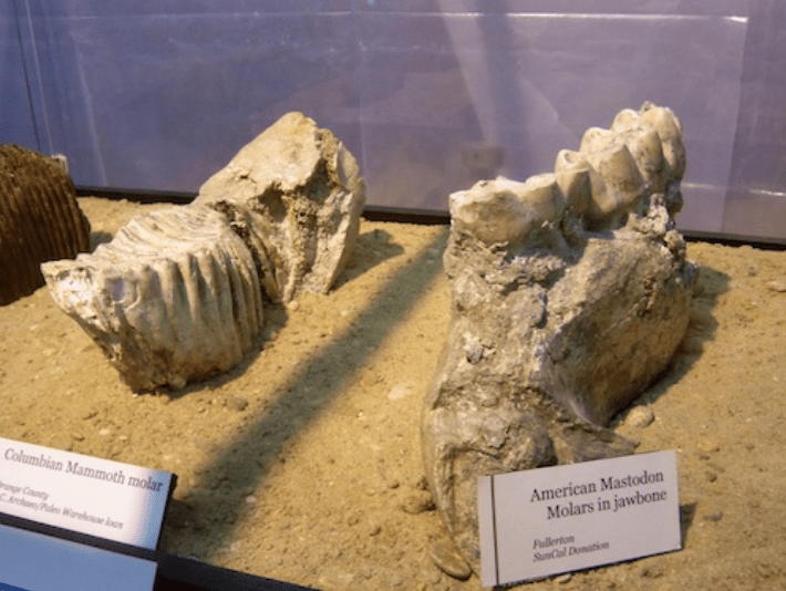
The evidence of this can be seen at the Interpretive Center at Ralph Clark Park in Fullerton–a little local treasure of paleontology.
Here are some of the marine fossils and bones that were found when that park was excavated, now on display:


In his book Fullerton: a Pictorial History, Bob Ziebell writes, “It was, perhaps, seven hundred thousand years ago that the earth rose and played host to giant mammoths–larger than the elephants of today–and vicious sabre-toothed cats, and to lions similar to the African lions of today as well as the mountain lions which still inhabit the area, and a rare breed of llama, and camels, very large bison, wolves, coyotes, ancient horses and antelope, weird-looking sloths and tapirs–and the opposums of forty thousand years ago which remain with us today.”
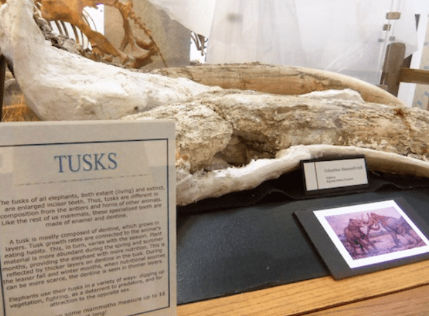
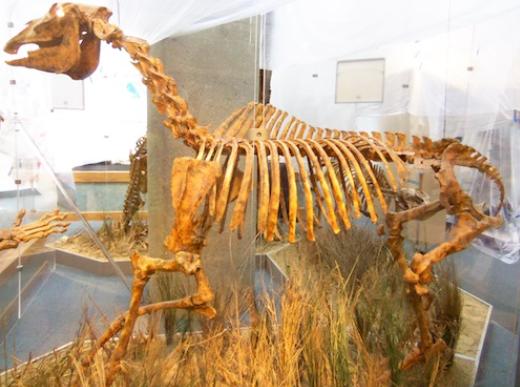
Here are some of the mammal fossils on display at the museum:


What about the plant life?
Ziebell paints a picture of the landscape the first human inhabitants would have seen, perhaps 15,000 to 20,000 years ago: “They found these lands nurturing grasses, wild mustard and bushes, with some oak woodlands along streams on the plains areas and chaparral as well as gnarled, low-growing broadleaf evergreen plants in the hills…a fertile valley topped by gentle, rolling hills which dip again toward the basin known as the La Habra Valley. The Coyote Hills to the northwest and Puente Hills to the north and northeast, had drained their rich soil across this broad expanse, and a river–the Santa Ana–had often sent its flood waters meandering over the valley floor, depositing life-giving silt and creating the rich alluvium which was to serve these [later] farmers and ranchers so well.”
Thus the ancient prehistory of Fullerton’s landscape would lay the groundwork for two of its major industries: oranges and oil.
“The lesson in all this,” Ziebell concludes, “would seem to be that the many changes which have occurred in the 200-plus years since written history of this area began…are miniscule when considered in the greater perspective of the last one million years on life’s landscape.”
First Inhabitants
The tribe that originally occupied North Orange County and Los Angeles has been called different names over the years. Historians often refer to them as Gabrielenos or Gabrielinos, because that’s what the Spanish missionaries (like Father Junipero Serra) called them, after Mission San Gabriel. The Spanish adopted a policy of re-naming California Indian tribes after nearby missions. According to other sources, the local tribe is called the Tongva. But I’ve met members and leaders of the local tribe, and they have told me they prefer the name Kizh (pronounced Keech).
Ostrich Eggs for Breakfast, a history of Fullerton I had to read in third grade, includes this passage: “Sometimes people ask, ‘What happened to the Indians?’ As far as anyone knows, there are no Gabrieleno Indians left in Fullerton.”
While this may be technically true, it implies a great lie: there are no more local native people left anywhere–no more Kizh. I know this is a lie because I’ve actually met the chief of the local tribe. His name was Ernie.
In 2013, I attended a fascinating event at the little Paleontology Museum located inside Ralph Clark Park in Fullerton. The event was about Orange County’s “prehistory,” and (to my astonishment) actual, living Kizh Indians were there, including their chief, Ernie Salas, and tribal historian, Timothy Poyrena-Miguel.
I sat down with Timothy. I didn’t have any agenda or prepared questions.
“Tell me about your people,” I said and, man, did he have a story to tell.
The history of the Kizh people goes back thousands of years. For millennia, they had developed a complex and beautiful culture, which included religion, astronomy, rich and varied cuisine, economy, and social structure. They developed ingenious ways to live sustainably off the land and its natural resources. The name of the tribe, Kizh, comes from the dome-like dwellings they lived in. They had tools, technology, clothing, handicrafts, dances. They were one of two California tribes who mastered boat-building, and traveled along the coast of Southern California.

In the 1700s, Spain began to colonize California, and thus began the long journey of suffering for the Kizh people. Contrary to what we learn in school and on field trips to California Missions, the Spanish were not a benevolent presence in California. The missions they established were like concentration camps, where Indians lived in a state of quasi-slavery, and were made to abandon much of their culture. Violence and disease decimated the local native populations. Kizh women were raped by Spanish soldiers and died of syphilis. Timothy compared Spanish figures like Father Junipero Serra to Nazis, in the way they systematically destroyed native cultures and lives.
Both Timothy and I expressed our frustration that the California Missions are taught to children in public schools as benevolent, even quaint examples of California history, when the truth is much darker.
Things did not improve for Native Americans when Mexico won its independence, nor when the United States conquered California. Under American rule in the 1800s, a policy of “extermination” of native people was pursued. Timothy told me the story of a whole Kizh village rounded up into a valley near where the Rose Bowl is today, and blasted with guns and cannons. Some children managed to escape, and found shelter among Mexican-American families in the San Gabriel area. Children of slain parents were adopted by Mexican-American families, and this is why Many Kizh people today have Spanish/Mexican surnames.
Due to widespread racism, these children feared to identify themselves as Indian, stopped speaking their native language, and learned Spanish or English.
One result of all this suffering and bloodshed was the eradication of the Kizh language. Timothy told me they have some words and songs that were passed down orally, but no one alive today speaks their native language.
As I listened to Timothy tell the story of his people, I felt a heaviness in my chest, a complex mixture of sadness, outrage, and compassion. It is this last bit, compassion, that I hope to evoke with my writings. If we don’t know their history (and most people don’t know Kizh history), we do not feel compassion. But, in listening to their stories, harrowing and horrific as they are, we develop a strong sense of compassion. We pay for the crimes of our ancestors, but we do not have to repeat those crimes. The act of storytelling can be a powerful, healing force. It is my hope that, in listening and sharing stories like this, a new chapter in the Kizh story may open, one of understanding, healing, and reconciliation.
To learn more about this local tribe visit their web site: www.gabrielenoindians.org.
Tribal Leadership (The Tomyaar)
The source for the following information is an excellent book called The First Angelinos by William McCawley.
Prior to European contact, the total Kizh population is estimated to be around 5,000 people organized into communities/villages which were usually between 50 and 100 individuals each.
The chief of each village was called a tomyaar, and he was also the head of a family lineage. Tomyaars formed alliances with other villages and tribes (sometimes through marriage) for purpose of trade and peaceful co-existence (shown through ritual exchange of gifts and large inter-tribal celebrations).
According to McCawley, “The tomyaar was the focus of the religious and secular life of the lineage and community, serving as chief administrator, fiscal officer, religious leader, legal arbitrator, and commander-in-chief. Tomyaars were usually 30-35 years in age when elevated to office.”
The tomyaar’s position was hereditary, passing from father to eldest son, though there were sometimes female tomyaars.
One of the most important duties of the tomyaar was to manage the economic affairs of the village, particularly collecting and distributing food. Those who hunted animals and gathered plants and seeds would give part of their bounty to the tomyaar for food reserves. These food stores would be used to feed the poor, and the community in times of shortage. Mismanagement of food stores was a serious offense that could be punished by death.
Another of the tomyaar’s primary duties was to be a leader of trade and relations with other tribes. Good relations were maintained through the ritual exchange of shell beads, which were like currency. There was a vast network of inter-tribal relations with neighbors like the Cahuilla, Serrano, Chumash, Salinans, and other California tribes. These ritual exchanges were a way to prevent conflict and war, and provided avenues for obtaining food in times of shortage (through trade).
In addition to being the political leader of his community, the tomyaar was also a religious leader, managing “the ritual interaction between his lineage or community and the supernatural world.” For example, he would “preserve and maintain the ritual implements stored in the ‘sacred bundle’ (a length of reed matting in which ceremonial objects were wrapped) and to schedule the dates for religious celebrations.”
McCawley explains that “the tomyaar’s prestige and authority derived in large measure from his knowledge of, and access to, supernatural power…As he was descended from a line of leaders, some ability to handle power was inborn.”
He was spiritually connected to the legendary “First Chief ” Wewyoot and the supernatural being Eagle: “In ritual performances the tomyaar often served as an intermediary with the supernatural world by assuming the identity of Eagle. In such performances the tomyaar wore a ceremonial skirt sewn from the feathers of an eagle and performed dances which symbolized a soul’s magical flight into the afterworld” (McCawley).
To show his sacred authority, the tomyaar’s house was built right next to the yovaar (sort of like a temple), which was “the most sacred and powerful location within the community.” He was one of a few people who was allowed to enter the yovaar.
Much of Kizh life involved sacred rituals, and the installation of a new tomyaar was no different. When a new tomyaar was to be installed, there was a large festival in which inhabitants of neighboring tribes and communities were invited.
During the installation ceremony, the new chief’s body was painted black with ash from a charred feather. He was enrobed in a feather skirt and a crown of feathers. He entered the sacred yovaar and began a ceremonial dance, accompanied by singers who chanted to music of turtle shell rattles.
Visiting tribal leaders also joined the dance, and the new tomyaar continued until fatigue overcame him. After the ceremony, the new tomyaar was acknowledged by all, and everyone celebrated with a massive feast/party that lasted three or four days.
Like all good leaders, the tomyaar was not alone. He was assisted in his duties by a Council of Elders, which was composed of other leaders in the community, each of whom had his own important role.
The Shaman
Shamans existed in many ancient and indigenous cultures around the world. According to McCawley, “shamans were an integral part of the political, economic, legal, moral, and religious affairs of the community.” They served as doctor, psychotherapist, philosopher, intellectual, and mediator with the spirit world.”
In Kizh society, shamans could be men or women. An important female shaman was Toypurina who famously attempted a revolt against the Spanish at Mission San Gabriel in 1785.
The most powerful shamans, it was believed, could transform themselves in to animals, especially bears.
There existed, among southern California tribes, shamanic associations which provided “a regional framework or religious and political authority.” The Kizh shamanic association was called the yovaarekem.
Before becoming a shaman, a person received a “Divine Call” in the form of a dream. They then went through a difficult apprenticeship. McCawley explains, “In cultures throughout the world, the shamanic initiation typically involves a series of trances, during which the candidate undergoes ordeals of suffering, death, and rebirth at the hands of supernatural beings.”
Each shaman had a “guardian spirit” which resided in his/her body (usually the heart). A guardian spirit could be an animal, a natural force (like thunder or lightning), a supernatural creature, or a plant.
One of the powers of shamans was “magical flight” in which a shaman would leave their body and commune with other realms for various purposes such as obtaining supernatural help for the community, learning about the universe, leading the souls of the dead to the afterworld, and curing disease.
This magical flight was accomplished through the ingestion of the hallucinogenic plant datura (also called jimson weed), which was also ritualistically used in Asia, Africa, and medieval Europe.
It was common for shamans to carry “power objects” imbued with supernatural force, such as wands, animal skins, plants, minerals (like quartz crystals), charmstones, pipes, and effigies (stones carved in the form of whales, fish, birds, mammals, canoes, and abstract shapes). A large collection of effigies was discovered in 1962 in Santa Monica canyon.
Shamans also had “extensive knowledge of astronomy and cosmology that they used to predict the future and schedule religious festivals” (such as the summer solstice). Kizh society developed solar and lunar calendars as well as star charts.
Shamans were also “responsible for preserving sacred and historical knowledge contained in the oral literature. This knowledge was passed on by word of mouth and memorized by each generation. Certain males were trained from youth as bards, or storytellers, with the ability to memorize long stories and orations and repeat them word-for-word.”
Shamans were also powerful healers. Kizh herbalists used a wide variety of natural resources for curing disease such as yerba de pasmo, chilicote, wild tobacco, chuchupate, saltgrass plant, elder pitch, wild rose, coastal sagebrush, oak bark, datura, and the meat of the mud turtle. Other treatment methods included massage, sweating, rest, hypnosis, surgery, and ritual singing.
For many diseases, an ordinary herbalist was sufficient; however in cases of serious maladies such as “soul loss” a shaman was required to undergo magical flight “to retrieve the lost soul and return it to the owner’s body.”
Because shamans possessed such power, “society had a decidedly ambivalent attitude toward them. Supernatural power could be used for evil as well as good…the abuse of supernatural power could result in severe punishment and even death.”
There exists in Kizh oral literature the story of two brothers who were powerful shamans. A tomyaar at San Gabriel paid them to curse or destroy his enemies. Consequently, an epidemic of disease struck the area and people started dying. When the community learned of the cause, they sent a war party to Catalina Island, where the shamans were hiding. A great battle ensued and the shaman brothers were killed because they had used their power for evil.
Archaeological Evidence of Early Inhabitants of Fullerton
The area which the Kizh (Fullerton’s first inhabitants) inhabited was vast (encompassing the LA basin and North Orange County), and there is archaeological evidence of their habitation and presence in Fullerton.
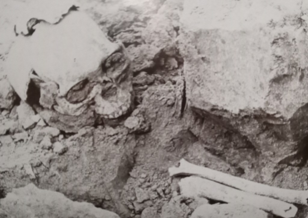
In Fullerton: a Pictorial History, Bob Ziebell writes: “On November 7, 1939, while excavating for the new City Hall (now the police building at the northwest corner of Commonwealth and Highland) workers were startled to uncover human skeletal remains. The remains–dubbed ‘Fullerton Man’ by the Fullerton Daily News-Tribune–were those of an Indian and were at least a thousand years old, according to John W. Winterbourne, who was then the archaeologist in charge of a museum being developed at Fullerton College. The remains were given to the college for preservation–except for an arm bone, which, in 1941, was placed, along with other artifacts and documents, in the cornerstone of the building.”
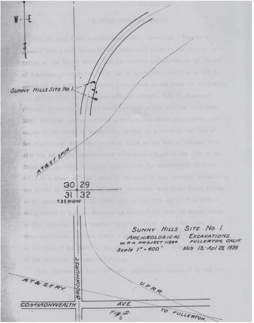
In 1939, the United States Works Progress Administration (WPA) sponsored an archaeological dig of a village site in Fullerton on what was then the Sunny Hills Ranch (a vast Orange Ranch owned by the Bastanchury family). Fullerton College and Fullerton High School jointly participated in the excavation.
The site was just north and west of the present Bastanchury Road–Malvern Avenue intersection. Here’s a map from the study, showing the site area, which is called “Sunny Hills Site No. 1”:
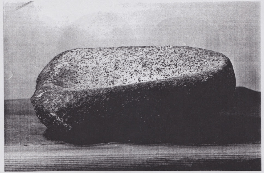
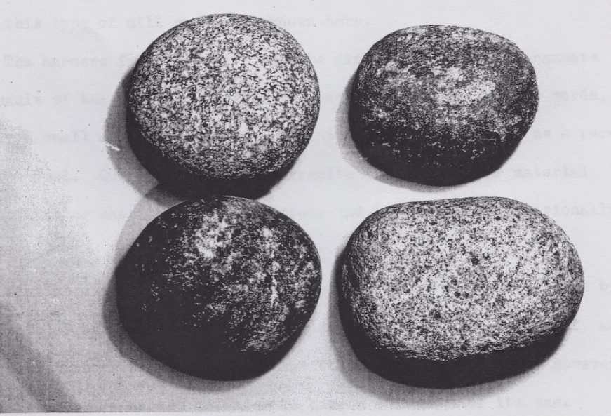
According to Ziebell, “A short time before the excavation began, a Bastanchury Water Company employee had taken soil from the site for use at the Water Plant garden and had removed three skeletons…Debris and fill from the roadbed of a Union Pacific Railroad spur line (still there) had covered a major portion of the camp. Nonetheless, a report on the “dig”–written by Louis Plummer, superintendent of schools, and the same John Winterbourne mentioned in the City Hall find–said a considerable number of stonework artifacts were found, such as manos, metates, and pestles–mill and grinding tools used in the preparation of food.”
Here are workers on the dig site:

During the dig, they uncovered many native American artifacts belonging to the local tribe known as the Kizh (they are often erroneously called Gabrielino or Tongva). Louis Plummer compiled the findings of the study into a book, which is available for view in the Launer Local History room of the Fullerton Public Library. Here are some of the artifacts uncovered in this study:


Somewhat disturbingly, the archaeologists also uncovered a single object of Spanish origin, a metal spear point:
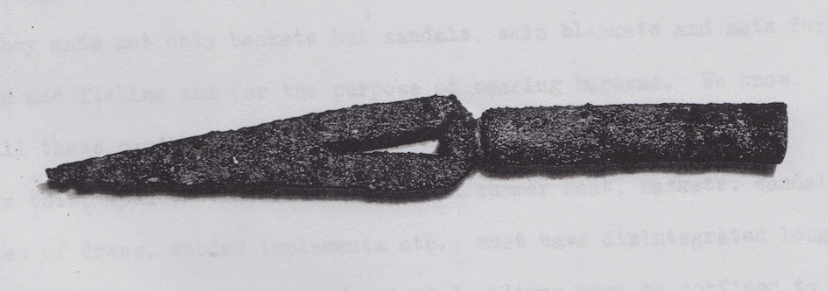
This is disturbing because it was Spain who first began to colonize California, and to force Native Americans to abandon thousands of years of living sustainably, and to instead live as quasi slaves in the Missions.
Another camp was identified to the north and east of the Malvern-Bastanchury site, but the excavators said the land, then part of the Emery Land Company, was planted to a young lemon grove and “cannot be investigated.”
Years later, in 1992, “a construction worker uncovered a skeleton while digging under a sidewalk on Commonwealth Avenue near the municipal airport,” Ziebell writes. “Judy Suchey, forensic anthropologist from California State University, Fullerton, aided in recovering about 95 percent of the skeleton and said it was that of a woman about four feet ten inches tall who was at least eighteen years of age when she died. The remains, she said, were at least four hundred and perhaps a thousand years old. The old Indian’s Gabrielino [Kizh] descendants later reburied the bones near where they had been found.”
The Expedition of Gaspar de Portola
For thousands of years, the native Americans who inhabited the Los Angeles basin and North Orange County, including Fullerton, (called the Gabrieleno Band of Mission Indians Kizh Nation, or just Kizh) had no documented interactions with Europeans. Beginning in the 1500s, waves of explorers, conquistadors, settlers, and missionaries would forever alter their way of life.
The first recorded contact between the Kizh and Europeans is the 1542 expedition of Spanish explorer Juan Rodriguez Cabrillo, who led a crew of sailors up the California coast, searching for a waterway across North America.
The next recorded contact happened 60 years later in 1602, with an expedition led by Sebastian Vizcaino, who was seeking a northern harbor for Spanish galleons returning from Manila.
150 years would elapse between the Vizcaino expedition and the next one, which began in 1769, led by Gaspar de Portola, a soldier who had recently been appointed governor of Las Californias, New Spain. The impetus for the expedition was concern by the Spanish crown that English and Russian explorers would encroach on “their” territory (Alta, or upper, California).
The Portola expedition was the first overland attempt at actual colonization of Alta California, not just exploration. Portola was accompanied by soldiers and Franciscan missionaries, including Father Junipero Serra (head of the Franciscan mission to the Californias).
Captain Fernando Rivera y Moncada led an advance group, consisting mainly of soldiers, scouts and engineers. Portolá and Serra followed in a second group with the civilians, livestock and baggage.
Three ships were dispatched to aid the expedition with supplies.
The expedition began on the Baja California peninsula, and went north toward Monterey. Upon arrival in San Diego, Serra stayed, while Portolá and Rivera led a smaller group north.
Three members of the expedition kept journals: Portola, Miguel Constanso, and Father Juan Crespi.
Below are excerpts from the portion of Portola’s journal (which have survived) as he traveled through present-day Orange County. I have introduced the daily entries with the present day-locations where he traveled.
July 22, 1769: To Christianitos Canyon, which reaches the Pacific at the southern edge of today’s city of San Clemente: “We proceeded for three hours and a half, the entire way through a pleasant country of ranging hillocks. We halted in a gully where there was much pasture and a pool of water. Here there was a village of about twenty natives in which Father Crespi and Father Gomez baptized two dying children.”
July 23: North up Christianitos Canyon, over the hills and down to San Juan Creek (named later for the mission). They followed the creek west to the future location of Mission San Juan Capistrano. The state highway that now follows San Juan Creek in this area is named Ortega Highway after the leader of Portolá’s scouts. On this day, the travelers crossed from today’s San Diego County into Orange County: “We proceeded for four hours. Much pasture and water, and many trees.”
July 24: To Aliso Creek. The neighborhood where the creek exits the hills is now called Portola Hills: “We proceeded for about three hours and a half. We halted in a gully which had much water, pasture, and many trees, where we came upon an Indian village of about fifty persons; they made us a present of much grain and we made them a suitable return. We rested for a day.”
July 26: Short march northwest along the edge of the foothills, to a spring at the northern edge of today’s Irvine, California. From a hill above, the party first sees the broad coastal plain of northwestern Orange County: “We proceeded for three hours on a good road. Scant pasture; no water for the animals, though enough for the men.”
July 27: To Santiago Creek, so named by Crespí: “We proceeded for three hours on a good road. Much pasture and water.”
July 28: To the Santa Ana River, one of the major rivers of southern California. The soldiers of the expedition gave the river the name Santa Ana. A strong earthquake is felt that afternoon; aftershocks are recorded over the next few days: “We proceeded or two hours on a good road and we halted by a stream about eight yards wide and about sixteen inches deep which flowed with great rapidity. Here, at twelve o’clock, we experienced an earthquake of such violence…[text lost]…supplicating Mary Most Holy. It lasted about half as long as an Ave Maria and, about ten minutes later, it was repeated though not so violently. Much pasture and water. Here there was a very large Indian village of about seventy inhabitants, to all appearances very docile.”
July 29: North-northwest to the hills north of modern Fullerton, or possibly a little further north into La Habra: “We proceeded for three hours on a good road. Much pasture, but water sufficient only for the men. Here there was an Indian village of about fifty inhabitants.”
July 30: Leaving Orange County and entering Los Angeles County, the expedition heads north over the pass (La Habra) through the Puente Hills. Today’s North Harbor Boulevard follows the Portolá route over the pass. The march continued northwest to the San Gabriel River, where the party built “a bridge of poles” to cross the miry riverbed. This bridge (La Puente in Crespi’s diary) is remembered in the name of today’s nearby city of La Puente: “We proceeded for four hours on a good road, with the exception of two very steep hills. We halted in a very large valley where there was much pasture and water. Here we had to construct a bridge to cross the gully. I consider this a good place for a mission.”
[Mission San Gabriel would be established in 1771]
July 31: West-northwest to the western end of San Gabriel Valley, near the modern city of Alhambra: “We proceeded for four hours; near the camp we found much water with a great deal of pasture which had grown [so tall] that the animals had to jump in order to get through it. Here we rested [for one day]. We experienced six or seven severe earthquakes. In this valley we discovered, on the south side between two mountains, a spring that flowed like a river, giving evidence of deep soil.”
The Journals of Juan Crespi
What follows here are excerpts from the portion of Crespi’s journal as he traveled through present-day Orange County–from July 22-30, 1769. To me these first-hand accounts provide a unique window into first contacts between the native inhabitants of this area, and the Spanish colonizers. The journals are also valuable in that they record what the land looked like before it was developed by Euro-Americans into the landscape we know today.
July 22, 1769: [To Christianitos Canyon, which reaches the Pacific at the southern edge of today’s city of San Clemente]: “At eleven o’clock we came to a pool of fresh water, found by the scouts yesterday at a dry creek where there is a great amount of sycamore and live oaks. We must have gone four leagues to reach this spot. We stopped close to the pool and close to a village of heathens who visited us once, some fourteen men and as many more women with boy and girl children. They are all very tractable Indians. They say there is another large pool further downstream at this place. The spot, a good one for a farm, has its small share of soil and good grass.
On our reaching this spot the scouting soldiers told us that they had seen yesterday a girl infant in arms who was dying. We requested the Governor for two or three soldiers to go with us, and then we two Fathers went to the village to try to see this infant in arms and baptize her if she was in danger. We did find her in her mother’s arms, scarcely able to nurse, but the mother would not in any wise see us. We gave her to understand, as well as we could that we did not wish to harm the child, only to wash its head with water, so that if it died it would go to Heaven. As well as he could with her clutched to her mother’s breast, Father Fray Francisco Gomez baptized her; she was named Maria Magdalena, and I have no doubt that she will die and that in passing by we have won this soul’s passage to Heaven. We named this spot the small pool of San Apolinario, Saint Apollinarius.
We met not a heathen upon this whole day’s march before reaching this spot. As I was finishing writing up this day’s march, we were reminded of another little girl, about two and a half years old, who had also seemed ill to us though we had never been able to assure ourselves whether this were the case. In the end we went back with some soldiers and learned that she had been burned and was feeling very sick, so that I took the measure of baptizing her. Since Father Gomez had baptized the other, I christened this one myself, naming her Margarita. God take both of them into Heaven; and so, in passing by, we have gained these two who would to pray in Heaven for the winning over and conversion of all these poor wretches here.
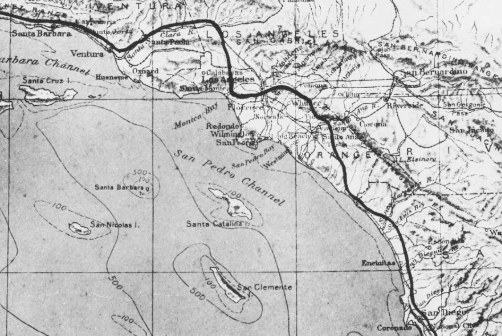
About on a parallel with this spot lies the first island of the Santa Barbara Channel, called San Clemente.

July 23: [North up Christianitos Canyon, over the hills and down to San Juan Creek (named later for the mission). They followed the creek west to the future location of Mission San Juan Capistrano. The state highway that now follows San Juan Creek in this area is named Ortega Highway after the leader of Portolá’s scouts]:
A good many live oaks have been seen all along the way, here and there on the knolls and hills. We came across a good-sized heathen village at one of the two hollows, where they commenced shouting to us as soon as they were aware of us, and came to meet us as though to set us on the watering place whither we were bound…The spot seems a very fine one for a mission…
In all of the past days marches, I have been forgetting to set down that they possess dogs at all of the villages. We have seen villages having two or else three black and white parti-colored dogs; in the village we set out from today we saw a black one.
On this day’s march we came across two mines of what seemed good red-earth, ochre, and a very white earth. They were located at some small knolls, and we passed nearly through their midst; clearly, they must have been opened by the heathens to get the paints which are their normal dress.
This hollow and stream rises at the foot of the mountains within view here, and runs from about north-northeastward, with the whole of this direction being very much lined with a great deal of trees, sycamore, willows, large live oaks, cottonwoods and other kinds we could not recognize. It is a well-watered spot, one for founding a good-sized mission at…On reaching this spot, we heard some heathens crying out across some knolls, but they have not shown themselves nearby.
July 24: To Aliso Creek. [The neighborhood where the creek exits the hills is now called Portola Hills]:
Before our setting out, about nine heathens belonging to the villages of this hollow showed themselves, coming up unarmed. They are very friendly, tractable Indians, and by no means unruly like what we had experienced with the ones at San Diego. Coming down into the hollow here, we shortly came upon two good-sized villages worth of of them where they were encamped beneath some bushes with their women and children. We were unable to count them because of their being packed together; with the heathen men all smoking upon very big, thick Indian pipes of baked clay. Upon our greeting them, none of them stirred, except to make the usual speech (no telling what they were saying to us), and we passed on.
We went two leagues through this hollow, with very good soil; its width between hills must be three to four hundred yards in spots; it had all been burnt off by the heathens [local tribes would do controlled burns as a type of land management].
…On going about another league over good-sized tablelands, we came down to a pleasant stream and hollow all lined with a great many large sycamores and large live oaks, so that the entire bed of this hollow looking so handsome makes a very agreeable effect, seeming like a fig orchard. On going about three hours, in which we must have made three leagues…
This lovely spot, so excellent for a good-sized mission…hoping for it to be in time to come a good-sized mission for the conversion of the tractable, well-behaved, and friendly heathen folk here.
Here we met a good-sized village of heathens who at once, on seeing us approaching, all set up a sort of general howling at us, as though they had been wolves, but all of them well-pleased; and at once upon our arriving, they all came over entirely weaponless to our camp, and have stayed with us the whole time we have spent here. A very fine heathen folk indeed: they presented us with a great deal of their grass seeds, which are very good [and] a great deal of very good sage [gruel] refreshment; while the soldiers have also gotten a great amount of them by barter. Our governor, and the Captain, presented them with beads, with which they were well-pleased…
They make very good-sized and fine baskets, bowls, and a sort of rushwork-wickerweave made of very close-woven rushes. Because we stopped very close by their village, we have had them at the camp almost continually, men, women, and children showing such friendliness, cheerfulness, and happiness as though they had been dealing with us forever. We counted twenty-some men; there were a good many women and children, and some of the children are very fair and red-haired. The women are very decently covered up. The two of us have been saying many things to them about God, saying “love-God,” “amor a Dios,” very often, and we have had them kiss the crucifix and our rosary crosses, which they did many time without the slightest reluctance. Whenever we would retire into our little tent, the moment we came out to get anything they would see us and all together would break out with “Amar a dios, amar a Dios.” I have had the little ones repeating the Acts of Faith, Hope, and Charity over and over; indeed these heathens have so entirely won my heart that I very gladly would have stayed with them.
From a high knoll at this place, we saw the first two islands of the Santa Barbara Channel, called San Clemente and Santa Catalina, about four leagues off.
(Every day, we can plainly recognize that there is a change in the language.) I shall set down here some terms belonging to the language of this spot; as I saw afterward, it goes on being understood over a distance of some leagues. They are as follows; first the Spanish and then come the word in the language:
What is it called: Ibi
Water: Pal
Bear: Junut
Live oak: Uasal
Hand: Nima
Is Coming: Igage
Fish: Loquiuchi
Hare: Suichi
Deer: Sucuat
Antelope: Pat
Way: Petlou
Sea: Momt
Village: Esat
Sun: Temete
Moon: Muil
Sage: Pasal
Sky: Tupachi
Canoe, or balza float: Paut
Earth: Exel
Stone: Tot
Man: Potato
Woman: Sungal
Small child in arms: Amaisicalla
Cup or bowl: Joil
Fire: Cut
Tobacco: Piut
Pipe: Cabalmel
Reed: Juiquichi
Flint: Tacat
Arrow: Jul
Bow: Catapichi
July 26: [Short march northwest along the edge of the foothills, to a spring at the northern edge of today’s Irvine, California. From a hill above, the party first sees the broad coastal plain of northwestern Orange County]:
On our setting out from there, the entire village gathered together as though to show they were sorry, telling us over and over what we had taught them to say, “Love-God, Love-God,” by way of a farewell…
We traveled over very open country of very low rolling knolls and tablelands all very grass-grown, up hill and down through three of four hollows with very good soil and a great deal of sycamore trees in the hollows. We came across six antelopes and a great many hares, none of which could be taken, all of them being very swift runners.
July 27: [To Santiago Creek, so named by Crespí]:
The water here flows through the midst of this large plain of apparently very good soil and of leagues in breadth and length; how far away the sea must be there is no telling. We christened this grand, fine, and lovely spot with the name of Santiago Apostol, Saint James the Apostle, Patron of the Two Spains…
July 28: [To the Santa Ana River, one of the major rivers of southern California. The soldiers of the expedition gave the river the name Santa Ana. A strong earthquake is felt that afternoon; aftershocks are recorded over the next few days]:
We pursued our way and at about a scant league and a half came to this full-flowing river, and indeed it is one, a good-sized river going through the midst of the plain here. It is not sunken in: its bed must hold at least ten yards worth of running water, with a depth of half a yard of water all across the bed.
Its course comes out of the mountain range that must lie about two or three leagues away from us, from northeast to southwestward, an it is imagined that southwestward it must empty into the sea…This river bed here is very much lined with trees, white cottonwoods, willows, sycamores, and other kinds we have not recognized.
By what we have noticed from the sands along its banks, this river must plainly carry very large floods, and we had some trouble fording it even now, in the depth of the dry season and the dog days. There will be no crossing it in the rainy season–its current is rapid enough now. They have seen good-sized catfish in it.
A large village of friendly tractable heathens is upon the other side of the river, who came over as soon as we had arrived and set up camp, about 54 heathens, bringing us their usual present, two large bowls half full of sage gruel, and other sorts of parched grass seeds that they consume…The women and children were so many that we were unable to count them…Their chief gave the usual speech and presented it to our Governor, and their chief took a string of shell-beads of the sort that they use and a net out of his pouch and made a present of it as well. (Our Governor presented them with the usual beads, and a handkerchief.)
They are all very well-behaved, tractable folk, who seem somewhat lean–though the men were very strongly built–and food must be in short supply with them.
We made camp close to the river here, and we have felt these strong earthquakes within less than an hour today at noon. The first and most violent must have lasted the length of a Creed, the other two less than a Hail Mary, a great shaking of the ground, however, was felt during all three.
This is the most beautiful spot, with a great amount of soil and water–with this beautiful river going, as it does, through the midst of the wide and far-reaching level here–for founding a mission…We christened this grand spot here The Most Sweet Name of Jesus, of the rio de los Temblores, River of Eartqhakes. This afternoon the villagers returned and kept inviting us to come dance at their village, but we told them it was not our custom to dance.
They also brought white gemstones appearing like fine glass, which we understood they had gotten from the islands of the Santa Barbara Channel. They urged us not to go away, saying that this is their land, that they will sustain us on sage [gruel] of which they have a good amount, and on bear [meat]. We told them that we are coming back, and we will stay with them and build a house with them.
In order to have us remain, they pointed out for us one man who is their chief and the owner of all this land. Our Sergeant and the two of us Fathers told them we would come back, and when we did, we would make a house for the Sergeant and for ourselves (and one for God that He might be worshipped by them), and upon our saying this, such tears of joy and happiness sprang to their chief’s eyes as he touched the hearts of all of us.
And would they allow me to, I would most gladly return in order to stay with these poor wretches for their conversion and the good of their souls–That in case any people shall want to harm us, they will protect us, and we said the same to them, and that we will keep them fed and clothed as well. Blessed be God, for I trust the hour is near that they shall know and worship Him.
July 29: [North-northwest to the hills north of modern Fullerton, or possibly a little further north into La Habra]:
Once across the river, everything is overgrown with prickly pear and sage; very shortly the soil became very grass-grown with dry grass. On going a short way we turned north-northwestward, and on going about a league and a half back again to the northwest, and went up the aforesaid nearer range, which had become very low in this direction, and at a bit over two hours travel came down to a little, very green hollow where there was a large heathen village with a small pool of fresh water. Here at this village we met a great many heathens from the river we had set out from. They wished us to stop at their village, but as it lacked convenience there, we withdrew to a very grass-grown knoll about a musket shot away and there set up camp. Because this knoll lies in a large valley, three of four leagues in length, it may be; the width may be a league, and by what we understood from the heathens there, there is no water in it but this little pool, which only had what was needed for the people, and this evening the mounts had to go without. Once camp was made, the whole village came over, so that what with men and boys we counted about seventy souls of them, all very fine, well-behaved heathens like the ones at the river we last crossed, and we saw none of them carrying weapons.
We have been gathering that messengers are going out to the following villages to tell that we do not harm them but are good people, so that they are already notified, and quite fearless of us. I give this spot the name of The village of the little pool and valley of Santa Marta, Saint Martha. A strong quake was felt here, though lasting less than a Hail Mary.
July 30: [Leaving Orange County and entering Los Angeles County, the expedition heads north over the pass (La Habra) through the Puente Hills. Today’s North Harbor Boulevard follows the Portolá route over the pass. The march continued northwest to the San Gabriel River, where the party built “a bridge of poles” to cross the miry riverbed. This bridge (La Puente in Crespi’s diary) is remembered in the name of today’s nearby city of La Puente]:
Once across this valley here, which has very fine soil and better grass, we went up a hill, all grass-grown and sheer soil, and came into hollows with er large live oak, and sycamores, and through these, on going three hours in which we must have made three leagues, we came down to a very wide-reaching, green, exceedingly spacious valley of dark, very level friable soil, all burnt off by the heathens. Going about a league through this valley, we came to the water the scouts had found; it is a very large stream of running water flowing through the midst of a very green swamp much clad in all sorts of plants and good grasses, and here we made our camp…
This swamp and watering place here lies upon the east of this valley, and because of it being very miry, a bridge had to be made to get across the aforesaid stream. In every way a very grand, excellent spot for a very large plenteous mission. I called it La puente del arroyo del Valle de San Miguel, the bridge of the stream of the Saint Michael Valley. A strong earthquake was felt this afternoon, though a very brief one, yet the ground shook a great deal. I observed this spot in north latitude 33 degrees 54 minutes.
The Dark Legacy of the California Missions
In fourth grade I, like every other kid who attends public school in California, had to build a model of a mission. The state-sponsored curriculum taught me that these were sites where kindly Spanish padres and California Indians lived together peacefully and happily.
This was also the impression I got when, as an adult, I visited Mission San Juan Capistrano. There, a nice lady dressed as an “old Californian” told pretty much the same story.
In school, I was also taught that no one knows what happened to the native Californians of Southern California. They, like the wooly mammoths who used to roam these lands, were gone, extinct.
Imagine my surprise, then, when a few years ago, I happened to meet actual, living members of the local tribe (which has historically been called the Gabrieleno, but they prefer the name Kizh). I met the chief (Ernie Salas) and others at a special event at the little paleontology museum at Ralph Clark Park in Fullerton. Speaking to these native Californians, I learned a completely different version of the California mission story.
They described the missions as sites of slavery, disease, brutality, and death. The missions, according to the local natives, were places of horror and trauma.
After meeting and befriending these living native Californians, I became fascinated with this other side of the California mission story. Based upon my research, I made some startling discoveries. While there are plenty of books written about the missions, they seem to be pretty well divided into two categories: “nostalgic” books (which perpetuate the “happy” mission story), and academic books (which tell a darker and more complex story).
At present, there seem to be more books available to the general public of the nostalgic type than the academic type.
Thankfully, this appears to be changing. Quite recently, a new batch of scholarship (and even popular histories) have come out which dive deeply into California history from the native point of view.
Such a book is Elias Castillo’s A Cross of Thorns: The Enslavement of California’s Indians by the Spanish Missions, which came out in 2015.
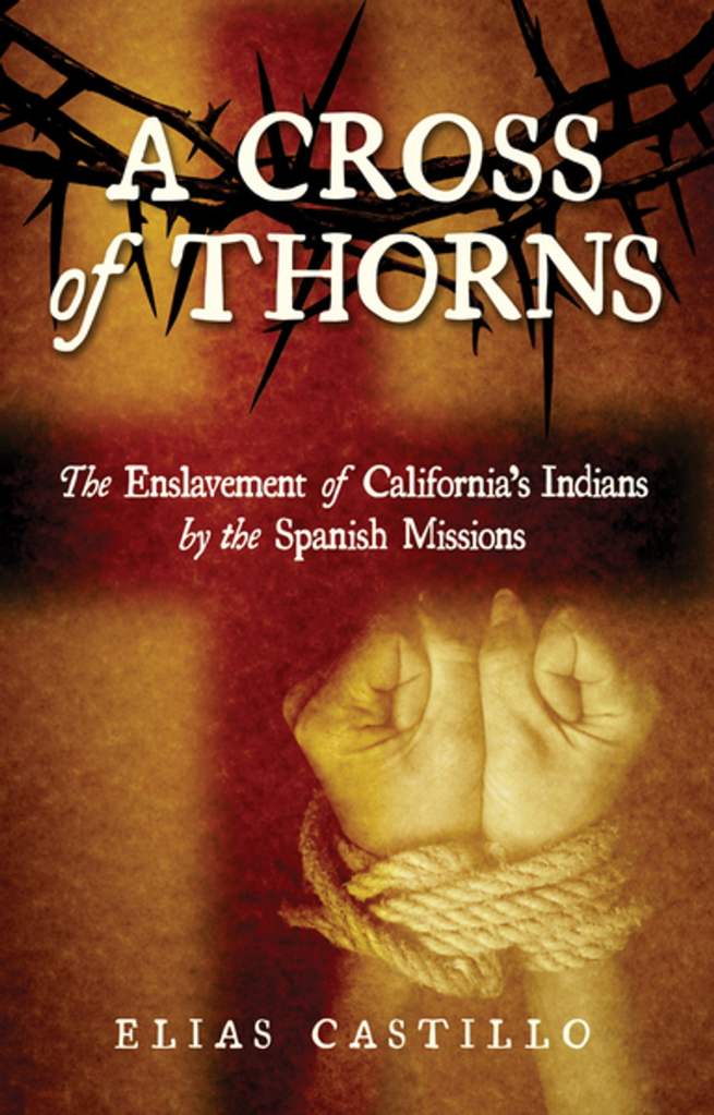
His book, based upon a bedrock of research and primary sources, strives to shine a light on the real story of the missions, and the tragedy they wrought upon the native peoples of California.
In the interest of sharing knowledge and ideas, and to hopefully correct some widespread historical misconceptions, I have decided to present some of the historical evidence Castillo provides.
Some may ask: “Why does this matter? The past is the past. Get over it.” To that, I would respond that it matters very much to living descendants of those who were killed, enslaved, and mistreated. Understanding their stories helps us to better grapple with ourselves as a State and as a society.
It’s also important for people to better understand this because many California tribes (like the Kizh) are still striving for official federal recognition, which will afford them certain benefits and a proper place in our historical understanding.
To that end, I here present some documentary evidence for the tragedy that was the California mission system. These are all primary sources, with a bit of context given for each.
Whipping and Death as “Spiritual Benefit”
On July 31st, 1775, Father Junipero Serra sent a letter to Spanish military commander Fernando Rivera y Moncada, requesting that four Indians who had tried to flee from Mission Carmel be whipped. He also offered to send shackles, in case the commander didn’t have any:
“Two or three whippings which your Lordship may order applied to them on different days may serve, for them and for the rest, for a warning, may be of spiritual benefit to all; and this last is the prime motive of our work. If your Lordship does not have shackles, with your permission they may be sent from here. I think that the punishment should last one month.”
On January 7th, 1780, Serra wrote a letter to then-governor of California Felipe de Neve, defending his practice of whipping the natives:
“That the spiritual fathers [friars] should punish their sons, the Indians, by blows appears to be as old as the conquest of these kingdoms.”
Governor Felipe de Neve envisioned a secular future for the missions, where the Indians would be freed and granted basic human rights. He wrote that the Indians fate was “worse than that of slaves.”
Due to mistreatment, confinement, and widespread diseases for which the natives had no immunity, the mission Indians began to die in huge numbers. Rather than mourn them, however, Serra was happy to see so many newly-baptized souls go to heaven. In a report dated July 24, 1775 to Friar Francisco Pangua, his superior, Serra wrote:
“In the midst of our little troubles, the spiritual side of the missions is developing most happily. In [Mission] San Antonio [de Padua, about 60 miles south of Mission Carmel] there are simultaneously two harvests, at one time, one for wheat, and of a plague among the children, who are dying.”
“A Species of Monkey”
The Franciscan padres generally considered themselves to be culturally, intellectually, and spiritually superior to the native peoples, which tended to provide a justification for mistreatment. Friar Geromino Boscana (stationed at Mission San Juan Capistrano) writes:
“The Indians of California may be compared to a species of monkey; for in naught do they express interest, except in imitating the actions of others, and, particularly in copying the ways of the razon [men of reason] or white men.”
Father Serra’s successor, Friar Fermin, also considered the Indians to be akin to “lower animals.” In 1786, Fermin wrote:
“They satiate themselves today and give little thought to tomorrow…a people without education, without government, religion or respect for authority, and they shamelessly pursue without restraint whatever their brutal appetites suggest to them.”
An Enlightened Point of View
Sometimes, travelers and explorers visited the missions, and their writings provide a unique, first-hand account of the actual conditions. Such was the case with French Navy Captain Jean-Francois de Galaup, Comte de Laperouse, who was the leader of a major scientific expedition. His ships sailed into Monterey Bay on September 14, 1786, and Laperouse describes his shock at seeing the conditions under which the Indians were forced to live. He compares the mission to slave plantations he’d seen in the Caribbean:
“Everything…brought to our recollection a plantation at Santo Domingo or any other West Indian island…We observed with concern that the resemblance is so perfect that we have seen both men and women in irons, and others in stocks. Lastly, the noise of the whip might have struck our ears.”
Laperouse continues, “Women are never whipped in public, but in an enclosed and somewhat distant place that their cries might not excite too lively a compassion, which might cause the men to revolt.”
The men were whipped “exposed to the view of all of their fellow citizens, that their punishment might serve as an example.”
It’s interesting to contrast the worldviews of a French explorer like Laperouse, imbued with the spirit of the Enlightenment and the rights of man, with a Spanish missionary like Serra, still imbued with the ideas of the Middle Ages. Serra was actually a part of the infamous Spanish Inquisition. Laperouse laments the ideas and methods of the Spanish missionaries, writing, “I could wish that the minds of the austere charitable, and religious individuals I have met with in these missions were a little more tinctured with the spirit of philosophy.”
Laperouse and other writers of the time show that violence and brutality toward native peoples wasn’t “just the way things were” or “just how everyone thought back then.” There were people living at the time who believed in the notion of human rights
De Facto Slavery
Writings from the time demonstrate that the California Missions were basically west cost slavery.
Laperouse writes: “The moment an Indian is baptized, the effect is the same as if he had pronounced a vow for life. If he escape to reside with his relations in the independent villages, he is summoned three times to return; if he refuses, the Missionaries apply to the governor, who sends soldiers to seize him in the midst of his family and conduct him to the mission, where he is condemned to receive a certain number of lashes with the whip.”
Overseers called alcaldes were also tasked with capturing, returning, and punishing runaways. Indians were not allowed to leave mission grounds without permission.
American Sherbourne F. Cook, who visited the missions, described women being locked up at night in unsanitary, cramped quarters: “There can be no doubt that the women were packed in tightly, and that the accumulation of filth was unavoidable…it is unbelievable that they (Indians) should not have resented years of being confined and locked in every night in a manner which was so alien to their tradition and nature.”
Cruel and Unusual Punishments
American farmer Hugo Reid, who was sympathetic to the Indians, describes the strange barbarism of a Friar Jose Maria Zalvidea at Mission San Gabriel:
“He was not only severe, but he was, in his chastisements, most cruel. So as not to make a revolting picture, I shall bury acts of barbarity known to me through good authority, by merely saying that he must assuredly have considered whipping as meat and drink to them, for they had it morning, noon, and night.”
Friar Ramon Olbes of Mission Santa Cruz, in an incident recounted by former neophyte (baptized Indian) Lorenzo Asisara, attempted to force a childless Indian couple to have sex in his presence to prove that they had potential to conceive [probably because Indians were dying at alarming rates]. The husband “refused, but they forced him to show them his penis in order to show that he had it in good order.”
Olbes sent the husband to a guard house in shackles. He made the wife enter another room in order to examine her private parts. She resisted him and there was a struggle between the two. Olbes ordered the guards to give her fifty lashes and lock her in the nunnery. He then ordered that a wooden doll be made like a newborn child, and ordered her to present herself in front of the church for nine days. Olbes had the husband shackled and made him wear cattle horns affixed with leather.
Taking Mass at Gunpoint
Ludovik Choris, an artist traveling with a Russian expedition, visited Mission San Francisco in 1816, and described how attendance at church services was compulsory: “All the Indians of both sexes without regard to age, are obliged to go to church and worship…Armed soldiers are stationed at each corner of the church.”
Captain Frederick William Beachey of England’s Royal Navy visited Mission San Jose in 1826, and described how Indians there were rounded up and forced to go to church twice a day:
“Morning and evening Mass are daily performed in the Missions…at which all the converted Indians are obliged to attend…After the bell had done tolling, several [Indian overseers] went round to the huts, to see if all the Indians were at church, and if they found any loitering within them, they exercised with tolerable freedom a long lash with a broad thong at the end of it; a discipline which appeared the more tyrannical as the church was not sufficiently capacious for all the attendants and several sat upon the steps.”
Thus, Indians who chose not to attend church were whipped. Beachley continues, describing a similarly grisly scene inside the church:
“The congregation was arranged on both sides of the building, separated by a wide aisle passing along the centre, in which were stationed several [overseers] with whips, canes, and goads, to preserve silence and maintain order, and…to keep the congregation in the kneeling posture. The goads were better adapted to this purpose than the whips, as they would reach a long way, and inflict a sharp puncture without making any noise. The end of the church was occupied by a guard of soldiers under arms, with fixed bayonets.”
Church services were given in Latin (which the Indians could not understand), and (against the goal of educating them), the official mission policy was, as with slaves, not to teach the Indians to read or write.
In a letter written in 1769 to Father Serra’s close friend Friar Francisco Palou, Spanish Visitor-General Jose de Galvez writes, “I stress my request to your most reverend person that you do not teach the Indians how to write; for I have enough experiences that such major instruction perverts and hastens their ruination.”
Followers of St. Francis Living Like Kings
The friars who founded the California missions were of the Franciscan order, which was founded by St. Francis of Asisi, the famous saint who took a vow of poverty. Like their founder, Franciscans were obliged to take a vow of poverty. However, accounts exist of Franciscans living luxuriously in the missions, while the Indians did not share in the great wealth the vast mission lands amassed.
Pablo Tac, a Luiseno Indian who grew up at Mission San Luis Rey, wrote an account of his experiences and described how the “Father is like a king. He has his pages, alcaldes, majordomos, musicians, soldiers, gardens, ranchos, livestock, horses by he thousands, cows, bulls by the thousand, oxen, mules, asses, twelve thousand lambs, two hundred goats, etc.”
In addition to being religious institutions, the missions also grew to be large commercial enterprises, with hundreds of thousands of acres for crops and livestock, where the fathers amassed great wealth, and often traded with the English and Americans.
Meanwhile, according to Indian Lorenzo Asisara, the friars “were very cruel toward the Indians. They abused them very much. They had bad food, bad clothing. And they made them work like slaves. I was also subject to that cruel life. The Fathers did not practice what they preached.”
Death and Despair
Due to mistreatment, disease, and deplorable conditions, nearly half of the missions’ populations died each year. From 1779 to 1833, the year the missions were effectively dissolved, there were 29,100 births and a staggering 62,600 deaths.
Russian explorer Otto von Kotzebue, who visited mission San Francisco in 1816, wrote that “the uncleanliness in these barracks baffles description, and this is perhaps the cause of great mortality: for of 1,000 Indians at St. Francisco, 300 die every year.”
Because of all this death, combined with the tragedy of being cut off from their culture and traditions, depression and despair took its toll on the mission Indians, as evidenced by accounts from visitors.
British Navy Captain George Vancouver visited Mission San Francisco while exploring the California coast in 1792, and described the demeanor of the Indians: “All the operations and functions both of body and mind appeared to be carried out with a mechanical, lifeless, careless indifference.”
The Russian artist Choris wrote that he never saw an Indian laugh: “They look as though they were interested in nothing.”
Spanish Accounts of Abuses
Some may argue that these outsiders descriptions were motivated by opposition to Catholicism or Spain, but there are ample records in the mission archives themselves which corroborate the picture.
Friar Antonio de la Concepcion Horra, assigned to lead Mission San Miguel in 1798, wrote a letter to the Viceroy of Mexico expressing his dismay at mission life:
“Your Excellency, I would like to inform you of the many abuses the are commonplace in that country. The manner in which the Indians are treated is by far more cruel than anything I have ever read about. For any reason, however insignificant it may be, they are severely and cruelly whipped, placed in shackles, or put in stocks for days one end without receiving even a drop of water.”
The governor of California, Diego de Borica looked into Horra’s complaints and wrote: “Generally, the treatment given the Indians is very harsh. At San Francisco, it even reached the point of cruelty…I also know why they have fled. It is due to the terrible suffering they experienced from punishments and work.”
Fleeing For Their Lives
Due to the misery of mission life, Indians sometimes attempted to escape. For example, between 1769 and 1817, there were 473 documented cases of Indian fugitives from Mission San Gabriel alone.
A group of Saclan and Huichin Indians who had fled Mission San Francisco in 1797 were asked by Spanish officials why they had run away. Here are some of their answers, dutifully recorded by Lieutenant Jose Arguello:
Tiburcio: He testified that after his wife and daughter died, on five separate occasions Father Danti ordered him whipped because he was crying. For these reasons he fled.
Magin: He testified that he left due to his hunger and because they had put him in the stocks when he was sick, on orders from the alcalde.
Malquiedes: He declared that he had no more reason for fleeing that that he went to visit his mother, who was on the other shore.
Liborato: He testified that he left because his mother, two brothers, and three nephews died, all of hunger. So that he would not also die of hunger, he fled.
Timoteo: He declares that the alcalde Luis came to get him while he was feeling ill and whipped him. After that, Father Antonio hit him with a heavy cane. For those reasons, he fled.
Magno: He declared the he had run away because, his son being sick, he took care of him and was therefore unable to go out to work. As a result, he was given no ration and his son died of hunger.
Prospero: He declared that he had gone one night to the lagoon to hunt for ducks for food. For this Father Antonio Danti ordered him stretched out and beaten. Then, the following week he was whipped again for having gone out on paseo (to visit his village). For these reasons he fled.
Russian hunter Vassili Petrovitch Tarakanoff, who was taken prisoner by the Spanish in 1815, recalls witnessing the treatment of Indians who had fled their mission and were recaptured:
“They were bound with rawhide ropes, and some were bleeding from wounds, and some children were tied to their mothers…Some of the runaway men were tied on sticks and beaten with straps. One chief was taken out into the open field, and a young calf which had just died was skinned, and the chief was sewn into the skin while it was yet warm. He was kept tied to a stake all day, but he soon died, and they kept his corpse tied up.”
Rebellion
Aside from running away, another reaction to death and mistreatment at the missions was armed revolt.
Diegueno Indians rebelled and burned down Mission San Diego in 1775. When asked why they had burned the mission, the Indians later said “they wanted to kill the fathers and soldiers in order to live as they did before.”
A female Gabrieleno (Kizh) shaman named Toypurina planned a revolt at Mission San Gabriel in 1785. Unfortunately, the plot was discovered and stopped. At her trial in 1786, Toypurina (who is a hero to the Gabrieleno today, sort of like Joan of Arc), said to her accusers: “I hate the padres and all of you for living here on my native soil, for trespassing upon the land of my forefathers and and despoiling our tribal domains.”
Perhaps the most successful uprising involved Quechan Indians who wiped out a mission and two settlements founded by the Spaniards on the California side of the Colorado River in 1781.
There was also the Great Chumash Uprising of 1824, which involved Indians from three Missions (Santa Ines, Santa Barbara, and La Purisima) taking arms against their Spanish oppressors.
After the Missions
In 1821, Mexico won its independence from Spain. Missions were secularized in the 1830s. The vast lands were supposed to be re-distributed among the Indians, but things didn’t work out that way. Many were cheated out of property, or lands were seized by corrupt officials. Many Indians became ranch hands on Mexican ranchos. Under Mexican, and then American rule, the Indians would continue to suffer in new and traumatic ways.
Reflecting on the legacy of the missions, Friar Mariano Payeras wrote to his superiors in Mexico City in 1820: “I fear that a few years hence on seeing Alta California deserted and depopulated of Indians within a century of its discovery and conquest by the Spaniards, it will be asked where is the numerous heathendom that used to populate it?…even the most pious and kindly of us will answer: the Missionary priests baptized them, administered the sacraments to them, and buried them.”
Between 1769 and 1890, the Native American population declined from an estimated 300,000 to 16,600.
Whitewashing History
Despite this documented record of oppression, disease, cruelty, and death—the California Missions experienced a revival in the late 19th and early 20th century as a way to market oranges, real estate, and a romantic myth of California’s past.
Castillo writes, “The missions, where thousands of Indians remain buried in unmarked mass graves, were resurrected in the 1890s and early 1900s and rebuilt as monuments to a concocted past that featured a loving, cooperative relationship between the friars and the Indians. Many California leaders, either ignorant of the truth or choosing to ignore what happened, joined in this duplicity.”
In his book Orange County: a Personal History, in a chapter entitled “Our Climate is Faultless: Constructing America’s Perpetual Eden” local writer Gustavo Arellano discusses how American businessmen and early 20th century mass media contributed to the myth of a Spanish Mission past that never existed.
On orange crate label art like Charles Chapman’s Old Mission Brand and in films like Douglas Fairbanks’ The Mark of Zorro (and all the Zorro stories that followed), the mission myth was born—ignoring the ugly historical reality.
This myth continues today. “Across California, streets, playgrounds, and even schools have been named after Padre Junipero Serra,” Castillo writes, “Yet Serra is still revered by many in California as a kindly friar who loved and treated the Indians as if they were his children.”
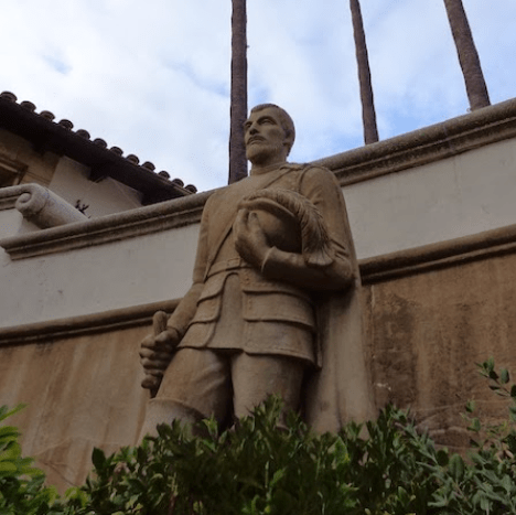
In Sacramento, on the grounds of the state capitol, there is a bronze statue of Serra. In San Francisco a gigantic statue of Serra overlooks the entrance to Golden Gate Park. And in Washington D.C., in the National Statuary Hall of the nation’s Capitol Building, there is a statue of Serra holding a model of a mission in one hand and a large cross in the other. Not to mention the numerous statues of Serra at the missions themselves.
“For decades, the California State Department of Education has required every elementary school in the state to teach fourth grade pupils of the supposed contributions of not only Junipero Serra, but of the missions themselves,” Castillo writes.
In 1988, Pope John Paul II conferred beatification on Father Junipero Serra, a major step toward becoming a saint.
It seems that, as with American history in general, California still has much reckoning to do with its real past.
Toypurina: Hero to the Kizh
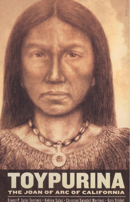
The story of the Kizh people has been one of tragedy after tragedy, and their history has been largely suppressed or distorted. When I met the members of Kizh nation, they told me their tribal history, and I picked up a relatively new book they published called Toypurina: the Joan of Arc of California. The book tells the little-known history of a Kizh woman named Toypurina who, in 1785, led her people in a revolt against their Spanish oppressors. She is a folk hero to the Kizh people and, according to the book, “She is the only Native American woman to have initiated, organized, and led a revolt against foreign oppression in all American history. She is outstanding and unique in Native American history and therefore, in American history as well.”
Here’s a brief summary of Toypurina’s story, taken from the book:
“In 1785, she was approached by a neophyte (baptized captive) Nicolas Jose at Mission San Gabriel. He was reacting to the conduct of the Spanish not only to his own situation, but also to the atrocities (murders, whippings, rapes, forced religious conversions, and slave labor) that had been committed against the Kizh from the beginning the Spanish invasion until that point. Toypurina, age 25, accepted the challenge and initiated, organized, and carried out a revolt utilizing an armed force of Indian warriors. On the night of October 25th, 1785, Toypurina led her force and attacked the mission. But because a corporal of the guard had been informed of the revolt ahead of time, the Spanish mounted an ambush. When Toypurina arrived, she and some of her warriors were arrested. She was then subjected to a sham trial at the mission where no less than the governor of Alta California, Pedro Fages, sat in judgment. As punishment, she was exiled, baptized into Christianity, forced to divorce her Native husband and remarry a Spanish soldier and then eventually was buried at Mission San Juan Bautista.”
Though the revolt was unsuccessful, it stands as an inspiring testament to the spirit of the Kizh, and their resistance to oppression. The authors of the book compare her to Joan of Arc because “Both were religious leaders of their people, both organized revolts against invading foreign powers, both led rebel forcers in the field, both were betrayed, both were subjected to sham trials, and both suffered tragic ends.”
The authors also compare Toypurina to other, more well-known female American heroes like Betsy Ross, Abigail Adams, Susan B. Anthony, Eleanor Roosevelt, and Coretta Scott King because “the common threads of all Ameicans are our love of freedom and our ‘American Dream’ to provide the best, both spiritual and material, for our families and for our children’s future…Toypurina rose to the occasion. She wanted to right the wrongs done to her people and to her land.”
The book serves as not only a biography of Toypurina’s life, but also as a kind of tribal history written, not from the perspective of outsiders, but by the tribe itself. The authors (which includes the chief) write at the outset: “With this work, we, the Gabrieleno Band of Mission Indians, are writing a new kind of history for us–our own history. It is a humanistic history rather than a cold, dispassionate typical study.”
Because Toypurina has been so grossly misrepresented even by scholars, much of the work of the book Toypurina is deconstructing false histories (which abound for Native Americans) and trying to reconstruct the real history, based both on scholarly study and tribal oral history. It is a unique book in this way. It is deeply self-conscious of the problems inherent in trying to reconstruct the past, and this is something more historians ought to wrestle with, especially when dealing with histories that have existed only on the margins of “official” history. It is a lovely, thought-provoking, and inspiring book that serves as a model of a how a group of people can, through research and storytelling, assert their identity and self-worth.
As the authors rightly note in the introduction: “Sometimes, in order to right the wrongs of the past, it is necessary to write the wrongs of the past.”
These Lands Used to Be Mexico
Any history of a human settlement must begin with “first families.” In the history of Fullerton, this “first family” is often considered to be the Ameriges, the brothers George and Edward, two commodities merchants from Boston who “founded” Fullerton in the year 1887. But this was not really the first family here. The landscape they found was not empty or devoid of people or history. In fact, the Amerige brothers were relative latecomers to this region. Before they arrived, there was another lengthy history.
The true “first families” in this region were Native Americans, specifically the Kizh tribe, who had many settlements in the landscapes that would become Los Angeles and Orange Counties. In 1769, the first Europeans passed through what would become Orange County–it was the expedition of Gaspar de Portola, the Spanish soldier sent to make the first explorations and settlements of California, which was then a part of New Spain. Twelve years later, in 1781, another group of settlers arrived to found the town of Los Angeles. That’s right, Los Angeles was founded in 1781!
Among the settlers on this expedition was a farmer from the Sinaloa region of Mexico named Josef Antonio Ontiveros. Josef’s grandson, Juan Pacifico Ontiveros, would in time become a very important landowner and rancher in the area that would become Orange County. His Rancho San Juan Cajon de Santa Ana included the land that would become Fullerton. And so, in the interest in telling the complete history of this region, I’ve decided to tell some of the story of this first family–the Ontiveros family. The source of this information is a well-researched book called The Ranchos of Don Pacifico Ontiveros by a woman named Virginia Carpenter. Here’s the story of the Ontiveros family…
The Founding of Los Angeles
Los Angeles was founded in the year 1781 by a group of settlers from Mexico. At this time, Spanish settlement in California was pretty sparse, and so the government financed pioneer parties to populate the region, sort of like how the United States would later create Homestead Acts to encourage settlement of its western regions. An important early settlement party of this type was led by Fernando de Rivera y Moncada, Lieutenant Governor of Baja (lower) California. He was commissioned by the government to recruit soldiers and settlers to found a pueblo (town) near Mission San Gabriel.
One of the settlers recruited was a farmer from the Sinaloa region named Josef Antonio Ontiveros, who was 36 years old at the time. Ontiveros was born in Pueblo San Pedro de Chametla (in Sinaloa) in the year 1744. At age 22, he married Ana Maria Carrasco y Birviescas. Of their children, we know they had a boy named Juan Patricio and a girl named Juana de Dios. His wife and children would accompany him on the difficult expedition into California.
Thankfully, the Spanish were pretty good record-keepers, and in the files from this expedition we find a cool description of Josef Ontiveros: “His stature 5 feet 4 inches and 9 lines, his age 36 years, his religion Roman Catholic Apostolic. His characteristics were chestnut colored hair, blue eyes, brown skin, reddish thick eyebrows, curved or hooked nose, a gash in the eyebrow of the right eye, another one above the chin, or beard and another one on the left side of the forehead, a thin beard.”
The expedition to Los Angeles consisted of two parties: one traveling overland, and the other by boat. The Ontiveros family traveled by boat. It took them six months. Along the way, two soldiers deserted and three people died of smallpox. Meanwhile, most of the overland party was massascred by Yuma Indians, including the expedition leader Rivera.
Amazingly, all of the Ontiveros family made it safely to their destination. On September 4, 1781, with the blessing of Governor Felipe de Neve, the settlers officially founded the town of Los Angeles. The full, original name of the town was El Pueblo de Nuestra Senora la Reyna de Los Angeles (The Town of Our Lady, the Queen of the Angels). For a time, Los Angeles was the only town between San Diego and Santa Barbara. Interestingly, however, Josef Ontiveros would not stay there long. The following year, 1782, he was transferred to the Presidio (military fort) of Santa Barbara.
Trouble in the Army
My source for all this material, Virginia Carpenter, does not say why Josef Ontiveros was transferred to Santa Barbara shortly after he arrived in Los Angeles, for which he was recruited as a settler/soldier. Perhaps he was just transferred there because he was needed. It also appears that his wife and children may have stayed behind, in Los Angeles and San Gabriel, while the father was away on military duty.
While at Santa Barbara, Ontiveros was arrested as part of a desertion plot, and sent further north, to Monterey, as punishment. Why would Ontiveros desert? Carpenter provides a possible explanation: “In the 1780s desertion became a problem for the army. Because conditions were so miserable (food, clothing, and other rations were sparse), many soldiers made the attempt to return to their homes in Mexico (there was no place else to go), in spite of the fact that it was almost impossible for a man to go alone. Even if he was lucky enough to steal a mule, there were the hundreds of miles of desert to cross and Indians to dodge or fight. If a man did reach Mexico, he had to live in hiding, for to be found was to be returned to the army–and California.” I can’t help but wonder if Josef wanted to return to Sinaloa or to Los Angeles, where his family was.
In either 1787 or 1788, Josef was discharged from military duty and rejoined his family in Los Angeles, where he was given a plot of land and became a shoemaker. Ten years later, in 1798, he died at age 54.
Rise of the Ranchos
In 1784, the governor of California, Pedro Fages, received petitions from three soldiers for land grants for the purpose of raising cattle. These were the first of the famous Spanish Land Grants, the largest of which went to Manuel Nieto, who received the land that would eventually contain the Ontiveros Rancho.
When his father Josef was transferred to Santa Barbara in 1782, nine-year-old Juan Patricio Ontiveros was left with the padres at the San Gabriel Mission. He was confirmed that same year. As soon as he was old enough, he joined the army, and reached the rank of corporal. In 1794, he married Antonia Rodriguez y Noriega, who was 14. This was considered a proper age to marry at the time. Antonia’s parents were both Indians from Sinaloa. The couple had eight children for whom we have records. The eldest son was Juan Pacifico, who will become the most important person in this narrative.
In 1814, when he was 42, Patricio was Mayordomo of the San Juan Capistrano Mission. Then, in 1825, he moved to Rancho Santa Gertruedes, which was owned by the Nieto family. There, he held the position of Encargador de Justicia, which was sort of like the Justice of the Peace. Shortly before he died, in the mid-1830s, Patricio petitioned governor Figueroa numerous times for a land grant, but was ultimately unsuccessful. That task would fall to his son, Juan Pacifico Ontiveros.
Juan Pacifico Ontiveros Becomes a Ranchero
Juan Pacifico Ontiveros, son of Juan Patricio Ontiveros, was born in Los Angeles on September 24th, 1795. In 1814, following in the footsteps of his father and grandfather, he enlisted in the army, and served for 20 years. In 1825, he married Maria Martina Osuna of Santa Barbara. He was 30 and she was 19. The couple had an astonishing thirteen children in their fertile marriage.
In 1835, after his father’s death, Juan Pacifico took up the matter of applying for a land grant. After two years of legal negotiations between Ontiveros, the Nietos family, and the Mexican government, Juan Pacifico was granted the 36,000-acre Rancho San Juan Cajon de Santa Ana, whose boundaries contained the present-day cities of Anaheim, Fullerton, Brea, and Placentia.

I’d like to include Carpenter’s description of the landscape in those days of the Rancho San Juan Cajon de Santa Ana, as this landscape is almost completely lost in my day:
“The ocean, 20 miles away, could be seen and occasionally heard. Fairly level, there were hills on the northern part and in the east where it included part of Brea Canyon. The soil varied from sandy, the diseno (map) shows a large sand wash through the center, to red clay near the Brea end. It was covered with chapparal (low bushes), mustard and large patches of cactus. The wildlife included snakes, gophers, ground squirrels, rabbits, coyotes, wild cats and mountain lions, quail, ducks and geese during their migrations. Bears and deer stayed in the canyons. There were many, many insects from fleas to ants. Trees were so few that they were used as landmarks, there were sycamores and poplar where there was water, and live oaks in the canyons.”

Now I would like to quote some fragments of Carpenter’s description of life on the rancho, as this is also a lost way of life in my day: “Families arose about three a.m. prayed and ate breakfast…The boys and young men slept out of doors…As the Indians did all the work, the rancheros had only the management to do…Men talked and gambled and rode over their land–Boys practiced riding and roping skills and played games, while women had much work to do…Older women dressed in black, as there were so many deaths to mourn in the large families…The important things were births and deaths, weddings, everyday and seasonal events and always the church…There were no schools, so few people could read or write…There was hunting, particularly bear hunts; but no fishing, all their sports being on horseback…The father, as head of the family, ruled it. He often arranged his children’s marriages and what they would do…all houses were made of adobe (sun dried bricks)…roofs (were made) of tule reeds and tar until so many were set afire in Indian attacks that the missions began making clay roof tiles, shaping them in wooden molds…everyone, even women, carried their own knives…Juan Pacifico lived quietly on his rancho taking little part in public events.”
Damn Yankees!
Alas, this way of life was not to last long, for already American businessmen had set their sights on southern California markets and real estate. As early as the 1820s, Yankees were immigrating to California. Carpenter writes: “They came for business, a new market. The New England clipper ships built to bring tea and spices from the Orient stopped in California and found that the vast herds of cattle were a source of tallow for candles and for the leather needed by the eastern shoe factories. About the same time a demand for beaver hats in the East brought the trappers, or mountain men, as they were called, overland into the west…Many of the Anglos who came in the late 1820s and 30s stayed and became Mexican citizens so that they could own land; they married Spanish girls and thereby inherited shares in ranchos as well. They opened stores and loaned money on cattle and land at ruinous rates, foreclosing when payments could not be met. The easy-living rancheros knew nothing about Anglo business methods, nor compound interest.”
One of these immigrants was an Italian named Giovani Batiste Leandri (or, as he was called in Mexican California, Juan Bautista Leandry). He moved to Los Angeles in 1827 and opened a store. He prospered as a businessman, became a citizen in 1839, married a Mexican woman named Francesca Uribe, and bought Rancho Los Coyotes from the Nietos. Next, Leandry brought suit against Juan Pacifico Ontiveros over the boundary between their ranchos, and managed to get a valuable water spring. Leandry died in 1843, but more losses were on the horizon for the Ontiveros family.
Between 1846-1848, there was the Mexican American War, which Ulysses S. Grant called “one of the most unjust ever waged by a stronger against a weaker nation. It was an instance of a republic following the bad example of European monarchies, in not considering justice in their desire to acquire additional territory.” This war ended with the Treaty of Guadalupe Hidalgo, in which Mexico was forced to cede half of her country to the United States. This included California, which was admitted to the Union as a free (as opposed to slave) state in 1850.
Conquest by Bureaucracy
In 1849, in the intermediary period between the Treaty of Guadalupe Hidalgo and the Statehood of California, Bernardo Yorba (owner of the neighboring Rancho Canon de Santa Ana) bought an area of the Ontiveros rancho called Canada de la Brea (which included modern day Brea Canyon). Yorba paid $400 for the land, which amounted to about 30 cents per acre. This sale was actually part of a more complex land deal, in which Yorba then traded Canada de la Brea to an Englishman named Isaac Williams, who’d married into a Mexican rancho family, and been given Rancho Santa Ana del Chino. If things start to get confusing at this point, I’m sorry. After the American conquest of California, things got notoriously confusing when it came to land ownership.
Carpenter explains the new and unfortunate situation for rancheros like Ontiveros in the early years after California became a part of the United States, an era which I will call Conquest by Bureaucracy: “The greatest difficulty which the rancheros experienced was to be in the matter of their land titles. The Treaty of Guadalupe Hidalgo guaranteed Mexican citizens possession of their property; but the United States did not consider a declaration of ownership sufficient; there must be official records. A ‘Board of United States Land Commissioners [was] appointed to settle private land claims in California’ and every ranchero was ordered to present proof of his ownership and the location and size of his rancho. This was disastrous for many of them and contributed to the break-up of the rancho system, because of the casual way the grants had been handled and their indefinite boundaries. Few of the rancheros could read or write, so a man’s word had served in business, and as many had lost their papers, most of the claims had to go through the courts, a time-consuming and expensive process…The Land Commission of three men handled over 800 cases between 1852 and 1856.”
Carpenter does a valiant and detailed job of explaining and summarizing the lengthy and frustrating legal battles that Juan Pacifico Ontiveros faced in an effort to hold onto his rancho. I will spare you the details and explain it as simply as possible. In 1854, the United States Land Commission rejected Ontiveros’ claim to the rancho he’d owned for 20 years. He appealed the decision and, in 1856, the Court of Appeals reversed the Land Commission’s decision. But the attorney for the Land Commission didn’t give up. He took the case all the way to the U.S. Supreme court, who in 1857 upheld Ontiveros’ claim.
The End of the Rancho, and the Founding of Anaheim, Placentia, and Fullerton
In 1856, Juan Pacifico Ontiveros purchased another rancho called Tepusquet near Santa Barbara. Within a few years, he would sell off all of his Rancho San Juan Cajon de Santa Ana and move to his new rancho. This period is really interesting because, in this era, we see the birth of the present-day towns of Anaheim, Placentia, and Fullerton.
First, Anaheim. In 1857, Ontiveros sold 1,165 acres of his rancho to a George Hanson, who was employed by a group of Germans in San Francisco who were interesting in forming a colony to raise grapes. These Germans formed the town of Anaheim.
Second, Placentia. In 1863, Pacifico and his wife deeded 3,900 acres of their rancho to their two sons Patricio and Juanito. Family tradition says that these brothers lost the land in a gambling debt to their brother-in-law, Augustus Langenberger. This guy then sold then land to a man named Daniel Kraemer, who was one of the founding members of Placentia.
Third, Fullerton. In 1863, Juan Pacifico sold the lion’s share of his rancho to Abel Stearns, who (at the time) was the largest land owner and cattle baron in Southern California. He paid $6,000 for 30,672 acres. In 1868, beset by financial problems, Stearns and his friend Alfred Robinson, along with businessmen in San Francisco, formed a syndicate called the Stearns Rancho Company. It was from the Stearns Rancho Company that George and Edward Amerige, two merchants from Boston, in conjunction with the Santa Fe Railroad, purchased the land upon which they founded the town of Fullerton in 1887.
Conclusion
For the conclusion of this post, I’d like to quote Virginia Carpenter: “The orange groves and mainly rural life remained until the 1960s when the boom made Orange County the fastest growing county in America reached the area. The five towns grew until their borders touched and the trees were pulled out to make way for houses, apartments, condominiums, business and industry. Stearns Ranchos Company and the Anaheim Union Water Company continued in business until the 1970s.
The price of land has increased ever more than the population which has grown from one family to over 400,000. Juan Pacifico Ontiveros paid nothing for his land; the first purchasers $2 per acre; Langenberger in 1864 only .95 cents per acre; Daniel Kraemer the next year $1.18; McFadden four years later, $10. By 1876 the price had risen to $50; orange groves were hundreds, then thousands of dollars an acre and now the price of an acre is in the hundreds of thousands and lots grow smaller.”
Juan Pacifico Ontiveros died in 1877 on his Rancho Tepusquet. According to the existing records, Pacifico had 88 grandchildren and 103 years elapsed between the birth of the first child and the death of the last one. Thus they lived through California history from its Mexican days to modern times.
Abel Stearns: A Transitional Figure
Just as Pio Pico, the last Mexican governor of California, represents an important (and representative) transitional figure in California’s history, stretching from the Native American Era to the Spanish Era to the Mexican Era, to the American Era, so does Abel Stearns, who once owned nearly all the lands that encompass present day Orange County, including Fullerton. Who was he? To answer this question, I just read a very interesting chapter on him from local historian Phil Brigandi’s book Orange County Chronicles. Here’s a little bit about Abel Stearns, aka Horse-Face.

He was born in Massachusetts in 1798, but was orphaned at age 12. After spending his adolescence traveling on trading ships, he settled in Mexico in the early 1820s, where he became a Mexican citizen. This was just after the Mexican War for Independence, and about 20 years before the Mexican-American War. Stearns eventually moved to Los Angeles in the 1830s. This was when Los Angeles (and all of California) was still a part of Mexico. This was the era of the Californios–Spanish-speaking residents of Alta (“Upper”) California.
In LA, Stearns opened a store dealing with cow hides and tallow (oil), which were the main exports of California in those days. The wealthiest California landowners at this time were almost all cattle ranchers. Abel became a sort of “middle-man” between the producers of cow hides, and the merchant ships. He was very successful at this, eventually establishing a warehouse near present-day San Pedro in 1834. The following year, he got into a knife-fight with a drunken sailor, who cut up Stearns’ face pretty bad. His ugly face earned him the nick-name “Caro de Caballo” aka “Horse Face”.
What he lacked in beauty, he made up in wealth. In 1841, at age 43, he married the 14-year-old daughter of a wealthy rancher. Her name was Arcadia Bandini. The following year, Horse-Face purchased his first rancho from governor Jose Figueroa, the 28,000-acre Rancho Los Alamitos, the first of many large ranchos he would purchase from debt-ridden Californios. The loss of the Mexican-American War proved disastrous to Californios, but provided a nice business opportunity for the Yankee Abel Stearns. By the late 1850s, Horse-Face had acquired the following ranchos: Los Coyotes, La Habra, Las Bolsas, Yorba, and San Juan Cajon de Santa Ana. At the height of his weath, Stearns owned around 200,000 acres of Southern California land.

Several factors contributed to Stearns’ decline. The dwindling of the Gold Rush hit him pretty hard–he’d made a fortune selling beef to gold-hungry miners in the 1850s. Then, there was a massive drought in 1863-64, which took a major toll on his cattle. By the late 1860s, Stearns began selling off his vast holdings to pay off debts. Along with his friend Alfred Robinson and other businessmen, he formed a real estate company, which sold off subdivided acreage to prospective settlers and town-builders. Two of these town builders were George and Edward Amerige, who bought the land which would be called Fullerton.
Domingo and Maria Bastanchury
I’ve begun flipping through Samuel Armor’s massive 1,600 hundred page book History of Orange County: With Biographical Sketches of the Leading Men and Women of the County who Have Been Identified with Its Earliest Growth and Development from the Early Days to the Present (1921). Here’s what I learned from reading the section on Fullerton pioneers Domingo and Maria Bastanchury. Fellow locals will recognize Bastanchury Road, one of Fullerton’s main thoroughfares, named after the Bastanchury family.
Domingo was born in Aldudes, Basses-Pyrenees, France in 1839, son of Gracian Bastanchury. He never received any formal education, but instead made his living as sheep herder. At age 21, he sailed for America, around Cape Horn, and landed in California. The difficult voyage took six months. He continued working as a sheep herder, gradually acquiring lands. At one time, he was the largest sheep herder in LA County (before the formation of Orange County in 1889), owning between 15,000 and 20,000 head. He eventually acquired over 6,000 acres, in and around present-day Fullerton, and switched his business to citrus cultivation. At one time, the family owned the largest citrus grove in the world. He and his sons (Gaston and John) formed the Bastanchury Ranch Company.

In 1874, he married Maria Oxarart, who was born in 1848, also in Basses-Pyrenees. She obtained a limited education in her home country before immigrating to America. Biographer Samuel Armor writes: “Mrs. Bastanchury shared with her husband all the trials and hardships incident to pioneer life on the plains of Southern California and while he was in the mountains with his sheep she was alone with her little family, her nearest neighbors being several miles away. She well remembers the country when there was no sign of the present town of Fullerton; all the trading was done in Los Angeles or Anaheim…There were only two houses between her home place and Los Angeles, and where now hundreds of autos travel the main road between Los Angeles and Fullerton, in the early days there would not be more than one team a week.”
Evantually, Domingo and Maria had four sons: Dominic (who owned a 400-acre ranch in La Habra), Gaston (manager of the Bastanchury Ranch Company), as well as Joseph and John (who also oversaw the ranch). Domingo died in 1909, leaving the vast family holdings to his wife and sons.
Early American Settlers
Following the Mexican-American War (1846-1848), the Gold Rush of 1849, and California becoming an American state in 1850, American settlers began arriving and putting down roots on the land that would become Fullerton.
In the 1860s, much of this land was owned by the Stearns Rancho Company, and so many of these early settlers purchased land from this company. The town of Fullerton wouldn’t be established until 1887.
My source for this initial survey of early pioneers is Bob Ziebell’s Fullerton: a Pictorial History.
An early settler was the Basque sheep herder Domingo Bastanchury, who arrived in 1868, and first leased, and then purchased land in what is now north Fullerton for his growing sheep herd. Over time, he acquired more acres, and expanded his business into cattle, hogs, citrus, and other crops.
Another early farmer/settler was Daniel Kraemer, perhaps more known as a Placentia pioneer who purchased 3,900 acres from August F. Langenerger and moved his family into the old Ontiveros adobe and began farming in 1867.
In 1868, Jerome B. Stone and his wife Anna arrived and purchased two hundred acres of land that extended from present day Harbor/Orangethorpe to the Santa Fe railroad tracks. Before it was called Fullerton, this area was known as Orangethrope. Other early settlers in the Orangethorpe area were the Germans Henry Burdorf, Chris Rorden, and Henry Boeckman.

In 1869, William McFadden purchased 90 acres around what is now Placentia and Yorba Linda Boulevards, and began farming. He, like many of these early settlers, would become involved in civic affairs like the Chamber of Commerce and water issues.

Alexander Gardiner, a native of Scotland, moved here with his family from Tennessee in 1869, and established a walnut farm.
Benjamin Franklin Porter came here from Texas on a wagon train in 1870, and purchased 40 acres of land on the north side of Orangethorpe. He and his wife raised 15 children. Porter helped establish the Orangethorpe school in 1872 and Fullerton High School in 1893.
In 1873, Otto Des Granges, a native of Prussia, bought 80 acres of land around present day Cal State Fullerton and Acacia Ave. and built up a citrus and walnut farm.
Richard H. Gilman owned another citrus ranch near Des Granges’. It was here that the first Valencia oranges would be cultivated.
The Amerige Brothers: Founders of Fullerton
To commemorate the 50th anniversary of the founding of the City of Fullerton, some local residents interviewed many early pioneers of the city in 1937. These interviews were paraphrased and compiled into a document entitled “The Story of Fullerton and Its Founders” which is available in the Local History Room of the Fullerton Public Library.
Included in this document is a narrative based on a series of interviews with George Henry Amerige, one of the founders of Fullerton. The interview was conducted by Darrel A. McGavran, whose father worked for the Chapman ranches. The following information is taken from this, and other, sources.
The Amerige Family
The Amerige family is of ancient Italian origin, being one of the oldest protestant families of Italy. The name, in Italian, Amerigo, is from the same derivation as that of Amerigo Vespucci (1451-1512), Italian explorer after whom the American continents were named.
Because of religious persecution (Italy was catholic, the Ameriges were protestant), the Amerige family moved to Germany. Maurice Amerige, grandfather of George Henry Amerige, came to Boston, Massachusetts around 1807. Maurice Amerige was a dealer in horses, and the Ameriges became one of the prominent colonial families of New England. Maurice Amerige and his wife Sarah had three sons:
George Brown, who went to California during the gold rush of 1849 and became the owner and editor of the Alta Californian, the first paper ever published in California.
William Amerige, who went to China as a trader, and died there in 1839.
Henry Amerige, father of George Henry Amerige, who became a prominent sail-maker and ship outfitter in Boston. Among the ships outfitted by Henry Amerige was the “Star of the East,” which carried missionaries to Honolulu, Hawaii. Henry Amerige outfitted the ship for the arctic explorer Dr. Elisha Kent, for his trip to the North Pole in 1852. In his early years, Henry traveled extensively and visited almost all of the continents of the world.
Henry Amerige helped develop the Boston suburb named Malden (after which Malden street in Fullerton is named), and became a leading citizen and city planner. There is a park in Malden called “Amerige Park.”
Henry Amerige married Harriette Elizabeth Russell, who also came from an old and prominent New England colonial family. Her great great grandfather, Eleazer Giles, lived in Salem, Massachusetts during the Salem Witch Trials. Her grandfather, also named Eleazer Giles, fought in the American Revolutionary War, commanding the armed brig “Saratoga.” He was a seafaring man and actually had a wooden leg. Her father, Benjamin Russell, was a slave trader.
Harriette and Henry Amerige had five children, of whom George Henry Amerige was the second born.
George Amerige was born in Malden, Massachusetts in 1855. Edward R. Amerige was born in 1857. The brothers established a successful grain and hay business in Massachusettes, before moving to California in 1886.
George and Edward Found Fullerton
The two brothers first visited northern California where they purchased some land in Sierra Madre. It was on a duck-hunting trip south that they discovered the potential for development in Southern California and decided to move here and invest.


They first moved to Anaheim, which was an already-established town.
According to “The Story of Fullerton and Its Founders”: “Driving out from Anaheim in all directions to shoot quail and dove, they became interested in what is now the Fullerton District and conceived and formulated a plan to start a town, thinking here, of all the places they had examined, would be the location for a successful and permanent municipality.”
In 1909, Edward reflected on their decision in “The Pictorial American and Town Talk”:
“At the close of the great boom of 1886 and 1887, when Southern California was attracting the attention of the whole United States, and, might I say, civilized world; when people were flocking to Los Angeles and vicinity by the thousands, attracted by its wonderful matchless climate and the possible resources of this, the new Mecca, for ambitions people of all climes–a land of peace, plenty and equitable climate excelled by no other; when cities sprang up like magic from wasteless and treeless plains; when by the advent of the eastern capitalist, who, with an abundance of enterprise and capital, made the supposed desert blossom and bloom like the rose; when, by the development of and use of water for irrigating purposes, a transformation scene was enacted that would equal ‘the fairy tales of Aladdin’–two young tenderfeet, G.H. and E.R. Amerige, attracted by the rich and beautiful Fullerton-Placential District, the accessibility and abundance of water for both domestic and irrigation purposes; after a thorough and careful inspection of all the surrounding country and many other locations, conceived and formulated the plan of starting a town, thinking that here, of all locations thy had examined, would be the ideal location for a successful and permanent municipality.”
The Amerige brothers purchased 390 acres from brothers D.E. and C.S. Miles, 20 acres from William S. Fish and another 20 acres from Joseph Frantz, to establish a 430-acre townsite.
In Fullerton: a Pictorial History, Bob Ziebell writes, “Using current names, the property was bounded approximately by Chapman Avenue on the north, Valencia Drive on the south, Raymond Avenue on the west. A copy of the agreement with the Miles brothers dated May 14, 1887, indicates the purchase price was $68,250.”
Starting a new town involved more than just purchasing a property. There was surveying, plotting, and grading to be done, as well as construction of some initial buildings.
According to “The Story of Fullerton and Its Founders”:
“When they learned that the California Central Railroad Company, a subsidiary of the Santa Fe Railroad, would soon build a line from Los Angeles to San Diego, passing through Orange County [then, it was not yet a county] the Amerige Brothers waited on George H. Fullerton who, at that time, was president of the Pacific Land Improvement Company and also the ‘right-of-way’ man for the railroad, who informed them that several surveys had been made, but none of them would take in their tract of land. By offering him a right-of-way through their land and an interest in the town-site, they prevailed upon him to change the survey to bring the railroad through their land and south into Anaheim.”
The Ameriges then formed a closed stock company, partnering with the Pacific Land Improvement Company and H. Gaylord Wilshire [who later developed parts of Los Angeles].
On July 5, 1887, Edward R. Amerige drove the first stake in a field at what is now the corner of Commonwealth Ave. and Spadra Road (now Harbor Blvd.).

As for the naming of the town, George Fullerton’s son, Perry, told it this way in 1947:
“Well, the way my father has always told it to me–I heard him tell it a number of times, was that they had laid out various towns around Southern California for the Santa Fe Railroad, and…they decided to put a town at this location, and when it came to the question of a name, why the board of directors…wanted to name it for my father. My father said no, he didn’t want to; he was a man who never wanted to put himself forward at all in the public eye, and he said no, he didn’t care for that at all. So it was stopped right at that time…but he had to leave the vicinity for a few days and when he came back, why, the town was named Fullerton, and the President of the Santa Fe Railroad had okayed it, so that was all there was to it. I guess that’s about the whole story. Oh, yes, Mr. Smith, who was then President of the Santa Fe Railroad, wanted to name the town Marceline, after his wife, but the board members thought it sounded too much like vaseline, so they said no…so they went ahead and named it Fullerton.”

The Amerige brothers’ real estate office, the first structure built in the town, still stands next to Amerige park on Commonwealth.

George and Edward named many of the first streets of Fullerton after streets of their hometown of Malden. Some of these include: Commonwealth Avenue, Malden Street, Highland Avenue, and Amerige Avenue. Other streets were named after officials of the Pacific Land and Improvement Company and the Santa Fe Railroad Company, which were business partners with the Ameriges.
George Amerige says he installed the town’s first water system “employing Chinamen to do the excavation work on the ditches…Hooker Bros. supplied the water pipe and made the connections…The first well was drilled by Padderatz Bros. [in the block bounded by Highland, Malden, Whiting, and Wilshire Avenues] on September 26, 1887…the first water was raised by an old fashion hot air engine and later by a windmill.”
Ziebell describes early buildings: “The first ‘significant’ building–and an imposing one it was–was the St. George Hotel, an elaborate three-story facility set back from the northeast corner of Commonwealth and Harbor, about where the southwest portion of the block’s interior parking lot is now located. Other structures soon followed, the first built by H. Gaylord Wilshire on two lots at the southeast corner of Harbor and Commonwealth, home of Fullerton’s first grocery store (Ford and Howell) and later the famed Stern and Goodman general merchandise story; the next by C. Schindler, P.A. Schumacher, and T.S. Grimshaw–the center store becoming known as the Sansinena Block–on three East Commonwealth lots behind the Wilshire Building: followed by the Chadbourne Block on four lots at the northwest corner of Commonwealth and Harbor.”
Water Use in Early Orange County
When we turn on the tap, or take a shower, few people take time to wonder: Where does the water come from? Like many aspects of life in developed areas, water is one of those things that we just take for granted.
But the reality behind water is vastly deeper than we might suspect. It involves agencies, agencies within agencies, politicians, lawyers, engineers, bureaucrats, and businessmen. Average folks like you and me have, historically, existed on the outside of water debates. Well, my fellow water-users, here’s an inside scoop, based mainly on the book A History of Orange County Water District by Barbara Milkovich. I’m fairly certain that I am one of a very small handful of people who have actually read this book. It’s no thriller, but it is instructive.
For centuries, water use in Orange County was fairly simple. Native Americans built their dwellings along the Santa Ana river and had all the water they needed to survive. This was at a time when the Santa Ana river was a real river, capable of sustaining local people, plants and animals, and not the man-made concrete trickling channel it has become.
The coming of the Spanish conquistadors and missionaries signaled the end of the Santa Ana river as it had existed for centuries. Milkovich writes, “Beginning in the 18th century, Europeans introduced their concept of community control of irrigation and water management as their colonies developed.” Only a European would view a river as something to be “managed.”
As they built missions and military outposts, the Spanish began the project of “controlling” the land and water for maximum yield: “Eventually the Mission [San Gabriel] had some 6,000 acres of land under irrigation, including tracts in Santa Ana.” They dug ditches [or, rather, compelled the Native Americans to dig ditches] to divert water from the Santa Ana river to their crops. It was the Spanish who taught the Native Americans to abandon their “primitive” ways and to embrace “civilization.”
Irrigation projects expanded as the Spanish government in California divided the land into ranchos, spanning thousands of acres, which needed increasing amounts of water.
When the United States took over California in 1851, water became a commodity to be bought and sold, like everything else. The first water company in Orange County was the Anaheim Water Company, which was owned and controlled by local landowners.
By the 1870s, other developers arrived on the scene, hoping to make lots of money off the land. A.B. Chapman and his partner established the Semi-Tropical Water Company to irrigate their lands from the Santa Ana river.
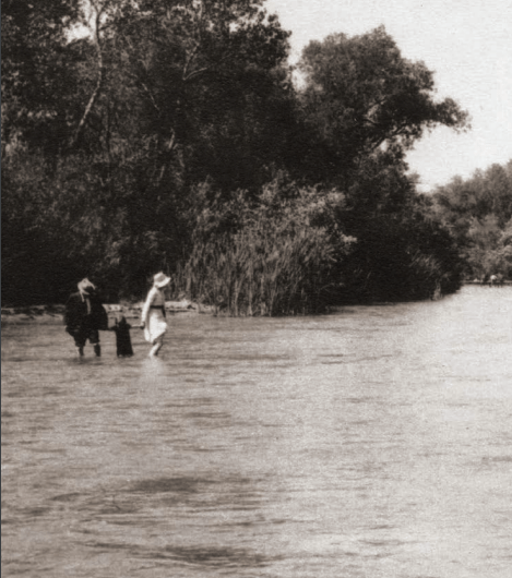
This ultimately led to a legal battle over water “rights” between the Anaheim Water Company and the Semi-Tropical Water Company, which went all the way to the California Supreme Court. Eventually, after a couple mergers of companies into larger more powerful companies, the case was settled out of court and the Santa Ana river water fell under the control of two large companies: The Anaheim Union Water Company and the Santa Ana Valley Irrigation Company. These two companies controlled and sold the water until the 1960s.
With the gold rush and agricultural boom of the late 19th century, the water of the Santa Ana river became inadequate to support all the new settlers and developers. To paraphrase a film: We drank that milkshake. We drank it up.
So developers looked to other water sources and found them in underwater artesian wells, which at one time held 2.5 to 3 million acre-feet of water in Orange County. Drawing water from these underground wells, the Santa Ana river, and the Bolsa Chica wetlands, agriculture skyrocketed in Orange County. Between 1888 and 1912, the amount of irrigated acres rose from 23,500 to 50,000.

This massive exploitation of local water resources was not without consequences. Water levels were dropping rapidly, faster than they could be naturally replenished by rain and mountain runoff. In 1925, water engineer J.B. Lippincott reported to the Orange County Board of Supervisors that the underground artesian well water had shrunk from 315 square miles in 1888 to 52 square miles in 1923.
So what was Orange County’s solution to this very real problem? Did they scale back the massive development? Did they seek more sustainable lifestyles? No way. They looked eastward, thirstily, to the mighty Colorado River. They didn’t want to limit growth and production. They wanted to exand, expand, expand! They wanted more, more, more! It was the American way.
In 1924, local growers like Charles C. Chapman (Orange Tycoon/Fullerton Mayor) lobbied hard for the creation of the Boulder Dam and the building of an aqueduct to bring water from the Colorado River to Orange County. They were successful. Consequently, the value of citrus crops rose in value and profits from $2.7 million in 1911 to $28 million in 1927.
That same year, 1927, saw the formation of the Metropolitan Water District, a joint business venture between wealthy growers and local governments. The MWD, which to this day provides Fullerton with some of its water, ensured decades of water to Orange County, courtesy of the Colorado river. By 1935, 54,000 acres of orange groves existed in Orange County, irrigated by diminishing local supplies and a seemingly endless supply from the Colorado river.
In 1931, prompted by concerns over shrinking groundwater levels, the Orange County Water District was formed with the purpose of conserving and replenishing OC groundwater. The directors of the OCWD were elected by property owners, who were in turn charged a “pump tax” in addition to whatever they were paying the MWD.
1890-1900
Fullerton had been founded just three years prior, in 1887, by the brothers George and Edward Amerige, in the waning days of a real estate boom that saw Southern California’s population explode and dozens of new towns spring up.
Fullerton in the 1890s was a small but growing town with an active downtown surrounded mostly by farms growing oranges, walnuts, lemons, and other crops.
Downtown, there was Alex Henderson’s blacksmith shop, William Starbuck’s Gem Pharmacy, Stern & Goodman’s General Store, the St. George Hotel, the Santa Fe Train station, and a handful of other business buildings.

Law and Order
Fullerton would not incorporate as a town until 1904, so in the 1890s there was no city government, police department, or fire department.
On weekends, those who liked to drink and party would come to Fullerton’s handful of saloons because of the lack of law enforcement, which led to situations like the following printed in the Fullerton Tribune newspaper:
“One result of having police officers in Anaheim who will not permit rowdyism and vulgarity on their streets, may be seen nearly every Sunday in this village. Men who have imbibed too much of the ardent, but who dare not make a noise in the streets of their own city, come over here and indulge in conduct which in a village having police officers would result in their arrest and punishment. Moral: Let us have a constable in town to keep order.”
“A number of roughs, hailing from everywhere, make it a point to come to Fullerton every Sunday, and after imbibing a library quantity of tarantula juice proceed to paint the town a bright, brilliant, carmine tint. They do this with the knowledge that we have no peace officer in this section, and accordingly they have no fear of arrest. We need a constable and a justice of the peace. Anaheim, a small village a few miles south of here, has two of each.”
Saloons!
The saloons in town quickly became the target of two local prohibition groups–the Women’s Christian Temperance Union (WCTU) and the Law and Order League. The liquor question would create serious divisions in the town.
Things started peacefully enough, with the local WCTU asking merchants and saloon keepers to sign an agreement to close their businesses on Sunday.
In 1894, because Fullerton was not yet incorporated as a town, the main governing political body was the county Board of Supervisors. In April, anti-saloon activists circulated a petition which they presented to the Supervisors in hopes of getting them to pass an ordinance outlawing saloons in Fullerton. At the same time, saloon owners circulated their own petition.
The Supervisors passed an ordinance of questionable legality, “compelling the saloon-keepers to remove all chairs, card, billiard, and pool tables and have nothing whatever for people to sit on,” the Tribune reported. “The saloon men are not at all pleased with this ordinance, hence the move to have it declared illegal or unconstitutional.”
In early May, the Supervisors took further action, refusing to grant any saloon licenses for Fullerton.
Following this decision, saloon owners took humorous action, posting the following notices on their public water troughs: “No prohibitionists allowed to water here.”
Things evidently got so heated that something as innocuous as a local school board election divided the town on the saloon question, and the Law and Order League brought out Orange County Sheriff Theo Lacy to keep the peace.
Meanwhile, the saloon owners won a legal victory as a Judge ruled against the legality of the Supervisor’s anti-saloon ordinance.
The Law and Order League responded by having all of the Fullerton saloonkeepers arrested “on a charge of selling liquor without a license.” Whether they were “arrested” by vigilante action or legally arrested is unclear.
We do know that at least three saloon owners were brought before a judge in Anaheim on the charge of selling liquor without a license. They were all acquitted.
Education
In 1889, local voters approved a bond issue of $10,000 to build a four-room brick elementary school building on the northeast corner of Wilshire and Harvard (now called Lemon) Avenues. Landscaping was done by students and teachers.
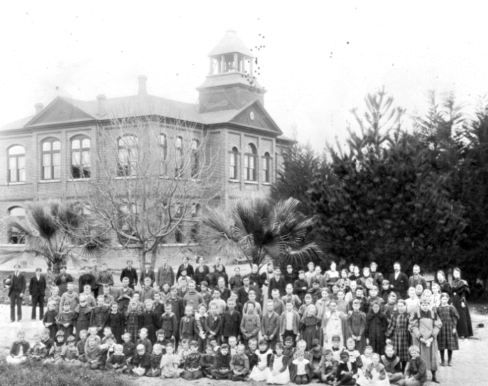
At the end of 1890, the first class graduated from the new school, consisting of just one pupil, Grace McDermont.
A high school would take a couple more years to come about.
“In the summer of 1892 William Starbuck and Alex McDermont canvassed the northern part of Orange County, hoping to transform educational ideas into action,” Louis Plummer writes in his history of Fullerton Union High School, “During the spring of 1893 these activities bore fruit in the form of a request to the county superintendent of schools to call an election for the organization of a union high school district.”
An election was held, and voters favored the creation of a new high school. The first trustees were William Starbuck, A.S. Bradford, B.F. Porter, and Dr. D.W. Hasson.
W.R. Carpenter was the first principal. At first, the new high school rented a room on the second floor of the Fullerton elementary school building, located at the corner of Wilshire and Harvard (now Lemon) avenues.
The Fullerton Union High School district first consisted of the territory of the elementary school districts of Buena Park, Fullerton, Orangethorpe, and Placentia.
Fullerton Union High School opened for classes in the fall of 1893 with eight students. Classes taught by Carpenter that year included Latin, physics, algebra, geometry, history, and English.
According to Thomas McFadden (class of 1896), “…during all the years I attended the Fullerton Union High School I drove back and forth with a horse and cart. All other students had to provide their own transportation.”
Worthington Means, class of 1898, said, “On the back boundary of the school grounds was located what would be a curiosity nowadays, namely, a shed where we could tie our horses.”
Enrollment in the Fullerton Union High School grew from 24 in 1896 to 62 in 1906, when Delbert Brunton became principal of the school.
“During that first summer he [Brunton] spent much of his time upon a bicycle visiting the homes of all eligible students whose names and residences he could learn. The school had not been completely accepted in all parts of the community as a permanent institution. It had added to the tax burden. The need for an educational program above the eighth grade was not universally recognized. Because of these conditions Brunton’s reception was not always cordial and results for the first year were not those for which he had hoped,” Plummer writes.
Immigration and Chinese Exclusion
The completion of the trans-continental railroad in 1869, which had relied heavily on Chinese labor, created a lot of job-seeking Chinese immigrants. These immigrants were a Godsend for large fruit growers in California, as Chinese laborers would work for very low wages.
According to the California Bureau of Labor, Chinese workers constituted around 80 percent of the agricultural laborers in the state in 1886. Low-paid Chinese labor was a major factor in the early economic success of the California fruit industry.
However, anti-Chinese sentiment became federal law in 1882 with the passage of the Chinese Exclusion Act, which curtailed Chinese immigration to America and made official what was already widely practiced. Chinese were forbidden from becoming U.S. citizens.
The Geary Act of 1892 continued the provisions of the Chinese Exclusion Act and also provided for massive deportation of Chinese from the US. The language of the Geary Act is eerily familiar. It “forced the burden of proving legal residence upon the Chinese, and required that all Chinese laborers register under the act within one year of its passage.”
During the years when this anti-Chinese activity was most acute (1893-1894), the United States was in the throes of a major economic depression. During this economic turmoil, Americans sought a scapegoat for their troubles, and found that scapegoat in Chinese workers.
Here in Fullerton, Chinese workers had been a presence since the beginning of the town. Bob Ziebell writes in Fullerton: A Pictorial History, “George Amerige says he installed the town’s first water system ‘employing Chinamen to do the excavation work on the ditches.’”
The Fullerton Tribune newspaper featured a running trend of articles dealing with the topic of Chinese Exclusion, all of which heartily supported it.
On October 7, 1893, Tribune editor Edgar Johnson reported that “Two Chinamen were arrested at Santa Ana Tuesday and taken to Los Angeles to go before Judge Ross on a charge of violating the Geary act by not registering within the time prescribed by law.” On Jan 6 of 1894, Johnson called it a “well-known fact that the Chinese do not make desirable residents in this country.” Edgar Johnson often refers to Chinese people with the racist (but commonly used) term “Chinamen.”
On February 17, 1894, Johnson reported an event that happened in Fullerton. Apparently a mob of 40 locals forced some Chinese workers to leave town.
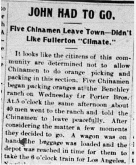
Water
In 1893, water was mainly controlled by the Anaheim Union Water Company, whose board of directors consisted of large landowners and ranchers.
Six years prior, in 1887, the California state legislature passed the Wright Act of 1887, whose purpose was to give small farmers a fair shake by allowing them to band together, form public collectives called Irrigation Districts, and get water to where it was needed.
This was not how the Act was presented in the Fullerton Tribune. Reading articles from 1893 onward, one gets the impression that the sole purpose of the Wright Act was to unfairly tax water companies. It was met with near immediate outrage by the larger local ranchers, who in 1893 formed the Anti-Wright Irrigation League, which saw itself as a defender of taxpayers (Which taxpayers? One wonders.)
The stated function of the Anti-Wright Irrigation League was “the complete annihilation of the Wright Act.” Edward Amerige, co-founder and member of the Board of Directors of the Water Company wrote in the Tribune: “I see inevitable ruin and bankruptcy in the future if the Wright Act is not wiped out.” William McFadden, also on the board, took a more nuanced approach, writing, “I am in favor of the [Irrigation] District, but think the directors made a mistake in levying the special tax. I think the Wright Law would be the best thing for the people if successfully carried out, but if it cannot be done, wipe it out completely.”
The Santa Ana River and its irrigation ditches were protected by men called zanjeros, paid by the Water Company, to ensure the water flowed to its rightful owners: “The zanjeros were instructed not to deliver water to anyone not a stockholder and then not to exceed his stock limit.” These private water police were needed because some people still had the gall to partake of a local natural resource without paying.
Early in 1893, a “zanjero reported that the Chinese at the vegetable gardens north of town had been stealing water from the ditches.” One doubts the veracity of this report, as the Chinese, at this particular moment in American history, were the feared and hated immigrant group of the day. They would soon be run out of town by armed vigilantes.
In addition to taxes, part of the conflict between the Wright-created Irrigation District and the Anti-Wright League (i.e. the Water Company) had to do with the creation of a reservoir. The Irrigation District, presumably representing the interests of small farmers, sought to create a reservoir in the under-represented region of Yorba. The Water Company, presumably representing the interests of the larger ranchers, sought to create a reservoir in La Habra.
And then came the Age of Cement. Perhaps irrigation ditches were already being cemented, but the first mention of this increasingly popular trend appears mid-1894, when the Water Company hired contractors “for cementing the south branch ditch from Crowther’s corner to Brookhurst, 24,244 feet, and the East street ditch form Sycamore Street to Santa Ana Street, 3,300 feet.” More cementations will follow. The Romans would be proud.

If 1894 inaugurated the Age of Cement, 1895 brought the Age of Bonds. With cash flow relatively low, the Water Company began doing large-scale infrastructure projects (i.e. cementing more ditches). How will it pay for this? Why, with bonds: “Speaking of the bonds, Mr. Botsford said that Los Angeles capitalists were eager to purchase the whole issue.” This Mr. Botsford will turn out to be an enthusiastic (and controversial) advocate of bonds.
Edward Amerige emerged as the principal opponent of Mr. Botsford’s bond schemes. In an 1895 letter to the editor, Amerige wrote: “To increase the present great indebtedness of the company at a time when the water sales do not pay running expenses, let alone interest on outstanding notes and bonds, which now amount to $1000 per month, or there about, by cementing the Placentia ditch at a cost of $14,000, is suicidal. It looks as the though the company was run in the interest of 1 or 2 directors.”
Part of the push for more bonds and cementing had to do with a push to expand the territory of the Water Company. Amerige noted: “Who are the people who are clamoring for an increase of the present district? Mostly speculators.” This is a bit ironic because when George and Edward Amerige founded Fullerton, just 8 years earlier, they could be considered speculators. This conflict was really about settled speculators vs. new speculators. Ultimately, it was a conflict over resources.
Amerige’s critiques of the water board become more direct and angry as 1896 rolled on. In an article called “The Water Fight,” he writes: “In looking over the cementing that has been done in the water district I find that the greatest outlay and the most expensive ditches have been made in the vicinity of several gentlemen’s places, namely W.F. Botsford, Wm. McFadden, W. Crowther, and F.G. Ryan. Does this not seem a little singular when all of these gentlemen are directors in the water company?”
By 1897, conflict had developed between the Board of Directors of the Anaheim Union Water Company and Edgar Johnson. Apparently, after Johnson printed some articles criticizing the management of the Water Company, the board of directors decided to stop doing business with the Tribune, which caused Johnson to write an angry editorial in which he said, among other things: “Because a paper criticizes the board is no reason why business should be withdrawn.” As it turned out, it was.
Complaints continued from residents of the region of Yorba, particularly from a Miss Yorba, probably a relative of the famous Bernardo Yorba, who refused to accept $100 for a “right-of-way” for water to pass through her lands. The residents of Yorba seemed to increasingly get screwed in these complex water dealings.
When an election was held for a new Board of Directors of the Water Company, Johnson criticized the election as corrupt: “Forgery was used to carry out the program of the water ring.”
There were often legal battles began between rival water companies. For example, the Anaheim Union Water Company and the Santa Ana Valley Irrigation Company went to court to prevent ranchers from the San Joaquin Valley from trying to use water from the Santa Ana River.
As the 19th century drew to a close, legal (and sometimes physical) fights over water would continue.
A Disastrous Fire
In 1898 a massive fire destroyed some buildings downtown, including part of Stern & Goodman’s store. At this time, Fullerton did not have a fire department. Instead, over 100 men and women pitched in to try to help extinguish the flames.
“At the time of the fire there was not a drop of water in the town tank but a bucket brigade was organized at once and was soon carrying water from the large storage tank on Commonwealth avenue, about 200 yards from the burning buildings,” the Tribune reported.
Fullerton’s fire department would not be organized until 1908, after another, even more destructive fire downtown.

1900-1910
Government & Politics
At the turn of the century, Fullerton was not yet incorporated as a town, and therefore had no City Council. The governing body was the County Board of Supervisors.
In 1902, Dallison Smith Linebarger, a Democrat who owned a livery [horse] business in town was elected to represent District 3 on the Orange County Board of Supervisors. He defeated fellow Democrat B.F. Porter (a Fullerton rancher) in the primary, and Republican William “Billy” Hale (also a rancher) in the general election. He would be re-elected and serve until 1912.
That same year, town co-founder Edward R. Amerige, a Republican, was elected to the California State Assembly. He would serve two terms.
Fullerton incorporated in 1904. Residents voted to establish Fullerton as a city, complete with a Board of Trustees (City Council) and taxation powers. The first Board of Trustees was Edward Amerige, E.K. Benchley, Charles Chapman, George Clark, and John Gardiner.
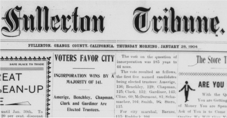
W.A. Barnes was elected city marshal, George Ruddock was elected City Clerk, and J.E. Ford was elected city treasurer.
The newly-established Board of Trustees began to pass a series of ordinances. They established a fire protection district, a board of health, franchises with telephone, gas, and electric companies, built new sidewalks, and made street improvements.
They also passed ordinances prohibiting some things in town, most of which make sense–no fighting in the streets, etc. But some of the town prohibitions seem quite harsh, such as bans on vagrancy and cross-dressing.
There was some conflict over the appointment of a postmaster for Fullerton. This was a position appointed by local congressman Milton Daniels. Although a petition with 500 signatures advocated the appointment of Cora Vail, Congressman Daniels appointed Vivian Tresslar (a man), allegedly at the request of Mayor Chapman.
“Captain Daniels has announced that he will absolutely refuse to recommend the appointment of any woman for the position,” the Tribune stated.
Tresslar was also the hand-picked editor of the Tribune’s rival newspaper, the Fullerton News–which was bankrolled by Mayor Chapman.
During the 1906 election, eschewing any kind of journalistic objectivity, Tribune editor Edgar Johnson clearly had his favorite candidates. Prior to the election, he ran articles/editorials that advocated for what he called “The People’s Ticket,” which included City Trustee candidates E.R. Amerige, R.T. Davies, and L.P. Drake.
This was in contrast to what Johnson called “The One-Man Power Ticket.” That one man was Charles C. Chapman, whom Johnson had taken to calling the town “Czar” and “The Great I Am.”
Unfortunately for “the people,” the Chapman ticket swept the race. Chapman, for some reason, was not up for re-election–perhaps he had a four year seat.
Town co-founder Edward Amerige, who was a part of the “People’s Ticket” wrote a letter to the Tribune after the election condemning dirty political tactics of his opponents. His words show that not much has changed in over a hundred years:
“I desire to say a few words in your paper regarding the anonymous letter which was sent through the mails during the recent election. Such a contemptible, sneaking, lying and cowardly act is hardly worth replying to through the medium of newspapers. The proper place to answer such a blackmailing and malicious letter is through the criminal courts and should information be secured as to the authorship of this libelous letter such an action will be commenced. The men and parties who would stoop to such despicable means of trying to influence voters would stoop to anything to carry their ends, and are a dangerous and undesirable element in any community. Several of the parties who are mixed up in this disgraceful attempt to besmirch decent men are supposed to be respectable citizens, but when they resort to such methods and are so cowardly as not to dare sign what they write, they are worse than a coyote that roams in the dark.”
In 1908, the City Council election pitted the “All Citizens’ Ticket” against “The Peoples’ Ticket.” Tribune editor Johnson clearly favored “The Peoples’ Ticket, and they (mostly) won. The newly elected trustees (council members) were: Will Coulter, August Hiltscher, J.H. Clever, and William Crowther. The treasurer was W.R. Collis, the clerk was W.P. Scobie, and the Marshal was Charles Ruddock. Coulter was chosen as Chairman, or Mayor.
In 1910, the following men were elected to City Council: R.S. Gregory, E.R. Amerige, and George C. Welton. Roderick D. Stone was elected Marshal, C.A. Giles was elected City Clerk, and W.R. Collis was elected Treasurer.
At the state level, California was in the midst of quite a political shake-up, with the election of progressive Republican Hiram Johnson as governor in 1910. At this time, the California Republican Party was divided between the more establishment/conservatives (who were connected to large business interests like the powerful Southern Pacific Railroad) and the progressives, who wanted to enact many political reforms. One of these reforms was the creation of the direct primary system. This allowed the voters, rather than party bosses to choose candidates. It was intended to help “clean up” corrupt “party machine” politics.
Meanwhile, another town co-founder H. Gaylord Wilshire, a noted socialist, had his magazine the Challenge banned from the U.S. mail. He ended up changing the name of the magazine to Wilshire’s Magazine and shipping them out of Canada, to get around the ban.
News
Tribune editor Edgar Johnson spent considerable space ruthlessly attacking the competing newspaper in town, the Fullerton News, which was funded by mayor/orange grower Charles C. Chapman because he didn’t like the coverage he was getting in the Tribune. Johnson called the Fullerton News the Fullerton Snooze! When Chapman sought to end the city’s contract with the Tribune to publish official notices and give the contract to the News, Johnson again called him “Czar Chapman.”

Meanwhile, some of the front page “news” stories in the Fullerton News were blatant puff pieces about Mr. Chapman and his sprawling orange ranch. Below are a few excerpts:
“He comes of that sturdy American ancestry which has ever in past times of peril been the salvation, and must in like times to come, be the hope of this country.”
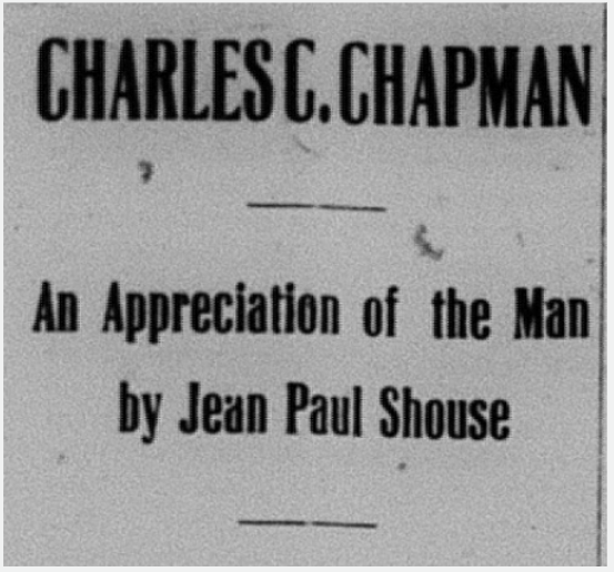
“Under Mr. Chapman’s ownership and management, this property has become the most famous orange ranch in the world, as well as one of the largest…Indeed, the Santa Ysabel is a model, perfect in every detail as an orange ranch and home, and one in seeking to describe it with justice would be forced to use language seemingly superlative to one who has not viewed it for himself. From the beautiful and elegantly appointed family residence to the cement flumes, ditches, and pipe lines no intelligent effort or expense has been spared, no opportunity neglected to bring everything as near perfection as lies within the power of human hand and mind.”

“It is to Mr. Chapman’s liberality that the Christian church of Fullerton is indebted for the cozy, attractive house of worship it now occupies. A well known religious periodical in speaking of him recently said: “This religion of his is not of the ‘holier than thou,’ sanctimonious sort, but the honest, rugged, straightforward kind that never parades itself, yet everywhere wins the respect of the world.”
His faith is the kind that never parades itself? The newspaper he was bankrolling ran a front page “article” extolling the virtues of Mr. Chapman.
“Mr. Chapman resides at his beautiful, though unostentatious, home; busy with material affairs, hospitality and good deeds.“

His “unostentatious” house had 13 rooms.
“He has been justly termed ‘The Orange King of the World,’ and this he does not resent.”
Then, as now, powerful men like to have a fawning press. Edgar Johnson of the Tribune would not bend the knee to “Czar Chapman.”
Prohibition
The sale of liquor remained (mostly) illegal in Fullerton, following an 1894 county ordinance. There was an active Women’s Christian Temperance Union and an Anti-Saloon League, and they involved themselves in county politics.
In 1902, a Jo Smith of Fullerton was arrested, charged, and found guilty of violating the county liquor ordinance by selling liquor.
Perhaps adding some fuel to the fire of the liquor question occurred when attendees of a temperance meeting of the State Anti-Saloon League at the Fullerton Methodist church were interrupted by screams. Apparently, a Mr. J.J. Grogan had returned home intoxicated and attempted to burn down his house.
One result of incorporation in 1904 was that the newly elected city trustees could either allow or ban saloons. Those opposed to saloons included members of the Women’s Christian Temperance Union (WCTU), some local pastors, and the Anti-Saloon League.
Famous prohibitionist Carrie Nation passed through Fullerton in 1903 and was interviewed by Tribune editor Edgar Johnson.
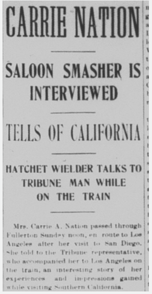
There was a highly publicized trial against a J.A. Kellerman who was accused of serving liquor in Fullerton as part of a Nationalist Club meeting. He was ultimately not convicted, as there was a hung jury.
The newly-formed Board of Trustees decided to put the question to a town vote as part of a larger city election.
In the newspapers leading up to the election, the Tribune printed editorials for and against prohibition.
Ultimately, a majority of residents voted to allow saloons downtown. However, two years later, in 1906, the town voted to outlaw them.
This was the result of years of organizing by the Women’s Christian Temperance Union and the Anti-Saloon League.
In 1909, when the liquor question again was put to a vote there was overt voter suppression of Mexicans: “A number of Mexicans who, it is believed, were anxious to vote for license, were challenged, frightened, and not allowed to vote, on the grounds that they could not read, etc.”
The town again voted “dry.”

Education
In 1902, Fullerton had a grammar school and a high school, with an enrollment in the hundreds. Neither of these buildings exist today.
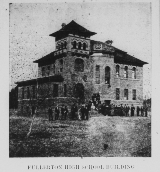

In 1906, voters approved the site for a new high school to be built on Commonwealth Avenue, where Amerige Park is today. The community was outgrowing the first brick high school building on Lawrence Ave. near Lemon.
The new high school was completed In 1908.
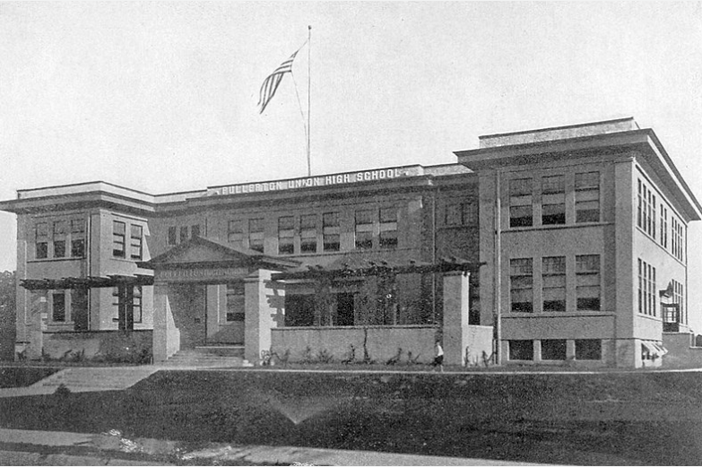
Unfortunately, in 1910, the building burned down.
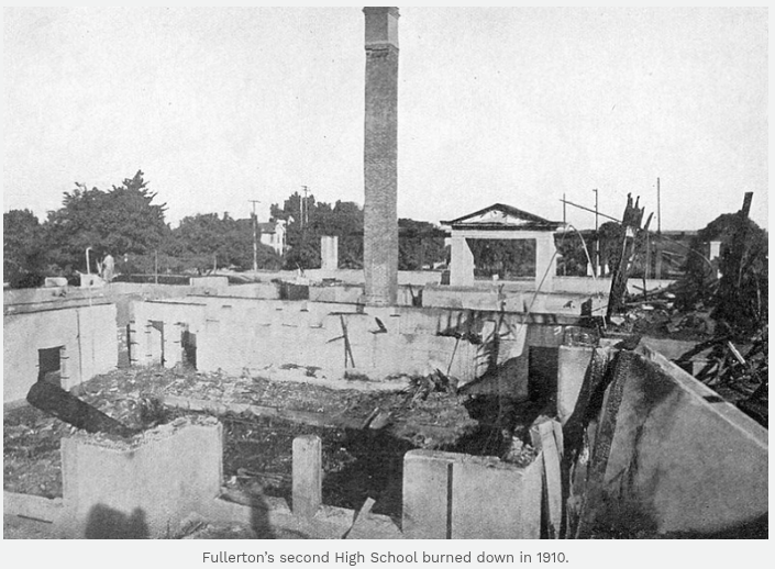
Following this tragedy, the community began plans for a new high school, which would be built on Chapman Ave–where the high school still stands today.
In 1908, a seemingly normal article about the sudden death of W.R. Carpenter, former Fullerton High School principal ended up revealing a scandalous story about how Carpenter left his wife for the widow of the local Baptist minister.
Apparently, Carpenter married a Mrs. French Chaffee (widow of the Baptist minister) at sea when he was also married to another woman. After Carpented died, Mrs. French sued Carpenter’s first wife for money that she claimed she had loaned to her “husband.” Ultimately, French Chaffee’s claim was denied in court.

Meanwhile, the Tribune got its hands on some steamy love letters written by Carpenter to French Chaffee, and published some of them–creating quite the local scandal.
Agriculture
The citrus industry was booming and growing. In 1903, there were nine packinghouses in Fullerton along the Santa Fe railroad tracks. The downtown was surrounded by acres of orange and walnut groves, plus a smattering of other crops. Some groves were relatively small, while others were massive.
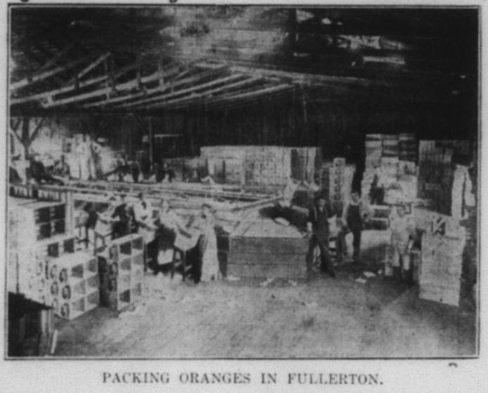
The most successful grower in 1902 was Charles C. Chapman, whose Old Mission brand Valencia oranges fetched the highest prices. Chapman’s ranch encompassed over 300 acres. In 1901, he shipped 130 carloads of oranges.
“C.C. Chapman, owner of the Santa Isabella ranchos and Orange groves, holds the highest record for prices obtained for oranges in the United States–$15.05 per box, besides being the largest individual grower and shipper of oranges in California,” the Tribune reported.
By the early 20th century, the orange industry was not functioning by the ordinary rules of capitalism and competition. Instead, the growers, shippers, and marketers were pooling their resources through Fruit Exchanges to eliminate the lower prices caused by competition.
“In this amalgamation the fruit exchanges and the independent shippers are to participate, irrespective of past differences, and the fierce competitive battle for supremacy in selling markets is likely to be replaced by a well-organized central sales agency, through which all independent and all exchange fruit will be marketed by a single board of control,” the Tribune reported.
This citrus conglomerate was initially called the California Fruit Growers Exchange, and later Sunkist.
Sunkist was essentially a union for the growers. Meanwhile, a 1904 article in the Tribune written by “one of the laborers” urged the workers to form a union of another kind–a worker’s union.
Here is the full text of the above (right) article:
“The Tribune has received a communication signed “One of the Laborers,” which advocates increased pay for ranch laborers in this section and their organization into a union to attain that object.”
The communication, addressed “To Whom it May Concern,” begins by stating that the American laborers in the Placentia district have a grievance in regard to their monthly pay. The writer says that the workers want a reasonable price for their day’s work, and cites the action of the Ventura laborers who organized a union, and decided not to work for less than $30 a month. The advantage of a union is then urged, and the local workers are called upon to organize for the purpose of getting their “price.” The communication declares that they now get 95 cents a day, which is denounced as a “regular outrage.” The warning is made that the workers will not stand for this “slavery any longer than the present time.”
After commenting that the hired man is “looked down on, snarled at,” the communication states that he is often forced to sleep in the barn, and concludes as follows:
“Boys, what do you think of that? We are not permitted to sleep in the house after a hard day’s work. We are brothers in Christ Jesus, born of one flesh and blood, and we ought to have a tender feeling for all. But after all of that the cold-hearted rancher sends his hired man to the barn to sleep with the living creatures that inhabit therein.”
On the same page as the above article was another entitled “The Chapmans Entertain Their Friends and Neighbors”:
Here is the full text of that article:
“Strictly the event of all social events in Placentia was the reception given by Mr. and Mrs. C.C. Chapman Thursday evening to their friends, neighbors, and strangers as well, of Placentia. The invitations were universal showing the good spirit and kindliness of the host and hostess, and the acceptance was almost universal. The guests were received by Mr. Stanley Chapman and his sister, Miss Ethel Chapman, and afterward by Mr. and Mrs. Chapman and Mrs. Hatchill, assisted by Mrs. McFadden and Mrs. Bradford. An orchestra occupied the music room and provided music throughout the evening. After cordial greetings on every hand the guests were given the opportunity to inspect the beautiful rooms on the first floor, consisting of library, reception hall, music room, dining room, breakfast room and kitchen. The rooms on the second floor were then shown. The guests were then invited to the third story which proved to be a hall strictly in keeping with the rest of the house. Here the guests were seated and most thoroughly enjoyed an entertainment.
Dainty refreshments were served in the breakfast room and then after a little longer social intercourse and a last lingering look the guests bade their host and hostess and family good night.
The above contrast between the situation of the workers and the lavish mansion of Chapman, the mayor and wealthiest orange grower, speaks to the social divisions of the day.
Water
In order to make this agricultural economy thrive, water had to be obtained and regulated. The company which oversaw allocation of water from the Santa Ana River and all the major irrigation channels in north Orange County was the Anaheim Union Water Company, which sometimes had legal fights with water companies to the South who also drew from the Santa Ana River, such as the Santa Ana Valley Irrigation Company.
These were private companies whose Board of Directors tended to be owners of large, local ranches. Water rights (also called riparian rights) were a really big deal—water is life, and profits for farmers. Around 1901, these two water companies met together to bring legal action against a Mr. Fuller, “the Riverside county land-grabber” to prevent his taking water from the Santa Ana River. This would be one of many ongoing legal battles over local water rights.
In the meetings of the AUWC, there was discussion of purchasing the water rights of James Irvine, the man whose descendants founded the Irvine Company, which now owns the city of Irvine. In those early days, “maintaining an accurate division of the water [was] difficult if not impossible to devise.”
Meanwhile, the Anaheim Union Water Company and the Santa Ana Valley Irrigation Company cut a deal to share water rights. Mr. G.W. Sherwood, a sometimes AUWC Board Member who liked to write lengthy articles in the Tribune criticizing those who disagreed with him, took issue with the deal. To which Samuel Armor of the Santa Ana Valley Irrigation Company replied: “G.W. Sherwood seems to be afflicted with a diarrhea of words accompanied by a costiveness of ideas. For two years or more he has been filling the papers west of the river with misrepresentations and insinuations against the S.A.V.I. Co. until his followers have come to believe the the people on this side are equipped with hoofs and horns and forked tails.” To which Sherwood replied: “I have always taken pleasure in setting Armor right, when he gets tangled up in the mazes of his own alleged erudition…With regard to the proposed division of water, Armor’s premises are false and his conclusions are wrong.”
Like any political entity vested with power, the AUWC was occasionally hostile to journalists who were critical of its policies. In 1903, the Board of Directors passed a resolution excluding reporters from their meetings. Shortly thereafter, the Tribune got word that an important report had been suppressed, to which Tribune editor Johnson replied: “The best way would be to permit the reporters to attend the meetings, then the reports and proceedings would not be suppressed.”
Perhaps the most contentious local water issue of 1906 was the question of whether the city would buy the town’s privately-owned Water Works (a pumping and storage plant) from its owners, the Adams-Philips Co. This issue created much public debate over the economic and philosophical merits of public vs. private ownership of utilities, a debate that feels relevant today. Prior to the election, it appeared that the majority of the citizens of Fullerton favored city ownership of the water works.
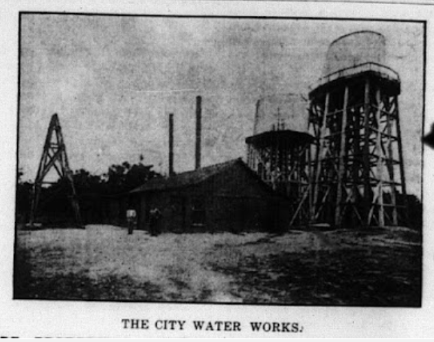

Ultimately, however, the issue went to a vote and was defeated. Tribune editor Johnson mused: “with the present plant owned by millionaires and in operation…the longer a city delays in acquiring public utilities, the more expensive becomes the undertaking.”
A group calling itself the Citizens Protective Association organized much of the opposition to the water bond issue.
In 1907, a seven year-long lawsuit upheld the water rights of the two Orange County companies, the Anaheim Union Water Company and the Santa Ana Valley Irrigation Company against a Riverside rancher named Fuller.
Fullerton rancher Charles Chapman was criticized by the Tribune (and apparently his neighbors) for changing the course of a waterway to protect his crops from flooding, meanwhile causing other ranchers’ properties to experience flooding during a recent storm.
In 1908, the Anaheim Union Water company completed the Yorba Reservoir, (later known as Yorba Linda Lakebed Park). The reservoir was located near Lakeview Avenue in Yorba Linda.
Oil
Starting in the late 19th century, several oil discoveries were made in the hills north of Fullerton, as well as in the Brea-Olinda area.
Early drillers included the Puente Oil Company and the Santa Fe railroad company.

Next, the Graham & Loftus company entered the field drilling “some of the best spouters in the Fullerton field, some of them going as high as 3,000 barrels a day,” the Tribune reported.
Then followed the Columbia oil company, the Fullerton Consolidated company, the Fullerton Oil Company, the Olinda Oil company, The Brea Canyon Oil Company, and the Union Oil Company.

Much of the Fullerton oil was piped to San Pedro by the Union Oil company’s 4-inch pipe line, a distance of 30 miles, and from there the company shipped to San Francisco for refining and other purposes.
By 1903, the Fullerton field was producing monthly nearly 125,000 barrels of oil.
Around this time, the Murphy Oil Company screwed the Bastanchury family out of oil they were entitled to.
The story is told in more detail in an article from the web site Basques in California:
“In 1903, the Murphy Oil Company leased the West Coyote Hills lands from the Bastanchury Ranch to dig for oil. One year of excavations found them hot mineral water at 3,000 feet. As one of the oil workers later confessed, they found an oil well at 3,200 feet but covered it up. In 1905, Murphy bought off from Domingo Bastanchury more than 2,200 acres in the surroundings of La Habra, at $25 an acre. Allegedly, Murphy assured Domingo before the acquisition, that those lands held no oil. Time later, the Los Coyotes Hills area became South California’s largest oil field.”
As time went on, the larger companies used their power to buy out smaller companies.
“The Fullerton field from Olinda to Brea Canyon presents an extremely busy appearance,” the Fullerton News stated. “As far as the eye can reach, new derricks rear their heads. Lumber and rigging are hauled in large quantities and the largest force in the history of the field is employed.”

Social and Business Clubs
At the turn of the century, around 6 million Americans were part of fraternal organizations. Fraternal organizations were a big part of the social life of Fullerton. The most prominent of these were the Masons, whose members included Dr. George Clark, William Berkenstock, William McFadden, A.A. Pendergrast, Otto Des Granges, and other prominent community members.
Another fraternal order, The Odd Fellows, had members who included William Goodwin, Edgar Johnson, Edward Magee, August Hiltscher, W. Schumacher, James Conliff, and others.
Local businessmen organized a Board of Trade in 1902 whose directors included Jacob Stern (co-owner of Stern & Goodman general store), William Brown, T.B. Van Alstyne, E.W. Dean, and V. Tresslar. Among the first matters taken up by the Board was securing electric lighting downtown, protecting the town against fires (the Fullerton Fire Department would not be organized until 1908), improving sidewalks and roads, and devising “a system of keeping tabs on any dead beats who may reside in the county or come this way…for mutual protection of our business men.”
A Chamber of Commerce was also formed, which seems a bit redundant with the Board of Trade. Its officers included Charles C. Chapman, Edward Amerige, and other prominent businessmen.
Religion
By 1902, there were at least three churches in town, all Christian. A Baptist Church, a Presbyterian Church, and an M.E [Methodist Episcopal?] church. In addition to fraternal organizations and schools, churches allowed for social interaction among the townspeople.

Homelessness
Edgar Johnson’s attitude toward the homeless was particularly harsh, and not that different from the attitudes of some today. Below are some excerpts of articles from the Tribune:
“Orange County Constables are having considerable trouble with hobos who infest its towns. Constable Llewellyn of Anaheim has been particularly active of late in making arrests.”
“Anaheim is not alone in being bothered by these wanderers. They abound in Fullerton and vicinity in almost as great an extent as in Anaheim. The experience with some of those arrested in the town down the road is evidence that these tramps are not only an obnoxious but in some cases a dangerous element in the country.
“Tramps are coming into Los Angeles and Orange counties in squads of forty and fifty. Every freight and passenger is loaded down with hobos and the trainmen are kept busy at every stopping point in vain endeavors to keep the brake beam artists off the cars.

Racism
By the turn of the 20th century, Japanese farmers and farm labor had replaced much of the Chinese labor that was curtailed by the Chinese Exclusion Acts. Dredging up the same arguments used to justify Chinese Exclusion (essentially, “they’re taking our jobs and doing better at business than we are”) white Californians agitated for excluding Japanese immigrants as well.
A 1907 Tribune article called “Japs Still in Town,” describes how a committee sought (apparently unsuccessfully) to run some Japanese people out of town, presumably because they were Japanese.

Here are a couple paragraphs from the article:
“Sunday afternoon a number of young men about town decided to go to the house where five or six Japanese reside at a late hour Sunday night with the intention of driving them out of town. Frank Claudina overheard the conversation of two or three of the brave lads and offered to pay the whole bunch $5 a head and also pay their fines if arrested, if they would go to the house and manage to get even one Jap out of the city. They did not take Frank’s offer, but declared that they would make good and hustle the foreigners out of town that very night.
This anti-Japanese sentiment found a welcome home in the pages of the Tribune, as shown by the following excerpts:
“While there has been no open declaration of hostilities there is war between the Japs and the whites of southern California.
“The Jap now clashes with the white, whether it be as a producer and shipper of vegetables, as a wage earner in the garden or orchard or as a laborer in other lines. This competition is becoming so strong that in some sections civic organizations are said to be preparing to appeal to the citrus growers and packers to employ none but Americans.”
Aside from racism, part of the white resentment against Japanese farmers stemmed from the success of Japanese farmers, both at growing and organizing their business.
“The Nipponese may not possess any great inventive genius, but they have not overlooked the co-operative methods of fruit and vegetable men. With a large acreage of farming land under their control they are preparing to adopt, and in some cases have adopted the co-operative marketing method of the Americans,” the Tribune reported.
Tribune editor Johnson re-printed an article by a Mr. Robbins, which argued that “The Japanese Must Go.”
“The question of Japanese exclusion was also being discussed at the national level with a Congressman Hayes introducing a bill “providing for the exclusion of the Japanese from this country, except certain favored classes,” the Tribune stated.
“As a matter of fact,” the article states, “the bill provides for excluding not only Japanese…but all orientals of the less desirable classes in other countries than Japan and China.”
“There is no doubt where the Pacific Coast stands on this question of Oriental immigration. All of the western members met together recently and agreed to support the Hayes bill, or at least the principles in general which it advocates,” the Tribune reported. “The Associated Chambers of Commerce of Orange County is going on record against Japanese immigration, against encouraging the Japanese to settle in Orange County, and against the sending of Orange County literature to the Orient.”

This anti-Japanese agitation would ultimately culminate in various exclusionary policies, including the 1913 Alien Land Law in California, which severely restricted the ability of Japanese (and other Asian immigrants) from owning or leasing land.
New Library
In 1907, Fullerton’s first real library, built with funding by industrialist Andrew Carnegie, was completed at a cost of over $10,000. The Library was on the site where the Fullerton Museum Center is today.
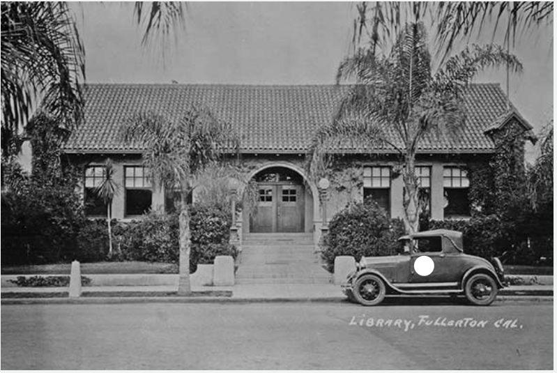
Sports
Walter Johnson, a future Hall of Famer, had been a pitcher at Fullerton High School. He went on to play for the Washington Senators, and became a source of pride for Fullertonians.
Fire
In 1908, a large fire destroyed three buildings downtown.
This fire prompted the citizens of Fullerton to organize the first volunteer fire department, to raise money for fire protection, and to consider municipal ownership of the waterworks downtown.
Health
In 1903, Fullerton’s first hospital opened. The Tribune called it “an up-to-date establishment and the best institution of its kind in Southern California. An efficient corps of nurses are in attendance at all times, so that patients of this hospital receive the best attention and care, which has already made the reputation of this hospital as one of the best.”

Deaths
In 1902, William “Big Bill” McFadden, died at age 62. Originally a schoolteacher, McFadden came to California in 1864, and served as Superintendent of Schools in Santa Ana. In 1869, he became a pioneer of citrus farming and was the second orange rancher in Placentia. He helped organize the Southern California Fruit Exchange, the Fruit Growers Bank, which then became the First National Bank of Fullerton, the Anaheim Union Water Company (on which he served as president and as a director). McFadden was a prominent figure in the local Democratic Party and was a representative from Orange County at the national Democratic convention of 1900.

The pallbearers at his funeral were Edward R. Amerige, Alex Henderson, Richard Melrose, Elmer Ford, Henry Lotz, and A.S. Bradford. The local bank and other stores closed for his funeral. He is buried in the Anaheim Cemetery.
In 1906, Fullerton pioneer rancher Henry Hetebrink died. His son John would later build that big old house (now vacant) on the Fullerton College campus, at the corner of Chapman and Berkeley.
In 1909, pioneer Fullerton resident Domingo Bastanchury passed away.

1911-1920
Fullerton’s population grew from 2,690 in 1910 to 4,415 in 1920.
Fire Protection
In 1908 following a big fire downtown, Fullerton created its first volunteer fire department. In 1914, voters approved bonds for a fire truck and named officers. J.M. Clever was chosen as chief.
Health
A new hospital was approved in 1912 at the corner of Pomona and Amerige. This building still stands today, although it is no longer used as a hospital.
In 1918, a deadly flu epidemic spread across the world, including the United States. Though it likely did not actually originate in Spain, it became known as the Spanish Flu. Hospitals were filled to capacity, and lots of people died, including here in Fullerton.

International Affairs
South of the border, the Mexican Revolution caused thousands of immigrants to migrate north, to the United States.
In 1916, Pancho Villa’s fighting forces raiding American settlements along the border, prompted a full-scale invasion of Mexico by U.S. troops, much to the consternation of Mexican president Carranza, who was also fighting Villa.
One unfortunate consequence of the conflict with Mexican revolutionaries was that it led to fear and suspicion of Mexicans in the United States, who were sometimes viewed as being in sympathy with Villa, or even secretly helping his cause.
“That secret recruiting of Mexicans for the Mexican army has been going on in Fullerton for the last week became known today. Half a score of Mexicans are known to have left town and others are said to be preparing to leave,” the Tribune reported. “Further precautions against possible rioting of lawless Mexicans here took concrete form Thursday night when the board of trustees, at a special meeting, approved the addition of thirty-five citizens to the ranks of the police force as deputy marshals…Five deputy marshals have been on the force for some time, swelling the total of officers available to forty, and other additions are to be made within a short time.”
In 1914, World War I began in Europe. The United States would not officially enter the war until 1917. Upon this announcement, local residents formed a Home Guard, and the high school formed a military company.

The U.S. government instituted a draft to obtain soldiers for the American military. Eligible adults aged 21-30 had to register. 385 people registered in Fullerton. Charles C. Chapman was local draft board chairman.
The Tribune actively sought to shame those “slackers” who did not register for the draft, printing the names of those required to register, and those who were caught not registering.
Patriotism was in the air, manifesting in rallies, Red Cross drives, Liberty Bond drives, and a massive fourth of July celebration.
Two local young men, Fred Strauss and Nels Nelson, registered for the draft. According to an oral history interview with Strauss conducted decades later, he explained what prompted him to enlist.
“We went there to Los Angeles and had a lot of beer. Finally, after we had had enough beer and we got to feeling pretty good, I said to my pal, ‘Let’s go and enlist and join the Army.’ And he said, ‘Okay, we’ll go.” So they enlisted.
Amidst all the patriotic fever, one local group took a public stand against the war–the local Socialist Party.
High School principal E.W. Hauck enlisted, or was drafted.
Unnaturalized Germans over the age of 14 living in the United States had to register with the postmaster.
In 1918, Germany surrendered, essentially ending the war.
The 1916 Flood
A terrible flood took place in 1916 when the Santa Ana river overflowed its banks. This was particularly devastating for Mexican-American families who lived in the lowlands along the river’s path.
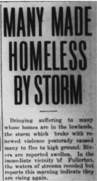
The Tribune stated, “Ten Mexican families are being cared for by Alfred Vail, who lives between Fullerton and Anaheim, and other Mexicans, are being cared for at Anaheim.”
“The body of Mrs. Eleareintia Nunez, a Mexican woman 89 years of age, was found by C.A. Myers in his walnut orchard. The body was identifited by Jose Nunez as that his mother, Mrs. Elcarcintia Nunez. Nunez also identified the body of the 12 year old Mexican boy discovered Thursday as that of his son Juan,” the Tribune reported. “The body of one of Nunez’s sons is still missing. Alberto, aged 9, was in the house at Peralta that was washed away by the flood last Sunday night. There were three persons in the house, the two boys and their grandmother. Nunez and his two daughters had gone to Anaheim for supplies, and did not return Sunday on account of the rain. That is all that prevented them from being in the house that went down the river.”
After the flood, local leaders began to talk about plans to control the waters of the Santa Ana river.
In 1913, Fullerton built a new municipal water system with a pumping plant, a reservoir, and 12 miles of underground water pipes.
Additionally, the city was building a modern sewer system.
City Council Members
Below are the City Council Members elected in each election during this period:
1914: George Anin, R.S. Gregory, August Hiltscher, and E. Livingstone.
1916: J.R. Carhart, J.M. Clever, A.H. Sitton, and Perry C. Woodward.
1918: R.R. Davis, Robert Strain, and Perry Woodward.
1920: W.F. Coulter, L.P. Drake, and R.A. Mardsen.
Women’s Suffrage
The state of California was ahead of the curve when it came to women’s suffrage. Women in the Golden State got the right to vote in 1911, as a result of a ballot measure (Prop 4), fully nine years before the passage of the 19th Amendment. Women could also run for political office.
Of course, not everyone was in favor of granting women the right to vote, as this advertisement in the Tribune demonstrates:

In the leadup to the vote, there were large gatherings on the issue of women’s suffrage, including in Fullerton. Ultimately, Prop 4 passed, and women were allowed to vote in California.
In 1920 the first woman was elected to public office in Fullerton. Belle J. Benchley was elected a grammar school trustee. Benchley would eventually move to San Diego, where she would become a noted zookeeper and author.

1920 was also the first year women were allowed to serve as trial jurors in Orange County.
Prohibition
In just about every election cycle since Fullerton incorporated in 1904, petitioners put the liquor question on the ballot. In 1912, with the large number of women registered to vote, the town voted (once again) to ban liquor licenses, thus making Fullerton a “dry” town.
The national prohibition question was also playing out locally.
“Laying plans for the 1917-18 campaign, prohibition workers from all parts of the county gathered in Fullerton Monday,” the Tribune reported.
The US Senate had passed the 18th Amendment in 1917, but it would not be ratified by a majority of the states until 1919, and national prohibition did not take effect until 1920, with the passage of the Volstead Act. Prior to that the Wartime Prohibition Act took effect in 1919, which banned the sale of beverages having an alcohol content of greater than 1.28%.
Both locally and nationally, the Women’s Christian Temperance Union had been an active proponent of Prohibition for many years.
Education
In 1910, Fullerton’s second high school, which was located at Amerige Park, burned down. In 1911, Fullerton voters approved a bond measure to fund the construction of a new high school. There was some debate over the location. Ultimately, the site was chosen on Chapman Ave. where Fullerton High School is today.

In 1913, Fullerton College was established. Today, Fullerton College is recognized as the oldest continuously operating community college in California.
The new college campus started on the newly-built high school campus on Chapman Avenue.
In 1914, the principal of FUHS was Delbert Brunton, and teachers were chosen by the Board of Trustees.
A popular movement seeking to prevent both racial and labor strife was called “Americanization” in which employers provided education to “Americanize” its foreign-born immigrant workforce. In contrast to today’s appreciation for diversity and cultural and linguistic difference, the Americanization movement sought to mold different ethnic identities into English-speaking Americans.
“Where no English is spoken disease breeds, because the immigrant cannot read the suggestions of the Board of Health. The I.W.W. [Industrial Workers of the World] breeds where no English is spoken,” the Tribune reported. “The country is awake to the danger of the alien population, and ‘Americanizing’ must become the great national movement.”
Locally, citrus growers, in collaboration with educational leaders, established special schools in “Americanization” for their predominantly Mexican workforce.
Read more about Fullerton’s Americanization program HERE.
Racism
In 1913, the California legislature passed the California Alien Land Law (also known as the Webb–Haney Act), which prohibited “aliens ineligible for citizenship” from owning agricultural land or possessing long-term leases over it, but permitted leases lasting up to three years. It affected the Chinese, Indian, Japanese, and Korean immigrant farmers in California. Implicitly, the law was primarily directed at the Japanese.
It passed 35–2 in the State Senate and 72–3 in the State Assembly.
The law was the culmination of years of anti-Asian sentiment in California, going back to the 1882 Chinese Exclusion Act.
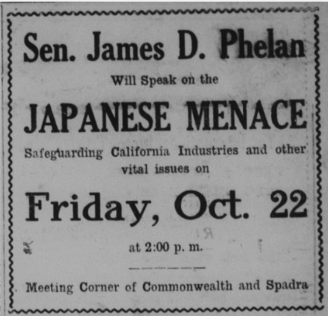
By 1920, anti-Japanese feeling in California was intense. Apparently, it was politically advantageous to demonize Japanese immigrants. A Senator James D. Phelan came to Fullerton to speak on the “Japanese Menace.”
California was not the only state to pass an exclusionary law against the Japanese. Texas (of course) followed suit, a long with Arkansas, Florida, Minnesota, Nebraska, Oregon, Utah, Washington, and Wyoming.
Speaking of racism, in 1914, California had laws on the books which outlawed interracial marriage. The News-Tribune printed an article which pointed out that some Japanese people in California had married white Americans. Given the widespread anti-Japanese sentiment at the time, this article was likely meant to provoke outrage, rather than sympathy. Interracial marriage, which was outlawed since California became a state in 1850, would remain illegal in California until the 1948 court case Perez v. Sharp.
In the early 20th century, there was an emerging pseudo-science called eugenics which was the basis for racist beliefs and practices, such as laws which prevented interracial marriage.
While Fullerton was building new housing and businesses for its white residents, in 1919, there was vocal opposition for the construction of housing for Mexican Americans.
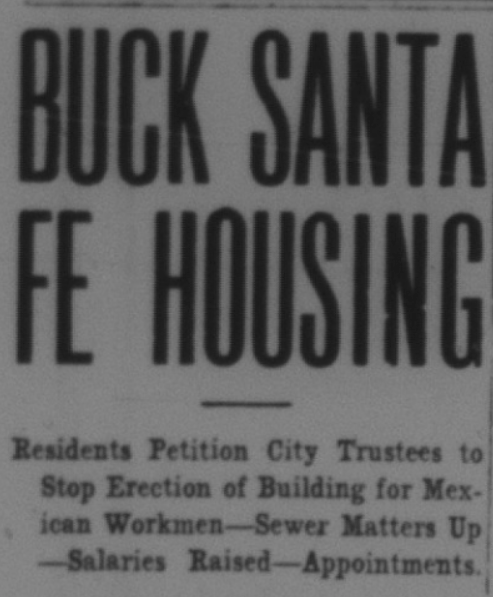
“The first thunderbolt was in the form of a petition from 117 prominent citizens headed by former trustee August Hiltscher and backed up by William French, former city marshal and now justice of the peace and newly appointed city recorder. This petition was a protest to the building of a concrete structure by the Santa Fe at Highland and Santa Fe avenues for the housing of its Mexican employees,” the Tribune reported. “The petitioners asked if it would not be possible to prevent the erection at that point or at least the housing of the Mexican element in that locality. The matter was discussed from every angle but there seemed to be no relief from a legal standpoint, and finally a resolution was adopted by the board asking the company to abandon that site and erect its building near its section houses, and City Attorney Allen was delegated to present the resolution in person to Superintendent Hitchcock at San Bernardino. Mr. Allen left for San Bernardino this morning to carry out the mission.”
“City Trustees Davis, Strain, and Woodward and City Attorney Allen were closeted with Superintendent Hitchcock of Hitchcock of the Santa Fe in his private car in the yards of the company at this place this morning to discuss the matter of the housing of Mexican workers at Highland and Santa Fe avenues by the company,” the Tribune reported. “A mass meeting has been called for this evening at the city hall for taking action.”
Ultimately, the Santa Fe Railroad won, and got the housing built, much to the consternation of Fullerton residents, many of whom showed up at a “mass meeting” to protest the construction.
“The Santa Fe Railroad Company will continue its work and complete its building at the corner of Highland and Santa Fe avenues for the housing of its Mexican employees and will house them right there,” the Tribune reported. “This bald assertion is made because the mass meeting at the city hall Thursday evening to take steps to avert the menace simply went up in smoke, and went sky high. The council chambers was filled to the doors with property owners, principally from the “infected” district, and they talked and talked and talked, but never got anywhere.”
One of the protestants was heard to say, “Well, we don’t like it, but we’ve got to take it.”
Crime
In 1912, after an Anaheim marshal was shot and killed by a Mexican man, local law enforcement scoured the region searching for the killer. There was even talk of lynching.
An ordinance was passed with the aim of “separating the bad element among the Mexicans from their guns.” Civil liberties were perhaps not being equally respected.
“It is my desire that all my deputies should enforce this ordinance at every instance, and especially among the Mexicans. It will be your privilege and duty to search every man you suspect of carrying a concealed weapon, and if found to bring him to the county jail, at the expense of the county,” OC sheriff Charles Ruddock stated.
In other crime news, a rancher named Gerorge Biggs brutally slayed his neighbor F.A. Montee and his wife in a debate over a strip of roadway. As far as I can tell, there was not a similar effort made by law enforcement “to separate the bad element among the whites from their guns.”
Fearing juvenile delinquency, in 1916 the board of trustees of the Fullerton Union High School District urged the City Trustees to pass an ordinance banning teenage boys from pool halls.
Also, in true Footloose fashion, local churches successfully lobbied to have a planned series of outdoor dance events banned.
The biggest crime story of 1920 was the murder of local rancher Roy Trapp and the assault of his wife by a Black man named Mose Gibson, who fled town after the crime.
There was a manhunt for the murderer, who had given the false name of Henry Washington.
Because the murderer was Black, many local citizens wanted to lynch him when he was caught. This was the 1920s, when lynchings were not uncommon.
Eventually, Mose Gibson was captured near the Mexican border, and brought to the Los Angeles jail, where he confessed to the murder.
Gibson was tried and sentenced to death by hanging.
As reported by the News-Tribune, feeling in Fullerton regarding Gibson was “intense.”
Editor Edgar Johnson didn’t exactly help matters by calling Gibson “the lowest type of human beast.”
Prior to being hanged, Gibson also confessed to several other murders and crimes across the United States. One of the people he confessed to murdering was J.R. Revis of Louisiana. Unfortunately, a Black man named Brown, it turned out, had been wrongfully lynched for the murder.
While Gibson was in San Quentin prison awaiting execution, a group called the Housewives Union sent a letter to the governor of California, pleading for the man’s life.
“We ask your attention to the case of Mose Gibson, condemned to suffer the death penalty, September 24,” the letter stated. “The fact that the man is a negro is likely of itself to prevent him fro having that consideration before the law which a white man in his humble position might receive. It seems that when a negro is the culprit, that the white man feels it his peculiar privilege to indulge in any amount of brutality.“
Alas, Gibson was hanged, nonetheless.
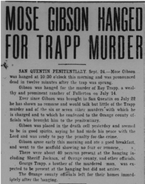
Labor
In labor news, members of the Industrial Workers of the World (or “Wobblies”) passed through Fullerton sometimes, spreading their message of working class solidarity. They were viewed with suspicion, fear, and hostility.
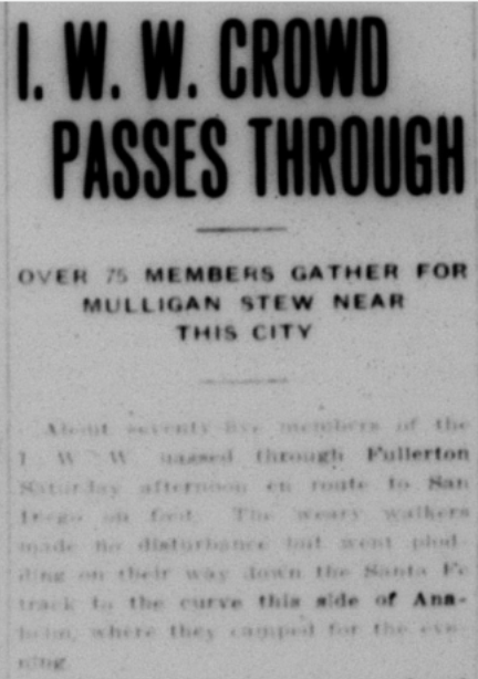
“Cowed by the guns of the police, sixteen I.W.W.’s were captured here Thursday night after repeatedly defying the crew of a Santa Fe train who attempted to drive them from the cars,” the News-Tribune reported in 1917. “Ten of the I.W.W.’s were marched to the depot, where they were held under armed guard till Sheriff Jackson and deputies arrived from Santa Ana. Six more I.W.W.’s were captured later and they were driven from town.”

And a bit later: “Shortly before 8 o’clock Thursday night word was received from Los Angeles at the Santa Fe depot in Fullerton that I.W.W.’s had taken possession of an east bound freight train that was due here a few minutes after 8. Deputy Sheriff Murillo was quickly called and he immediately sent word to Marshal French. The latter responded at once and a few minutes later the two were joined by Deputy Marshal Woodford.”
In response to a strike by Mexican Citrus workers, growers brought in “Negro” labor from Los Angeles.
“Negroes are being imported in to Orange County in relieve the labor situation developing through the refusal of Mexicans to take contract jobs or to work for less than $3 or $4 a day,” the Tribune reported. “Twenty-five were brought into the beet fields Tuesday afternoon from Los Angeles and agents of the sugar factories and farmers, are now in Los Angeles securing more.”
As a kind of punishment to the striking Mexican workers, some local merchants stopped allowing Mexican strikers to purchase food on credit.
With some wartime labor shortages, there were special provisions to bring in Mexican farm labor, but not Chinese Labor, which Californians were not keen on.
“Last year Mexicans were brought here to help in the sugar beet harvest. This was done through a resolution of congress allowing the immigration department to make that kind of an importation, and in the regulations those bringing in the Mexicans were under bond to return them to the border,” the Tribune reported. “This does not apply to Chinese labor. It is my firm opinion that efforts to get the bars lowered so that Chinese can come in will not be successful. Whatever the qualifications of the Chinese as a laborer may be, I don’t believe there is any possibility of getting congress to alow the Chinese to be brought in even temporarily.”
Oil!
Large oil companies like Standard Oil and Union Oil were buying up properties of smaller local companies in the Fullerton Oil fields.
“At the opening of the year 1916 the daily production of all wells in the field totaled 35,273 barrels,” the Tribune reported. “The production has been steadily increasing during the year until the daily production in round numbers is 55,000 barrels. The production for the past year will run close to 18,000,000 barrels.”

In 1914, a number of lawsuits were filed against A. Otis Birch, owner of the Birch Oil Company by landowners who felt they were cheated out of oil profits on their land.
In 1918, the pioneering Bastanchury family sued the Murphy Oil company for defrauding them of millions of oil dollars.
Back in 1903, Simon J. Murphy secured a lease of a couple thousand acres to search for oil. He told Domingo Bastanchury that he found no oil, and yet still convinced the old man to sell him the land for $35 an acre. He paid Bastanchury $79,000 for the land.
About a month after purchasing the land, the newly-formed Murphy Oil Company sunk a well that was a 3,000-barrel a day gusher. Many other oil-producing wells were subsequently sunk on the land.
In 1912, the Murphy Oil Company sold its oil holdings to the Standard Oil Company for around $24,000,000.
Meanwhile, Domingo Bastanchury died, and his lands fell to his widow and sons.
In 1917, former workers of Murphy Oil told Domingo’s son Gaston that they had actually discovered oil prior to the purchase of the land, and Murphy lied to Domingo about this fact.
The Bastanchury heirs sued Murphy for recovery of funds from the millions of barrels of oil that had been extracted over the past fourteen years, alleging that the property was obtained by fraud.
In 1919 the Bastanchury family won a large $1,200,000 judgment against the Murphy Oil company.
Meanwhile, local oil workers organized a union, also seeking better wages.
Perhaps a part of the widespread labor unrest, some oil wells were bombed in the Fullerton fields.
“Believing that they have in custody one of the perpetrators of the recent bomb outrages in the Fullerton oil fields the police today detained a man describing himself as Antone-Kratchel, aged 35, an Austrian, who was arrested at First and Gless streets by Patrolmen H.R. Boehm and J.Y. Walton,” the Tribune reported.
Culture & Entertainment
Before the Fox was built in 1925, Fullertonians went to see movies at the Rialto Theater. It was located at 219 N. Spadra (Harbor Blvd).

The Rialto Theater featured a talented musician named Winifred Wilbur, who played multiple instruments that accompanied the films.

In 1918, popular entertainer Roscoe “Fatty” Arbuckle made a special appearence at The Rialto.
Sometimes famous people would speak at the high school auditorium, including Helen Keller and politician and failed presidential candidate William Jennings Bryan.

In a more racist vein, there was in the Tribune an advertisement for the Geo. Primrose All White Minstrel Show, presumably featuring white people in black face.
The local American Legion post sponsored a Big Minstrel Show, which presumably featured white performers in blackface.

Another form of popular entertainment at this time was the traveling Chautauqua show, which came through town.
In 1920, the local Masons built a huge new temple which is now the Springfield Banquet Center.
Transportation & Infrastructure
In 1914, Fullerton voters approved bonds for the fire department but voted down bonds for road improvement. What else is new?
In 1917, Fullerton finally got a Pacific Electric passenger train line to pass through the town. The Pacific Electric “red cars” would become, by the 1920s, the largest interurban rail system in the United States. The whole system would unfortunately be dismantled in the 1950s, as southern California became firmly entrenched as a “car culture.”
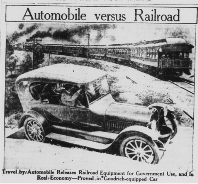
Homelessness
The local policy toward homelessness had, for years, been to jail people on vagrancy charges. However, in 1916, given the inadequacy of the local jail, town Marshal French decided to stop this practice.
“They can implore as much as they want,” he declared, “but I shall place no more prisoners in the city jail. In the first place the arrest of vagrants and tramps is not included in the duties of the city marshal. It is up to the constable to make those arrests and if the county wants the floating class handled, let him do it.

“I shall no longer make an attempt to control the undesirable class in Fullerton so long as they violate no city ordinances. The necessity for a new jail will probably be impressed upon the people by the time the floating class is allowed to remain unmolested for a short time.
In 1917, in the category of “the more things change, the more they stay the same,” local authorities shut down a homeless encampment near the train depot.
“Officers early Wednesday evening raided a hobo camp east of the depot and sent thirteen tramps out of town with instructions not to return. The raid was made by Marshal French and Deputy Sheriff Murillo,” the Tribune reported. “Reports reaching Marshal French said the tramps had established a camp near the wye made by the branching of the Santa Fe to Richfield. The spot is favorite site for a camp with bums, a permanent camp having been established there last year despite daily raids by the police.
“When the two officers arrived at the camp Wednesday night the thirteen occupants were stretched about a camp fire, some of them lying down and others engaged in cooking supper.”
“None offered resistance when the officers searched them for arms. All of them were without weapons and most of them had no money.
“According to their story to the police they were on their way to San Diego, where they expected to find work in the kelp beds.
“Most of the crowd were young men and all of them were shabbily dressed. The oldest man in the camp, bent and grizzled, gave his age as 62 and told the police he did not know where he was going.
“The camp raided Wednesday night is the first that has been established by hoboes this year, according to Marshal French.”
Housing
Fullerton’s population was growing, and there was a housing shortage, so there was much new construction. The 1920s would bring a big housing boom to Fullerton. The Board of Trade established a “housing fund” to finance construction of new housing.
“The Housing proposition is the most important problem which confronts the city today. We not only need good houses but we need business blocks, as people who desire to engage in business here are turned away every day,” the Tribune reported.
In 1919, realtors R.S. Gregory and George A. Ruddock announced the opening of a new subdivision on six acres of walnuts and Valencias on the 200 block of West Whiting, next to downtown. Another new subdivision was Jacaranda Pl., developed by Charlie Gantz. Many of these homes still stand today as well.
In addition to housing, new business blocks and buildings were added to downtown, such as the Gardiner Building, McKelvey & Volz Drug Store, the Sanitary Laundry Building, and more.
Unfortunately, part of this “progress” meant destroying old buildings, such as the Henderson Blacksmith shop, which was one of the oldest shops in town.
The Town of Orangethorpe
Before the town of Fulleton was founded in 1887, some early ranchers settled in an area south of the town-to-be, an unincorporated community called Orangthorpe. In 1920, city leaders attempted to annex part of Orangethorpe so as to extend the city’s “sewer farm” which is now the Fullerton airport. The ranchers who lived around this area organized to fight this Annexation.
The ranchers were successful in blocking this annexation, and they even voted to incorporate as the town of Orangethorpe to protect the land from future annexation attempts.
Deaths
In 1912, Joseph Goodman, co-owner of the Stern & Goodman general store, passed away.
That same year, Colonel Robert “Diamond Bob” Northam, passed away after being assaulted in his home. Northam was for years the agent of the Stearns Rancho company–which owned and sold thousands of acres of prime southern California real estate. He was a colorful and wealthy local figure.
Chapman Avenue was originally called Northam Avenue. In 1911, his wife Leotia sued him for divorce, stating that she was fed up with his drunkenness.
In 1911, the Tribune painted an interesting picture of Diamond Bob: “He is now 65 years of age and a millionaire manufacturer and is widely known as a princely spender, bon vivant and general good fellow…Colonel Northam is a pioneer, coming here in 1870, and today, in addition to the manufacturing business at 110 West Twelfth street Los Angeles, has large realty holdings, including the beautiful country place, Los Robles Viejos at Santa anita, one of the well known show places of the big county.”
He had married his wife 10 years prior when he was 55. She was just 20, an aspiring actress.
Mrs. Northam said, “No one could have treated me better than Bob in every way…dresses, jewels, a beautiful home–I had all that heart could desire. But his constant drinking drove me to distraction…He is his own worst enemy and was fast becoming mine.”
In 1914, Jose Antonio Yorba, a descendant of the pioneering Yorba family of Orange County, passed away.
That same year, Loma Vista Memorial Park, Fullerton’s first cemetery was established. It remains Fullerton’s only cemetery, and many early pioneers are buried there.
B.G. Balcom, pioneering Fullerton banker, also died in 1914. Balcom Avenue is named after him.
In 1915, Fullerton co-founder Edward R. Amerige, who had served on City Council and in the California State Assembly, passed away.
In 1917, Charles E. Ruddock, former Fullerton marshal and Orange County sheriff, died.
“Ruddock was born in Chemano county, New York making him almost 53 years of age at the time of his death,” the Tribune reported. “He and his family came to Fullerton from Wisconsin in 1897 and since have made their home here. Serving a trifle more than two years as a city marshal of Fullerton, Ruddock also served as county sheriff from 1910 to 1914.”
Goodbye, Old St. George Hotel
The Shay Hotel, originally called the St. George Hotel, was one of the first buildings in town at the corner of Spadra (Harbor) and Commonwealth. Sadly, in 1918, it was torn down.
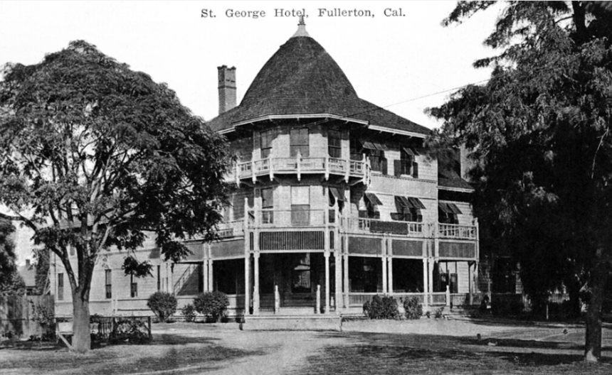
“Bright and early this morning a large force of men started in to dismantle this old landmark of Fullerton,” the Tribune reported. “George Amerige, the proprietor, has sold the building to the Whiting Wrecking Company of Los Angeles for wrecking purposes and the work of razing the old str
Fullerton in The 1920s
Growth
Throughout the 1920s, Fullerton enjoyed a period of rapid growth, as shown by a 1922 population of over 10,000, 20 miles of paved roads, 15 new subdivisions on the market, hundreds of new homes being built, and 15 new business blocks going up. The 1921 shipments of oranges and lemons was 2645 carloads, walnuts was 120 cars, and the oil territory produced 30,000,000 barrels annually.
A 1921 article entitled “Building Boom On” states, “With five new business buildings under way in the downtown section, a new grammar school and scores of dwellings being erected in the outlying districts the activity in this direction has been most marked, and is entirely gratifying to all who are interested in the city’s progress…In addition to the above the new public work on sewers and lights have given employment to many men, and the water extension construction to begin in the near future, will swell the total to many more.”
In 1921, Fullerton business owners and residents began raising money for what would become the California Hotel (now called Villa del Sol), which would open in 1923. The Chapman Building was completed in 1923.


There were plans in the works for constructing a City Hall; however, these were stalled and eventually scrapped. Fullerton City Hall (now the police station) would not be built for another 20 years. Meanwhile, the city government rented quarters in the Wickersheim building on West Commonwealth downtown.
Prior to the 1920s, Fullerton’s two main industries were oranges and oil. Starting in the 20s, the city created a 400-acre industrial zone where factories could locate.
These early factories included: Western Glass Company, Balboa Motor Corporation, Newton Process Company, Los Angeles Paving Company, Citrus Fruit Juice Company, and Orange County Brick and Tile Company.
A new fire hall on west Wilshire Avenue was built in 1926. It stood on what is now Half Off Books in the Wilshire Promenade building.

The Odd Fellows Temple was constructed in 1927. It remains an impressive building downtown.
In 1930, the Fullerton High School Auditorium and the new Santa Fe train station were built.
Housing
Many new housing subdivisions were built. Unfortunately, most of these had racially-restrictive housing covenants, which prevented non-whites from purchasing or renting homes there. In a recent post on this topic, Fullerton Heritage wrote:
“By the 1920s, they [racial covenants] were quite common, particularly in what is now the historic areas of the city…Fullerton newspaper advertisements for new housing subdivisions often signaled whether a tract was limited to whites only. A few advertisements were direct, but most used a coded language that potential homebuyers would understand. Words or phrases, such as ‘rigidly restricted’, ‘exclusive tract’, ‘reserved for the finest’ indicated that minorities were excluded from a subdivision.”
This is an example of systemic racism; that is, a racist policy (as opposed to individual prejudice) that was baked into the housing system. For decades, this policy made it harder for people of color to build generational wealth than it was for their white peers. This is one example of a policy whose economic impact can still be seen today, even after it was made illegal.
Below are some advertisements from the News-Tribune in the 1920s, with the “restricted” portion of each ad circled in highlighter:


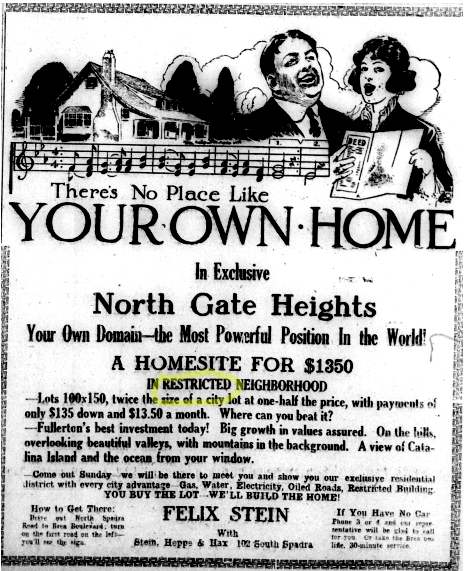
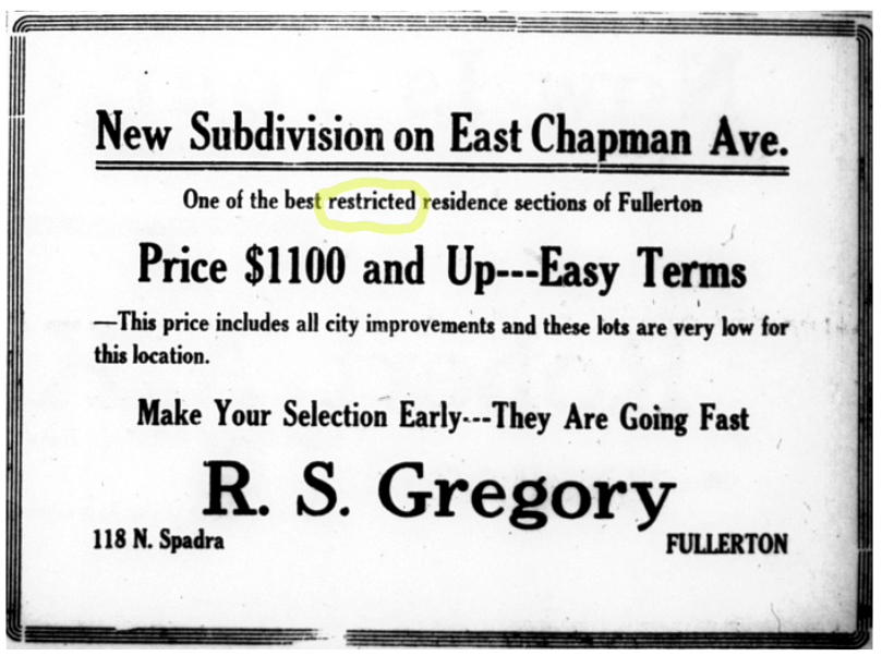
Builders could not build homes fast enough to keep up with demand. This “housing shortage” created a situation of very high rents.
To alleviate this problem as new homes were being built, the Fullerton Board of Trade came up with an idea in 1922 to build temporary tent houses on the field next to the newly-built Ford School, which prospective home buyers could rent while they looked for a house to purchase.
Not surprisingly, this brought a storm of protest from surrounding homeowners.
“Like the eruption of a Mt. Vesuvius, a storm of protest has burst forth against the action of those responsible for the erection of tent houses on the West side Grammar School grounds for rent to people seeking a place of abode,” the News-Tribune stated.
A Mrs. G.F. Molleda of 317 N. Richman avenue, said, “No decent white man will put his family in a tent among low class foreigners and criminals…The hundreds of children that are supposed to be surrounded with an environment of beauty and refinement while being educated, are to be daily confronted with a view of dirty tent inhabitants and clotheslines of black, dirty rags.”
“I am speaking for all the homeowners in the vicinity of the West Side grammar school when I make this protest,” continued Mrs. Molleda, “and a petition is being prepared which will voice this protest in no unmistakable terms.”
Despite the statements from the Board of Trade that the tent houses would be neat and sanitary and “only the most desirable class of people would be permitted” to rent there, the nearby neighbors weren’t having it.
“Two hundred people signed a petition condemning the idea of increasing Fullerton’s housing capacity in this manner,” the Tribune stated. “The main points set forth in opposition being that the established of the project in this particular location would be detrimental to property interests, a menace to the school children and would tend to destroy the effect of the beautiful new school building and grounds recently created up there.”
“R.S. Gregory of the Board of Trade housing committee, under whose jurisdiction the placing of the tent houses has been left, warmly defended the action of the committee, stating in effect that the colony was not one in which undesirable people would be housed, but instead would be one in which only the most desirable class of people would be permitted to live, and these only long enough to permit them to find homes in the city,” the News-Tribune stated.
Education
As Fullerton grew, so did the need for new schools. Ford School was built in 1921. There were also additions to Fullerton Union High School throughout the 1920s.
Ford School, completed in 1922, was later torn down to make way for senior apartments and Ford Park.
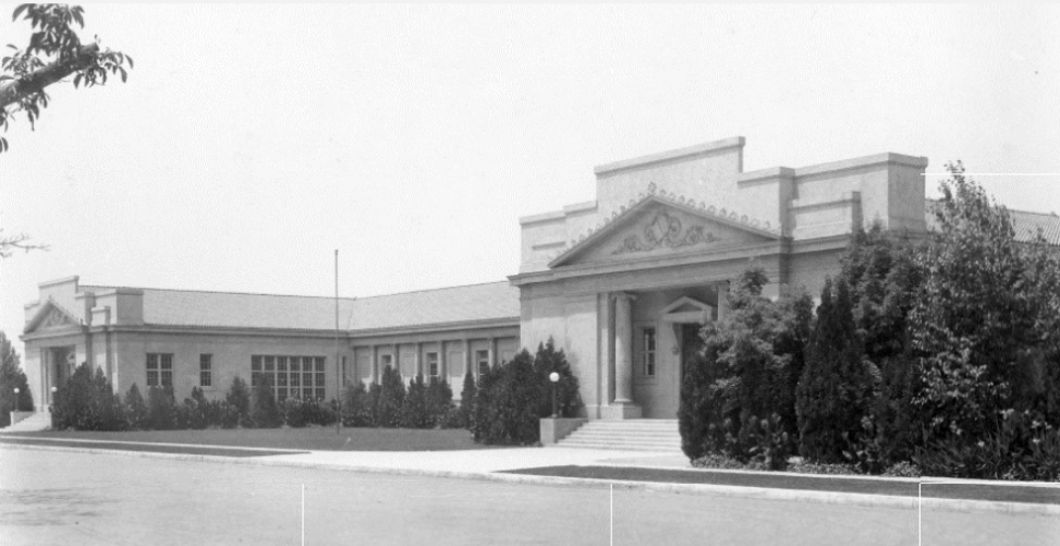
In 1924, to satisfy increasing enrollment, Maple School opened on the southside of Fullerton.

Lottie Morse was elected to the School Board, one of the first women to hold elected office in Fullerton.
In high school news, a policy was adopted in which girls (but not boys) had to wear uniforms. This was likely a reaction to popular new clothing styles.
In 1924-25, there was serious consideration of establishing a new University of California campus in Fullerton on land that was mostly owned by the Bastanchury family. Ultimately, these plans did not pan out, and UCLA was built at its present site in Los Angeles.
Gaston Bastanchury, owner and manager of the vast Bastanchury ranch in Fullerton, created a bound proposal with lots of photos, extolling the virtues of the proposed site.
Residents of the oil towns of Brea and Olinda voted in 1925 to leave the Fullerton Union High School District and form their own.
Americanization
As Fullerton was building new schools and homes, it was also building separate facilities for its Mexican farm workers and their children under the auspices of an “Americanization” program.
“As Fullerton is the center of a great citrus and walnut growing section, many Mexicans are needed to do the work on the groves and great numbers of them are employed by the packing houses during the time when the fruit is being picked, packed, and shipped,” the News-Tribune stated in 1922. “On this account the Mexican problem has become quite a serious one, and Fullerton has been gradually increasing its facilities for handling this problem by educating the foreigner and teaching him American customs.”
“In order to promote Americanization in this community, the Bastanchury Ranch Company and the Placentia Orange Growers Association have announced their intention to Principal Plummer of the Fullerton Union High School and Junior College, to erect school houses on their properties in Fullerton,” the News-Tribune stated. “This work will commence shortly on the Bastanchury property and on the Placentia Orange Growers’ land in town and the school houses will be completed in time for the fall opening of school in September.”
Druzilla Mackey, who had done similar work at “the Mexican colony in La Habra” was put in charge of Fullerton’s Americanization program.
There were at least two “Mexican” schools in Fullerton, one on the Bastanchury ranch amidst the several work camps, and another closer to downtown Fullerton, at Balcom.

The downtown camp, was called Camp Progressive, and later Campo Pomona “is at present composed of twelve houses each occupied by the family of an employee of the association. Each house is equipped with toilet facilities and there are two bath houses for community use, as a central community washhouse.”
The Placentia Orange Growers Association, who paid for the camp believed “that it will not only be an asset to their business but an institution of demonstrated worth to the community.”
Despite the fact that Mexicans were generally excluded from purchasing houses in Fullerton’s neighborhoods or attending its stately new schools, the proponents of Americanization saw what they were doing as a positive, helpful thing.
A 1925 Fullerton News-Tribune article states:
The Americanization department of Fullerton Union high school is staging some very interesting demonstrations of the work accomplished in the particular field of Americanizing the aliens in the northern part of Orange County. Besides a display of the work done in the various classes, open house has been kept on certain days and the general public has been invited to attend the classes and become better acquainted with the new citizens, who are…to attain American ideals and customs.
In a tiny camp called “El Escondito” or the hidden camp…on a part of the Bastanchury ranch, one of the most successful classes is being held. This class holds an unique position as being a 100 percent class. Every woman in camp has attended each session since the school was opened and their enthusiastic cooperation with Mrs. Alma Tucker, their teacher, has produced some amazing results.
An outstanding example of this applied industry is that of Senora Guadaluope Rodarte, who has attended school eight weeks with only a two weeks absence when a new daughter arrived at the Rodarte home. With her new baby immaculately clean and in white pretty dresses, Guadalupe attends the classes each day. During the short time of her instruction she has acquired a vocabulary of about 200 words in the English language.
Dona Felipa Avilos, who has learned all the English she knows during a like period, can also converse in good English to the extent of a visit to a grocery store and the purchase of supplies.
Mrs. Tucker uses the Gonin method of teaching her pupils, but as adapted it to the local conditions, which add to its usefulness in teaching Mexicans. A new idea of using puppets to demonstrate a word or idea has been worked out by Mrs. Tucher which has proved very successful. The close cooperation and economy of the various departments of the Fullerton high school is demonstrated in this instance, for Miss Easton and Miss Bristol with their classes in art have prepared the puppets and the model houses and furniture, which Mrs. Tucker has found so useful. The class in the “Hidden Place” has a motto which is well understood and applied by the Mexican women and their teacher, and is written on the walls of the little dwelling, “Co-operation.”
In this instance the class is held at one of the Mexican homes, which although lacking many of the conveniences and sanitary additions of the American homes, is scrupulously clean with its board floor scrubbed white and pretty cretonne curtains at the windows. Flowers are in evidence both inside and outside the dwellings and in American flag is pinned to the walls of the room where the class meets.
The roll includes Gladalupe Rodarte, Marie Rodar, Isidra Avina, Rosario Gimenez, Felipa Avalos, Luciana Giminez, Maria Avila, Soledad Avalos, Maria Ramos, Aurelia Perez and Trinidad Rosales.
Occasionally students of the Americanization program showcased their progress to the community at large.
At one of these ceremonies, master of ceremonies, Crescencio Duran “distinguished himself by announcing every number in clear, well chosen English,” the Tribune reported. “Members of beginning English classes dramatized the various processes of buying and selling, while pupils in advanced English classes read original essays on Lincoln, Washington, Benjamin Franklin, and Roosevelt. They had also two excellent papers on thrift, accompanied by a dramatization of how to open a savings account in English.”
To read more about the social and educational segregation of Mexican Americans at this time, check out my article “The Roots of Inequality: The Citrus Industry Prospered on the Back of a Segregated Immigrant Workforce.”
King Citrus
Despite the fact that housing and commercial development was increasing, Fullerton was still a major farming area, with citrus being king of the local crops. Many of the wealthiest local people were Orange ranchers, like Charles C. Chapman. Orange growers large and small often pooled their interests and influence with politicians to get favorable laws, such as tariffs on foreign oranges and lower freight rates.
In 1921, local growers held a massive Valencia Orange Show in Anaheim, which featured elaborate exhibits of oranges. Heading up the proceedings was Charles C. Chapman. President Harding even phoned in to praise the Orange Show.
The Orange County Fair, which still happens annually, is a testament to Orange County’s agricultural past, even though those days are long gone, having given way to urbanization and development.
The citrus industry operated in a unique way, with growers both co-operating and competing under the California Fruit Growers Exchange, also known as Sunkist.
Here’s a 1928 description of how the system worked:
One fundamental reason for the great success of the California Fruit Grower’s Exchange lies in the fact that its plan of operation effectively combines the constructive features of both competition and co-operation.
Under the Exchange system, all growers compete to produce the highest quality of fruit. The highest returns in any Exchange association go to growers who produce the most fruit per acre, or who have the largest percentage of their crops sorted into the higher-priced top grades.
Likewise each local association competes with the other 201 associations within the exchange. But the rivalry is in operating efficiency. The association that packs and handles its fruit better, builds a following for its labels and wins premiums for its gains.
Every Exchange grower and association has the maximum incentive for efficiency in management, economy in operation, and skill in method. Through this constructive competition the rewards of success automatically go to the winners in the form of higher returns.
But when the lid is nailed on a box of Exchange fruit, competition ceases and co-operation begins. The problem is then to systematically distribute all the California crop to all the markets. The real competition is not among Exchange growers and associations. It is between California lemons and Italian lemons, California oranges or grapefruit and Florida oranges or grapefruit, citrus fruits against other fruits, fruits against other foods.
In this common task Exchange growers and associations stand shoulder to shoulder.
Orderly distribution is possible only when the marketing is directed by a central organization that has all the facts about supply and demand everywhere. Marketing through unrelated agencies, each acting independently, inevitably leads to the over or under-supply of some or all markets. Sales competition within the industry can only result in lowering prices.
The achievement of the Exchange in successfully marketing the fruit of its 11,000 growers lies in the fact that it handles 75 percent of the yield.
As the percent of the crop marketed efficiency of the organization has steadily improved.
The most beneficial single thing that could happen to the California citrus industry would be to have every carload of California oranges, lemons and grapefruit marked through the California Fruit Growers Exchange.
Then there would be as much competition for quality among California growers and associations as though the Exchange did not exist.
But there would be 100 percent cooperation in perfecting the systematic distribution of the entire crop to the markets of the world…and increased returns for every grower.
What the exchange is…
The California Fruit Growers Exchange is a non-profit organization of 11,000 California citrus fruit growers, producing about 75% of the California citrus crop, operated by and for them on a cooperative basis. Its object is to develop the national and international market for California oranges, lemons, and grapefruit by continuous advertising, and to provide a marketing organization that will sell the fruit of its members most advantageously, and at least expense. Receipts from sales, less only actual costs of operation, are returned to the growers. Applications are received through all of the Exchange’s 201 local packing associations.
Another major aspect of the citrus industry was labor. Most of the picking of the fruit was done by migrant Mexican labor.
As they are today, these migrants were sometimes the target of politicians.
“Restriction of Mexican and other Central and South American immigration into the United States on a quota basis was urged by Rep. John C. Box, Democrat, Texas, author of a bill for this purpose, before the house immigration committee today,” the News-Tribune reported. “The country was being flooded with an oversupply of cheap labor which not only was driving out native white and colored labor in the west and southwest but also was spreading northward, Box said.”
“If I had but one reason for urging this bill it would be to protect the American farmer from a system of peasantry,” Box declared.
“Henry Deward read a statement from the immigration restriction league, Boston, urging passage of the measure and also warning that Mexican labor is spreading to other parts of the country,” the News-Tribune reported. “Chairman Albert Johnson of the committee said he had ‘hundreds of letters from prominent people not only in the west but all over the country,’ endorsed the proposed restriction.”
But not everyone wanted Mexican exclusion. Large growers from the southwest still relied largely on Mexican migrant labor, and some American diplomats felt such restrictions would negatively impact international relations.
Oil!
Along with oranges, oil was Fullerton’s other main export in the 1920s, with very active fields in the hills north of town that regularly brought in gushers. Fullerton Junior College began offering courses in oil production.
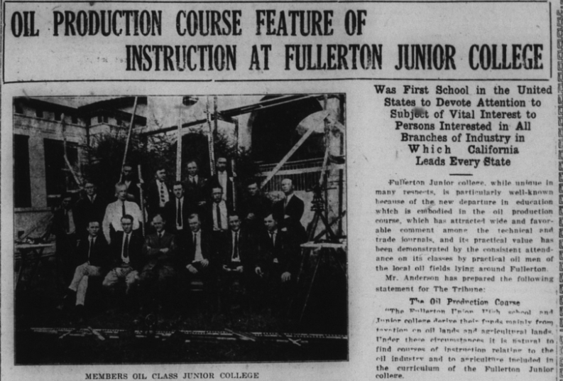
However, in 1921, all was not well in the local oil fields. Unhappy with wages and working conditions, Brea oil workers (who had recently unionized) voted to strike.
Perhaps the biggest news story of 1926 was the great Brea Oil Fire.
Lightning struck two 500,000 barrel underground oil reserves of the Union Oil Company a half mile west of Brea, creating a huge blast and igniting a massive oil fire.

“Plate glass windows in Brea stores were shattered by this blast which was felt slightly in Fullerton,” the News-Tribune reported. “Flames shot 500 feet in the air as the lightning struck eyewitnesses declared and burning fragments of the wooden roofs which covered the reservoirs were blown directly over the town of Brea by a strong westerly wind.”
Four hundred men were rushed to the scene to try to put out the fire and remove oil from the reservoirs. The fire threatened to spread to 10 other large tanks in the field.
Dikes were erected to halt the spread of the oil fire.
“Huge clouds of smoke billowed into the air throughout the day attracting thousands of persons from surrounding districts,” the News-Tribune wrote. “Brea fire department apparatus has been called out to protect homes near the scene of the flames and Union oil workers are moving out of their houses on the lease surrounding the tank farm as a precautionary measure.”
And then, the next day, a fourth tank caught fire.
Damage was estimated at over $5,000,000.
Fire fighters from Long Beach and Wilmington were rushed to the fire, “and workers from practically every oil field and oil company in Southern California were aiding the fight.”
To make matters worse, a cyclone struck sections of Brea causing more damage.
Finally, after a couple days of burning, the fire was gotten under control.
Ku Klux Klan
In the early 1920s, the Ku Klux Klan saw a massive resurgence, with a peak membership of around 5-6 million, with many in states outside the south. The Klan achieved real social and political power. It would ultimately make its way to Anaheim and Fullerton.
According to a 1979 UCLA doctoral dissertation entitled “The Invisible Government and the Viable Community: The Ku Klux Klan in Orange County, California During the 1920s” by Christopher Cocoltchos, “Councilman W.A. Moore, Judge French, and Superintendent of Schools Plummer [yes, that Louis Plummer] joined the Klan in the latter part of 1923, and R.A. Mardsen entered in mid-1924. Civic leaders were especially eager to join. Seven of the eighteen councilmen who served on the council between 1918 and 1930 were Klansmen,” writes Cocoltchos.
Throughout the early and mid-1920s, there are numerous articles about the growing KKK both around the country and locally.
It’s important to understand that the Ku Klux Klan saw itself as a Protestant Christian organization.
At a standing-room only sermon, Rev. C.R. Montague, pastor of the First Methodist Church of Fullerton, gave a sermon in which he (sort of) condemned the Ku Klux Klan.
However, his condemnation was only for the actions of the KKK, not their principles or values.
“While he scored the alleged acts of the Ku Klux Klan wherein that hooded body is said to have perpetrated acts of violence in an effort to remedy conditions which they believed were without the pale of law, Rev. Montague stated that he believed in fair play for them all, and expressed his entire approval of the tenets of the Klan as outlined in their published statements and oaths–allegiance to the United States government and a ‘square deal’ for every man,” the News-Tribune stated.
One of the main tenets of the Klan not mentioned explicitly in this article was white supremacy.
In order to boost their membership, the Ku Klux Klan tapped into issues that were popular at the time, such as Prohibition, which had been the law of the land since the passage of the 18th Amendment in 1919.
Bootlegging was widespread, and the KKK saw itself as a force against bootlegging.
A Klan raid on an alleged bootlegging operation in Inglewood in 1922 resulted in a policeman [and alleged Klan member] being killed and two others wounded. This prompted a grand jury investigation of the Klan’s activities locally.
Los Angeles District Attorney Woolwine sharply criticized the KKK, saying, “It seems to me that no right-thinking American could find the slightest excuse for the existence in this county of an organization such as the Ku Klux Klan.”
The grand jury found the Klan responsible:
“We, the jury, find that the deceased came to his death from a gunshot wound in the abdomen by Officer Frank Woerner in the performance of his duty while the deceased was acting as a member of an illegal, masked and armed mob, presumably instigated and directed by members of the Ku Klux Klan, and we recommend that the District Attorney convene the grand jury of this county to investigate this case further and take the necessary steps to prosecute the perpetrators of this crime.”
More arrests of Klansmen followed, as well as a raid on the KKK’s offices in downtown Los Angeles at Seventh and Broadway. As a part of this investigation, a list of Klansmen in Southern California was obtained, which revealed that the KKK had over 200 members in Orange County.
“That there are 203 members of the Ku Klux Klan in Orange county and only approximately 25 of that number are residents of other sections than Santa Ana, was the statement of District Attorney A.P. Nelson this morning,” the News-Tribune reported. “Of the Klan members outside of Santa Ana, there are said to be about 10 in Anaheim and three or more in Orange, Fullerton, Placentia, Huntington Beach and Seal Beach.”
It should be noted that this 1922 Klan list was incomplete, and another list would be discovered in 1924 that had over 1,200 names of Orange Countians.
Nelson chose not to make the names on the list public, but said he had it in his possession, should the KKK attempt further crimes.
Interestingly, like Rev. Montague, DA Nelson did not condemn the beliefs of the Klan, only their vigilante methods.
“Although stating that he thought the principles of the klan as outlined by the organization to be truly American, Mr. Nelson said that he was absolutely opposed to any organization, no matter what its principles that works by the methods attributed to the Ku Klux Klan, masked and with identities concealed to take law in their own hands,” the News-Tribune states.
After it became known that Nelson had the membership list, a mystery man appeared at his home while he was gone and tried to get his wife to get her husband to drop any further investigation into the Klan.
Meanwhile, the KKK tried to extort money from Black ministers in Los Angeles.
“Five negro ministers, one in Watts and the other four in Los Angeles, have received letters threatening themselves and their congregations with death unless they paid sums ranging from $1000 to $10,000 to the writers of the demands who signed themselves the ‘Ku Klux Klan’ according to a statement made at the sheriff’s office today,” the News-Tribune reported.
Given the growing popularity of the Klan and its threat to law and order, the Orange County Board of Supervisors voted to bar Klan members from working for the county.
“With the complete list of Klan members in the possession of District Attorney A.P. Nelson a complete check will be kept on the actions of those affected by the ultimatum of the supervisors. The names of those affected will not be made public,” the News-Tribune reported.
The resolution adopted by the Supervisors was as follows:
“Whereas, it has been called to the attention of the Board that certain employees of the county of Orange are members of and identified with the branch of that organization known as the Ku Klux Klan, and
“Whereas, the Board feels that membership in such an organization is not compatible with the duty which county employees owe to the public as servants of the public.
“Now, therefore, it is hereby resolved and ordered by the Board of Supervisors of the County of Orange, State of California, that all county employees, who are members of such Ku Klux Klan be and they are hereby requested to furnish to the District Attorney of the County of Orange satisfactory evidence of their withdrawal as members of the organization known as the Ku Klux Klan or tender to the proper officer of the county their resignation as an employee of said county.
Meanwhile in Oklahoma, an explicitly anti-Klan group formed. Because the KKK saw themselves as an “invisible empire,” this new group called itself the Knights of the Visible Empire.
“The Knights of the Visible Empire are gathering strength to oppose the white-shrouded host–the knights of the invisible realm. The Southwest is splitting into two factions–klan and anti-klan,” the News-Tribune reported. “Within the last few months the Ku Klux Klan has shown its strength. It appears to exist in every community. In the big, modern, fast-growing cities of the Southwest it numbers thousands of its “invisible empire.” This has been proved by parades and demonstrations in such cities as Dallas, Forth Worth, Beaumont, Waco, Oklahoma City, Tulsa, and other places.”
And then the News-Tribune makes a shocking, albeit buried, report:
“Here, only a few weeks ago, nearly 3,000 hooded figures passed through the streets. The parade was fifteen blocks in length. At its head masked riders bore aloft the emblem of the klan. Overhead an airplane circled, bearing a flaming cross.”
By “here” I can only assume Johnson meant Fullerton, or a nearby town.
In my previous research on the KKK in Fullerton and Orange County, I found evidence of large rallies in Anaheim and Fullerton, although I thought they only happened in 1923 and 1924. Evidently, there was also a huge Klan parade in 1922. Strangely, the Tribune doesn’t report on it outside the short paragraph above. Probably, as is sometimes the case today, some Fullertonians didn’t want to admit that the KKK was in their community, and prominent members joined.
And then, the Klan made themselves known in Anaheim.

“The first public appearance in Orange county of members of the Invisible Empire, Knights of the Ku Klux Klan, in the First Christian church tabernacle, Anaheim, last night was marked by lusty cheers of the congregation, and unlike popular beliefs was not featured by bloodshed or riot,” the News-Tribune states. “While scores sat emotionless in their seats, petrified by mingled fear and amazement, what is estimated to have been more than a dozen of the white-robed and hooded figures silently entered the edifice, presented the pastor, the Rev. C.L. Vawter, with a parcel and as silently departed.”
In 1924, the Ku Klux Klan was very active in local politics, with Klan members sweeping the Anaheim City Council majority [They would be recalled within a year].
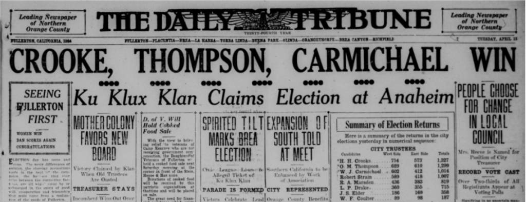
“Significant of Ku Klux Klan activity in today’s election, a huge fiery cross lighted up the heavens last night from the hill to the westward of Northgate Heights,” the News-Tribune reported in 1924. “That the burning of the symbol had a direct bearing on the local political situation was the general opinion today.”
According to the News-Tribune, “The claim was made today by a person in close touch with local Klan affairs that there is a membership of from 2500 to 3000 in this territory.”
Ku Klux Klan rallies drawing thousands took place throughout Orange County in 1924, including at least two large meetings at what is now Amerige Park, across the street from City Hall.
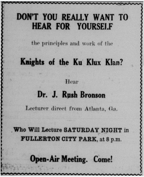
The Klan was so popular, in part, because it was presented as a patriotic organization. At the above advertised meeting, the speaker stressed the fact “That it is a white man’s organization, a gentile organization, a protestant organization and an American organization in which membership is restricted to native-born American citizens. That the KKK stands for white supremacy; for the enforcement of the law by the regularly constituted authorities; development of the highest standard of citizenship; rightful use of the ballot, and the worship of God.”
At another Klan meeting that drew around 5,000 attendees, the violence that lay beneath the rhetoric almost broke out.
Local businessman Dan O’Hanlon, who was Irish Catholic, was unhappy with the Klan speaker’s denunciations of catholicism, so he shouted “Liar!” during the speech.
This led to cries of “get that guy,” “where is a tar bucket?” from different parts of the crowd. O’Hanlon was taken by police officers, for his own safety, and booked him briefly at the city jail. He was released later that night, and according to an oral history interview with O’Hanlon’s wife Margaret, a cross was burned on their lawn that night.
The Klan also made an appearance at a downtown city carnival.
“Appearing from the direction of Wilshire avenue five members of the Ku Klux Klan, robed and with raised visors, injected a little dramatic note into the street carnival last night, when they marched through the crowds of merry-makers and presented a note containing $25 in bills to E.H. Tozier, conductor of the city band,” the News-Tribune reported.
Meanwhile, the Fullerton Rotary Club passed a resolution condemning the Ku Klux Klan.
“The action of the Rotary club today marks the first tangible, public recognition of the fact that the Ku Klux Klan has become an issue here in Fullerton as it has in Anaheim and in other parts of the county, state and country,” the News-Tribune reported. “Sentiment has been greatly inflamed here of late by the secret circulation of a list of names purporting to be that of local members of the order.”
The resolution read as follows:
Whereas, a situation has developed in our fair city by virtue of the teachings and activities of the Ku Kux Klan which has set neighbor against neighbor, causing suspicion, distrust and fear to fill the hearts of many; and
Whereas such teachings and activities impede the normal development of our beautiful city, interference with the happiness and contentment of our citizens, hold us up to ridicule before the outside world, and stamp us as being a narrow, factional, intolerant, un-American people; and
Whereas the objects of Rotary International are to promote fellowship and harmony among men of all nations, to make them better business men, better professional, better fathers and in fact better citizens of the country in which they live, having as its motto, “Service above self at all times,”
Be it resolved, that the Rotary club of Fullerton, unanimously deplores the existence of such conditions and is anxious to do all in its power to restore conditions to normal so that the right to the free exercise of our constitutional rights, together with tranquility and those blessings of liberty for which our constitution was ordained and established, be guaranteed to everyone, be it further
Resolved that we hereby publicly condemn the organization known as the Ku Klux Klan, which, by its teachings and actions, tends to develop racial hatred, religious intolerance or in any way denies full constitutional rights to any of our citizens no matter what his race, religion or political affiliations may be.
Local attorney Tom McFadden spoke at the above-mentioned Rotary Club meeting, suggesting that administrators of Fullerton High School were members of the Klan.
“We must keep out all forms of intolerance in our schools,” he declared. “We must keep it out of our high school here. No one has a right to hold a position of responsibility in that institution who holds and subscribes to intolerant beliefs. There are all shades of opinion and religion in our schools and Fullerton has attained a high standing by reason of its progressiveness and efficiency. It will sink from this position if intolerant views are allowed to interfere with its operation and administration.
“A community cannot grow and prosper when its citizenry is divided by mutual distrust and suspicion,” McFadden continued. “We must restore harmony and try to re-establish friendly relations. The Rotary Clubs of Anaheim and Fullerton can do much to foster the right spirit between the two cities and in their respective communities.
“A house divided against itself can accomplish nothing,” he said in closing.
The News-Tribune stated, “Although no direct mention of the KKK was made by name in McFadden’s talk, and no particular individuals were designated, he clearly indicated by innuendo that he was concentrating his attack on members of the local high school administration whose names are declared to be on the lists which are being circulated in this city.”
Although he didn’t name him by name, McFadden was likely referring to high school superintendent Louis E. Plummer.
The Rotary Club was not the only local group opposed to the Ku Klux Klan.
“Anti-Klan forces in Anaheim are going to make a determined effort to change the entire city administration. Recall petitions are to be circulated at once, it was announced at a mass meeting held under the auspices of the USA Club…last night,” the News-Tribune reported.
Local Politics
In the 1922 midterm election, Fullerton voters elected Roy Davis (who worked at the Fullerton Ice Co.) and W.A. Moore (of the Fullerton Realty Co.). Gurman Hoppe (of the Stein, Hoppe, and Hax store) was defeated.
Sam Jernigan, a member of the Ku Klux Klan, was elected county sheriff.

1924 was an election year, and Coolidge was running for re-election. There was a proposal for Fullerton rancher Charles C. Chapman to be Coolidge’s vice presidential running mate; however, he ultimately chose Charles G. Dawes.
In the 1924 Fullerton City Council election, Harry Crooke, O.M. Thompson, and W.J. Carmichael were elected.
Meanwhile, in Anaheim, the Ku Klux Klan claimed a city council victory, electing E.H. Metcalf, Emory F. Knipe, A.A. Slabach and Dean W. Hasson. They were later all recalled.
In Brea, Harry E. Becker and Isaac Carig were elected as city trustees. “Local gossip has it that the Ku Klux Klan played a prominent role in the election backing the successful candidates and defeating the nominees of the Brea Civic League.,” the News-Tribune reported.
In 1926, J.S. Elder and Bert Annin were elected to the City Council. Harry Crooke was again chosen as Mayor. Less than a year into his tenure, Elder resigned and Emmanuel Smith was appointed to replace him. William A. Goodwin was elected town constable.
In 1928, Republican Herbert Hoover was elected president, defeating Democrat candidate Al Smith. Back then, Orange County was largely Republican. In Orange County, Hoover got 30,100 votes, while Smith got only 7,597. Hoover received 2,966 votes in Fullerton while Smith only got 542.
In the 1928 City Council election, voters chose William Hale, R.S. Elder, and O.H. Kreighbaum. Bert Annin, who was not up for election, was chosen as Mayor.
Crime
A notable criminal case in 1921 involved two Black men (E.G. Brooks and Eddie Woods) who allegedly assaulted a bus driver (Darwin O. Grimes) in Fullerton, after he tried to make them sit at the back of the bus.
“The altercation which culminated in the attack on the stage driver is said to have arisen when the negroes started to enter the second seat against the wishes of the other passenger and the driver. When the passengers objected to the negroes sitting beside them, it is said that Grimes requested that the negroes sit in the back seat, in which there was ample seating space,” the News-Tribune reported. “They refused and stated forcibly that unless the driver allowed them to sit where they chose that they would not allow the stage to depart on the trip to Los Angeles.”
After allegedly attacking Grimes, the two men fled and were later arrested. Both men pleaded not guilty, arguing that they acted in self-defense.
Before the case went to trial, the bus driver Grimes was arrested over a charge that, when he was an immigration official, he abused his power by appropriating liquor seized from an automobile (this was during Prohibition times). He had since been fired.
During the trial, Brooks and Woods said that Grimes “took a belligerent attitude which they interpreted as something of a prediction of physical force in keeping them from occupying a seat in the stage other than the rear one.”
Character witnesses were introduced for both men, among whom were S.E. Reed, Santa Fe Agent in Fullerton, F.C. Johnson, special officer for the Santa Fe, and Joe Murillo, Fullerton officer for the Santa Fe, all of whom were well-acquainted with Brooks from when he worked as a Santa Fe porter.
This was also one of the first cases in Fullerton in which women served on the jury, having recently been granted that right.
Ultimately, the charges against Brooks and Woods were reduced to simple assault and they each paid a $100 fine.
Because this was during Prohibition, the most common “crimes” were liquor-related. One of the major ironies of Prohibition was that, despite its goals of “cleaning up” America, it led directly to an increase in organized crime and political corruption.
Among other fun-killing laws, Fullerton in 1922 started cracking down on roller skating, scooters, and riding bikes on sidewalks.
Among the various crimes reported in the Tribune in 1928, one stood out to me, because it happened right around where I live, which is in former railroad worker housing near the corner of Santa Fe and Highland. A man was murdered in one of the housing units. Was it mine? The Tribune doesn’t say. But perhaps this qualifies my residence for a stop on the Fullerton Ghost Tour.
Fullerton’s First Gang
In 1921, a group of local young men (sons of prominent families) formed a gang (Fullerton’s first gang) called the Hill Rovers. They made much mischief and committed crimes such as petty larceny, breaking and entering, and theft. OC District Attorney Alex Nelson investigated the group.
Because the boys were sons of prominent local families, the DA faced pushback about prosecuting them, or releasing their names.
Ultimately, four of the gang members were arrested, and two got five years for their crimes.
An article published in early 1927 gives some crime stats from the previous year. The majority of the arrests were for booze [this was during Prohibition] or “vagrancy” (homelessness?).
The report lists three suicides, three auto fatalities, 22 arrested for disturbing the peace, four for battery, four for disorderly conduct, 21 for drunkenness, one for operating a still, 21 for possession of intoxicating liquor. 198 car accidents, 47 arrested for vagrancy.
Sometimes the perpetrators of crimes would be given names by the media, such as the Praying Sisters (bank fraudsters who sought a more lenient sentence by showing their piety), the Chloroform Burglar (who knocked people out with chloroform before burglarizing their houses), and The Fox (a murderer who killed a girl in Los Angeles and went on the run, sparking a massive manhunt).
In 1927, a county Grand Jury probe raised ethical and legal questions about top law enforcement officials. Some were accused of being in cahoots with bootleggers. A big rally at what is now Amerige Park in Fullerton called for a recall of OC Sheriff Sam Jernigan for his alleged improprieties.
The meeting was presided over by Carrie Ford, a prominent leader in the Women’s Christian Temperance Union (WCTU).
Because, at this time, the Ku Klux Klan was a big supporter of Prohibition, some felt that the effort to oust Jernigan was a KKK plot. This rumor was dispelled by “attendees [who] said it was not a KKK plot.”
According to the News-Tribune, one attendee “challenged any members of the Ku Klux Klan to stand up and show themselves. About 20 men arose in response. The speaker then pointed out that more that 90 percent of the persons at the meeting were not of the Klan.”
This is fascinating to me because it shows that the KKK was still a conspicuous presence in local affairs, even after its popularity began to wane after 1925.
Prohibition
In 1919, Congress passed the 18th amendment to the U.S. Constitution (and the subsequent Volstead Act), banning alcohol. Locally, city council passed ordinances to help with enforcement of the Volstead Act and curb violations of the law.
One way that people sought to get around prohibition was to have doctors prescribe them liquor for “medical” reasons. On more than one occasion, police rounded up and arrested such violators.
Bootlegging was also fairly widespread, so raids and arrests were not uncommon.
The noted Bastanchury family had made their own wine for years. They were raided and some charged with violating the dry law.
Nearly every issue of the Tribune throughout the 1920s has a story about people being fined or arrested over illegal booze.
Although they had achieved their goal of national Prohibition, the Women’s Christian Temperance Union (WCTU) was still active, presumably because lots of people were still drinking.
One way the Ku Klux Klan gained popularity was by adopting popular positions on hot-button issues. In addition to being opposed to racial minorities, Catholics, and Jews, they were also in favor of restricted immigration and prohibition.
In 1924 the Klan and their supporters worked with local and federal law enforcement to conduct a massive arrest of bootleggers. The headquarters of the massive raid was the ranch of Fullerton pharmacist William Starbuck.
In what proved to be a dumb move, these anti-bootleggers then presented a bill to Fullerton city council for $2,800 to cover the costs of the raids (they hadn’t bothered to inform city council of the raid in advance). City Council refused to pay, as did other local city councils who received similar bills.
The Fullerton police department occasionally held public “booze pouring” events in which they dumped out hundreds of gallons of illegal booze they had seized.
And then, something embarrassing happened. Some Fullerton police officers were accused by another officer of stealing wine from the department’s stock of seized liquor for personal use.
After a few public hearings before City Council, the accused officers denied any wrongdoing and were not convicted of any crimes. The whole ordeal, however, caused a shake-up in the department, in which some officers were forced to resign.
Adding to the embarrassment, Fullerton City Councilmember Emmanuel Smith and beloved football coach “Shorty” Smith were both arrested and fined on liquor charges. Neither lost their jobs. By criminalizing a hugely popular activity, prohibition highlighted the hypocrisy of leaders [President Harding famously served and drank booze in the White House], and made the United States way more corrupt at all levels of government–from federal to local.
Sports
In sports news, baseball was quite popular locally. In addition to high school baseball, teams would play at the field on what is now Amerige Park.
By far, the biggest local sporting event of the decade was a 1924 exhibition game in Brea featuring baseball legends Walter Johnson (who went to Fullerton High School), Babe Ruth, and other big-league players which drew around 15,000 spectators.

Local athlete Glenn Hartnraft placed second in the shot put at the 1924 Summer Olympics in Paris.
The mascot of Fullerton High School was, and is, the Indian. In more recent years, this has proved controversial, as native American groups over the years have tried to get the district to change the mascot, arguing that it is offensive. Despite the fact that activists have been unsuccessful in changing the name, I too find it offensive, especially considering the fact that throughout the 1920s, the Fullerton Indians were regularly called the “redskins” and the “red men”. The school would host “Pow Wows” featuring non-native people dressing up as Indians. These “Pow Wows” were still happening as late as the 1990s, when I attended high school there.
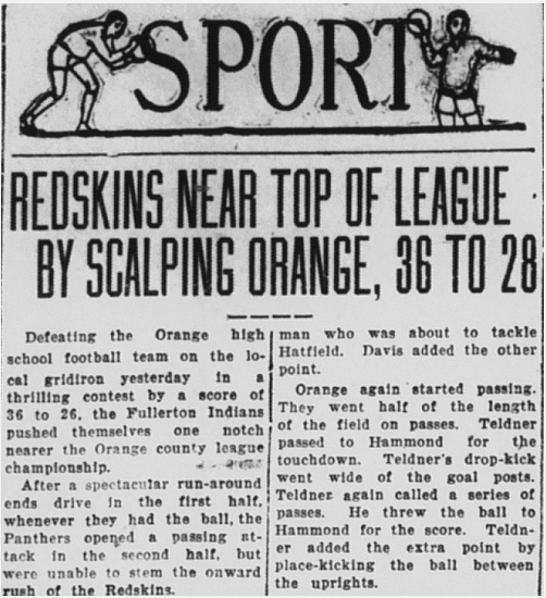

In 1928, Gaston Bastanchury, owner of the sprawling Bastanchury Ranch in the hills of north Fullerton, wanted to build an enormous venue to host a boxing match between world champion Jack Dempsey and Basque boxer Paulino Uzcudun, who would train on the ranch. Unfortunately, this never came to fruition.
In 1929, local baseball star Willard Hershberger was drafted into major leagues by the Washington Senators.
Golfing, both regular and miniature was popular locally, with the following courses:
Culture and Entertainment
Prior to the opening of the Fox Theater in 1925, locals would go see movies and Vaudeville shows at the Rialto Theater downtown.
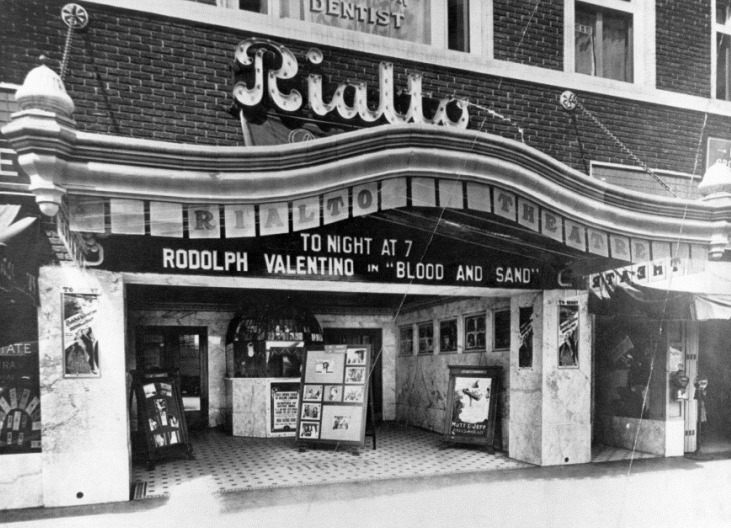
In 1921, Fullerton’s new Masonic Temple (now the Springfield Banquet Center) was formally inaugurated and its first officers chosen. In the early 20th century, fraternal organizations like the Masons and Odd Fellows were very popular.
Another popular form of entertainment in the 1920s was the traveling Chautaqua show, which featured musical performances, speeches, and more. The show came through Fullerton every year.
The other big gathering in the 1920s, outside of Klan Rallies, was the Armistice Day parade, celebrating the ending of World War I. This was a truly massive annual event, with thousands of attendees and hundreds of floats!
Unfortunately for movie-goers, Will B. Hays (former Postmaster General under president Harding) was hired in 1922 to censor movies of content deemed objectionable.
“A genuine ‘spring cleaning’ to purge motion pictures of all semblance of salaciousness was promised today by Will B. Hays, who leaves President Harding’s cabinet March 4 to head a new association of motion picture producers and distributors,” the Tribune reported.
“I will head what you might term a moral crusade in the film industry after March 4,” Hays said, adding that this would not be censorship. “I have two objects. We will attempt to attain and maintain the highest standards in motion picture production and seek to develop the moral and educational values of motion pictures to their highest degree. That is all we plan.”
Much of the discussion centered around depiction of sex in movies. There was much less discussion about depictions of violence. I always have found it ironic that many Americans tend to be much more averse to depictions of sex than depictions of violence in movies. We are generally more comfortable watching an action hero kill dozens of people than we are watching two people be intimate. This means something.
Just as there was something of a moral panic about sex in movies, there was also backlash against the influence of jazz music.
Probably the biggest news of 1925 for Fullerton was the opening of Chapman’s Alician Court Theater, which later became known as the Fox Theater, a classic old school movie palace. The theater was financed by C. Stanley Chapman, son of wealthy powerful orange grower Charles C. Chapman. The theater’s architect was Raymond M. Kennedy of the firm Meyer & Holler, which also designed Grauman’s Egyptian Theatre and the Chinese Theatre in Hollywood.

The theater opened with great fanfare with local and Hollywood notables in attendance, including Mary Pickford and her family.
“Dainty usherettes in Italian peasant costume…directed the guests to their places. Among those seated in the loge section were many distinguished visitors including Mendell Meyer, architect for the structure members of the Chapman party, and well known residents of Hollywood Mrs. Pickford, Lottie Pickford Rupp and Mary Pickford’s small niece, Mary Pickford Rupp,” the News-Tribune reported.
Attached to the theater was the fancy tea room known as the Mary Louise.
This local movie palace hosted several “Preview” screenings of major Hollywood films, where the stars would be in attendance, such as Harold Lloyd, Dolores Del Rio, and more. It must have been exciting to attend these star-studded events. In 1926, the theater’s name changed to the Mission Court Theater.
Not only was Fullerton home to a first class movie palace, it was also home to a significant movie director named Lois Weber.
Occasionally Weber and her husband Harry Gantz would host parties at their El Dorado ranch in Fullerton, and invite top Hollywood figures.
Unfortunately, in 1929, a popular form of entertainment was the “minstrel show” which featured white actors in blackface, reinforcing harmful stereotypes of African Americans. Below are advertisements for a film at the Fox Theater featuring the Two Black Crows, popular blackface performers, as well as a big Minstrel show sponsored by the Anaheim Elks Club.
Sadly, in 1930, the Rialto Theater (Fullerton’s first movie theater) closed, and was replaced by the First National Trust and Savings Bank.
In 1930, there was a Fox Theater in Fullerton and one in Anaheim. They would advertise their films in the News-Tribune.

While the Fox Theater in Fullerton still stands, the Anaheim Fox Theater was unfortunately torn down in 1979 along with many of that city’s other historic buildings. This was called “redevelopment.”
In 1930, the film “Hells Angels” featuring daring airplane stunts and produced by Howard Hughes, was filmed at the Fullerton Airport.
Medicine and Health
In medical news, local chiropractor Vanetta Henderson faced charges in 1921 for violating the Medical Practices Act. At this time, chiropractors were viewed with skepticism. I guess not much has changed.
In agriculture news, an outbreak of foot and mouth disease in 1924 in California led to restrictions on some California crops and even restrictions on human gatherings and travel.
“Motor touring outside the county is to be further restricted, according to announcement made at the Rotary Club luncheon here this afternoon by A.A. Brock, county horticuturalist,” the News-Tribune reported. “Coupled with an urgent plea to the public to stay home and in this way help the authorities to cope with the menace of hoof and mouth disease. Mr. Brock made the statement that a general tightening up of the present quarantine regulations is to be put in effect at once.”
Transportation
In transportation news, automobiles were very popular, with a few different car dealerships in town, like William Wickersheim’s newly-built Ford dealership on Commonwealth (It’s now the Ace Hardware Store). Other dealerships included O.L. Smith’s Oakland dealership on West Amerige, Albert Sitton’s Willys-Knight dealership on West Commonwealth, Lillian Yeager’s Dodge dealership in Spadra (Harbor) and Chapman, and William Goodrum’s Buick dealership.
An auto camp at Hillcrest Park was a popular spot for travelers to stop during the 1920s.
Formerly a “sewer farm,” the Fullerton Airport began to take shape in 1927, with locals volunteering to help clear the land.
Fraternal Organizations
The 1920s Ku Klux Klan arose at a time when fraternal organizations were very popular throughout the United States. Not all of them were explicitly white supremacist, like the KKK. Others were fairly “normal” like the Masons and the Odd Fellows. An article in the Tribune gives a bit of history of Fullerton’s Masonic lodge.
Fullerton’s Masonic lodge was formed in 1900 and held its first meeting at the home of Edward K. Benchley, president of the Farmers and Merchants bank. Early meetings were then held on the top floor of the old grammar school. They built their first temple (now the Parker Building), and then they built an even larger temple in 1920, which still stands today–it is the Springfield Banquet Center.
The Fullerton Masonic Temple is now the Springfield Banquet Center.
The leader of a lodge is called a “worshipful master” and this title was held by a number of prominent local men over the years, including William McFadden, Dr. G.C. Clark, Arthur Staley, C. George Porter, Charles E. Ruddock, J.R. Gardiner, and C. Stanley Chapman.
In 1923, membership in the Masons was 425.
Another popular fraternal organization at this time was the Independent Order of Odd Fellows (or just Odd Fellows).
The Fullerton Lodge of Odd the Fellows was organized in 1901. Like the Masons, a number of prominent residents joined, including William Schumacher, August Hiltscher, George H. Amerige, R.H. Gilman, Joseph Hiltscher, D.S. Linebarger, and E.R. Amerige, Edgar Johnson, Bert Annin, and Angus McAulay.
The Odd Fellows met above two different banks downtown before building their own massive hall in 1928. This building still stands today.

Natural Disasters
In 1927 a big fire broke out on the back of the Chapman building, drawing hundreds of spectators. Thankfully, the building survived.
A much more damaging natural disaster occurred in 1927 when heavy rains caused the Santa Ana River to flood its banks.
The flood disproportionately affected the homes of Mexican Americans who lived on the south side of town.
“The houses of many Mexican families on the south side between Spadra road and Lawrence avenues, were reported to be under water and uninhabitable and arrangements were being made by Mrs. Mae Reeve, city treasurer, for their accommodation. She will welcome offers of help,” the News-Tribune reported. “As a matter of precaution, the Placentia Growers’ association today moved about forty Mexicans form its camp on Balcom avenue, to the packing houses where they have been made comfortable.”
This prompted local efforts to deal with the flood and its aftermath.
The flooding also caused oil to pour onto farmlands.
At the regional level, plans were discussed to curb future floods by damming and channelizing the Santa Ana River.
Meanwhile, wealthy residents were encouraged to “Buy a Lot Today, High Above the Flood.”
In 1928, one of the greatest disasters in California history occurred, when the St. Francis Dam broke. Although this occurred in Los Angeles county, its devastating impact in terms of loss of life was felt across the region.
Water
Those familiar with the movie “Chinatown” may be familiar with the California Water Wars that broke out in the mid-1920s when LA officials used dishonest means to buy up land in the Owens Valley and then build an aqueduct that drew water from those farmers to the growing metropolis of Los Angeles.
“A state of virtual warfare existed in the hills bordering Owens valley today while officials here debated measures to curb dynamite attacks upon the Los Angeles aqueduct by bands of armed marauders in Inyo county,” the News-Tribune reported. “Along the 265-mile waterway stretching from the mountain lakes to the city of Los Angeles, through desert wastes and across barren foothills, powerful army flashlights gleamed last night. Meanwhile, the aqueduct guard had been strengthened by the addition of a squad of ex-service men, armed with machine guns and orders to shoot to kill in an effort to prevent another destructive sortie against the city’s main water supply, built at a cost of $44,000,000.”
Meanwhile state growers and politicians were pushing for the creation of Boulder Dam (now called Hoover Dam) which would bring additional waters from the Colorado River.
This is of interest to Fullerton because our city was one of the founding members of the Metropolitan Water District (created in 1928), so (to this day) some of our water comes from the Colorado River, although a larger portion comes from local groundwater sources managed by the Orange County Water District, which would be created in 1933.
In 1929, there was a big political fight over a ballot measure to issue bonds for construction of a series of dams on the Santa Ana river, as a flood control measure.
For weeks leading up to the election, well-funded groups ran advertisements making their cases for and against the bonds.
Ultimately, the bonds were narrowly defeated. Major flood control measures would have to wait until another major flood in 1938 brought the water to the peoples’ literal doorsteps.
Immigration
Congress passed the Immigration Act of 1924 (the Johnson-Reed Act), a profoundly racist law (one of its authors, Albert Johnson, was a eugenics proponent) that barred immigrants from Asia and created quotas that severely limited immigration from countries that weren’t northern European (i.e. white). This law was widely supported by many Americans at the time.
The majority of new immigrants to Fullerton in the 1920s were Mexican farm workers, who lived in segregated work camps or “colonias” and had a kind of second-class citizenship. Some of the reasons why Mexicans were the dominant labor force were laws that excluded Asians (like the Chinese Exclusion Act and the Johnson-Reed Act of 1924), and political violence and instability in Mexico, with the Mexican Revolution–causing Mexicans to flee north to relative safety.
As part of a recurring pattern in American history, there were clamors to restrict and deport Mexican immigrants. The article below, from 1929, says that rumors of mass deportations were unfounded. This would change in the early 1930s, as the Great Depression worsened and already vulnerable immigrants became convenient scapegoats, sparking one of the largest mass deportations in American history.
Throughout U.S. history, tough economic times have sparked strong anti-immigrant movements that have sometimes had devastating consequences. This happened during the Great Depression, with increasing calls to prioritize “white” over “foreign-born” labor.
“Petitions were circulated in Fullerton Saturday afternoon protesting employment of unnaturalized foreign-born workers on any public improvement project while white labor is available,” the News-Tribune reported in 1930.
“The petitions, circulated by R. J. Simpson of Costa Mesa, president of the Orange County labor association, will be presented to the board of supervisors and to the city councils of all the cities in the county.”
“Contractors have tended to employ unnaturalized Mexican labor to the exclusion of white labor, according to the petitions. This is because they will work cheaper and stand more, Simpson says. A mass meeting of working men will be held Friday night at Birch park in Santa Ana, Simpson said, to formulate further protests,” the News-Tribune continued.
Politicians got on the anti-immigration train and supported measures to restrict it.
Some large agricultural interests opposed immigration restriction, and supported allowing Mexican immigrants to continue working in the fields.
The anti-immigrant voices would grow louder as the Depression wore on, leading to one of the largest mass deportations in American history, primarily of Mexican-Americans, many of whom were actually citizens. This sad chapter of local and national history is chronicled in the book Decade of Betrayal: Mexican Repatriation in the 1930s by Francisco E. Balderrama and Raymond Rodriguez.
The Great Depression Begins
In 1929, Herbert Hoover was inaugurated as President, and the infamous stock market crash occurred later that year, sparking the Great Depression. Impacts could be seen locally, with a visibly increasing number of unemployed and homeless people, with some even seeking to sleep in jail.
In 1930, there was no such thing as unemployment insurance, and Franklin Delano Roosevelt would not be elected for another two years, so the New Deal programs did not exist.
Local communities were thus forced to fend for themselves. In Fullerton, the Chamber of Commerce sought (with limited success) to help get people jobs.
Hoover signed a protectionist tariff, The Smoot-Hawley Bill, which (predictably) sparked retaliation from other countries and actually worsened the Depression, causing prices to rise on many goods.
Fullerton in the 1930s
The Great Depression, Natural Disasters, and How the New Deal Benefited Fullerton
Following the stock market crash of 1929, the most significant problem facing Fullerton was the Great Depression.
Local groups like the American Legion operated a soup kitchen which offered food and (limited) lodging. Another soup kitchen was operated by the Maple School PTA.
In 1932, Democrat Franklin Delano Roosevelt defeated Republican Herbert Hoover in a landslide victory, becoming President of the United States. California, which had long been a Republican state, went blue for the first time in years, although a majority of Fullertonians voted for Hoover. The election was seen as a national repudiation of Hoover’s failure to improve the economic conditions of the Great Depression.

Roosevelt’s first 100 days of office in 1933 were filled with sweeping legislation aimed at combating the Great Depression.
Roosevelt called it the New Deal. At the time, unemployment had reached 25 percent—the highest in US history so far. Federal programs like the Works Progress Administration (WPA) and the Civilian Conservation Corps (CCC) were created to give people jobs, and to simultaneously build up the country’s infrastructure—new roads, dams, parks, public buildings and more were built.

The WPA alone gave over 8 million unemployed Americans jobs in its 8-year existence.
These government programs were not just for laborers. Artists, writers, actors, and musicians were also employed by the WPA to give folks not just jobs, but also hope and beauty in difficult times.
Today, nearly a century later, Roosevelt’s New Deal is primarily remembered in history textbooks and school curricula. But there is another way to remember its legacy—by recognizing the New Deal projects that still exist right where we live.
The city of Fullerton was a major recipient of New Deal funding and projects, many of which still exist today and have become some of the most iconic features of our local landscape. But first, a bit of context.
As if the Great Depression wasn’t hard enough to endure, Fullertonians also faced two major natural disasters during the 1930s.
First came the devastating Long Beach Earthquake of 1933, which caused over $50 million in damage and killed 120 people throughout the region, injured thousands, and caused tens of millions in property damage.

Some refugees from the earthquake took up temporary residence in their cars at Hillcrest Park and at the American Legion hall, where they were provided food and shelter by local volunteers and the Red Cross. The Izaak Walton Lodge was also opened to those who had fled the quake.
“Fullerton American Legion members continued to feed more than 100 persons at each meal at the Legion hall,” the News-Tribune reported. “Many of this group are lodged in Fullerton homes or camping in the park and are nearly without funds, their homes demolished or unsafe for occupancy in Long Beach, Compton, Bellflower and other points.”
Mrs. Clarence Spencer on W. Orangethorpe took in 27 quake refugees.
Most Fullerton buildings escaped damage, although a chimney fell at the California Hotel, crashing through the roof of the cafe kitchen and half filling it with bricks and shattered building materials. Thankfully, no one was there at the time. The old elementary school on Wilshire and Lawrence (now a parking lot) also experienced some damage, causing it ultimately to be condemned.
Then came the 1938 flood.

The story of the flood is all the more tragic because local residents had twice voted down bonds that would have allowed for flood control infrastructure.
In 1931, Fullerton residents voted to enter the Metropolitan Water District, which would give the city access to water from the Colorado River via aqueduct. In 1933, the Orange County Water District was created.
In 1935, over six million dollars of federal funds (around $138 million today) were planned for a large scale Orange County flood control plan–to build the Prado Dam, as well as channelize much of the Santa Ana river. These federal dollars were contingent on local voters approving a bond measure to supplement the federal relief funds.
A well-funded opposition campaign which called the bonds a waste of taxpayer dollars resulted in the bond issue, and therefore the federal relief dollars, being lost. Voters actually had two chances to approve the bonds, but they voted them down twice.
Unfortunately, because the flood control measures were not passed, a few years later the 1938 flood would devastate local communities. It would take a natural disaster for people to understand the need to invest in this infrastructure.
In 1938, following severe rainstorms, the Santa Ana river overflowed its banks and caused widespread damage, killing over 50 people.

“Water extended over an area of 30,000 square miles in Southern California’s rich agricultural districts today after the worst rainstorm and flood in a quarter of a century,” the News-Tribune reported.
Property damage was estimated at $10,000,000, and thousands were marooned by flood waters.
“Tragedy and desolation followed in the wake of an eight foot wall of water which swept through the banks of the Santa Ana river at the Yorba bridge to submerge Atwood [Placentia], La Jolla Camp, Anaheim and the south side of Fullerton,” the News-Tribune reported. “Water which swept houses, oil tanks and all obstructions aside swept down on Atwood and down Orangethorpe ave. forcing residents in many sections to take to their rooftops in a cold early morning rain while rescuers fought to save them from their dangerous quarters.”
The flood waters extended all the way to downtown Fullerton.
Local relief efforts were spearheaded by the Red Cross, local police and firefighters, and the American Legion. Shelters were set up in Hillcrest Park and St. Mary’s church for flood refugees.
Tragically, many of the victims of the flood were Mexican Americans living in citrus camps of south Fullerton, north Anaheim, and Placentia.
“Seven bodies were reported recovered at Atwood this morning. according to Chief of Police Gus Barnes at Placentia,” the News-Tribune reported. “Rescue workers with motorboats, rowboats and lifelines attempted to cross the river to the shattered cottages in which several hundred Mexican agricultural workers made their homes.”
The floods damaged or destroyed hundreds of homes, bridges, barrancas, and other infrastructure.
The 1930s were pretty rough.
“Because of these disasters, nearly every single community in Orange County was profoundly impacted by the New Deal,” Charles Epting writes in The New Deal in Orange County. “Dozens of schools, city halls, post offices, parks, libraries, and fire stations were built; roadways were improved, and thousands were given jobs.”
Out of the tragedies of the 1930s, here’s how the New Deal benefited Fullerton.
“With a population of just over 10,000 in 1930, Fullerton was one of the largest cities in Orange County at the time of the Great Depression. Relief projects were numerous. It is probable that Fullerton received more aid than any other Orange County city,” Epting writes. “What is also unique about Fullerton is that nearly all of its New Deal buildings are still standing and preserved as local landmarks.”
Maple School (244 E Valencia Dr): This school was retrofitted and expanded following the 1933 earthquake. It was partially funded by the Public Works Administration (PWA). It’s an example of Art Deco architecture. Plans were drawn by architect Everett E. Parks.
Wilshire Junior High School (315 E Wilshire Ave): Originally constructed in 1921, it was reconstructed and expanded during the 1930s with PWA funds. The style is Deco/Greco. Now it’s the School of Continuing Education.

“Pastoral California” mural on High School Auditorium (201 E Chapman Ave): Giant fresco painted by Charles Kassler under the Public Works of Art Project in 1934. Spanning 75 feet by 15 feet, the mural is unmatched in size and scope. One of the two largest frescoes commissioned during the New Deal. More on this later.

Fullerton College (321 E Chapman Ave): In 1935, Fullerton architect Harry K. Vaughn teamed up with landscape architect Ralph D. Cornell to create a general plan for the new campus, to be partially funded by the WPA and the PWA. The first building was the Commerce Building, next was the Administration and Social Sciences building, then the Technical Trades building.
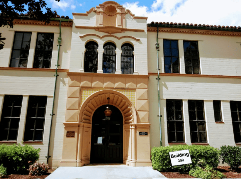
Fullerton Museum Center (301 N Pomona Ave): Fullerton’s first public library was an Andrew Carnegie-funded library built in 1907. Years of wear (and the 1933 earthquake) necessitated a re-building. In 1941, the Carnegie Library was demolished, and a new library was re-built by WPA workers. The building was dedicated in 1942. A new library (on Commonwealth) was built in 1973, and the Fullerton Museum Center has occupied the building since 1974.

Post Office (202 E Commonwealth Ave): The first federally-owned building in Fullerton, it was built in 1939 and funded by the Department of the Treasury, and built by crews of local workers. This post office also contains the mural “Orange Pickers” by Paul Julian, funded by the Treasury Department Section of Fine Arts. Paul Julian went on to have a very successful career at the Warner Bros. studios animating Looney Tunes shorts.
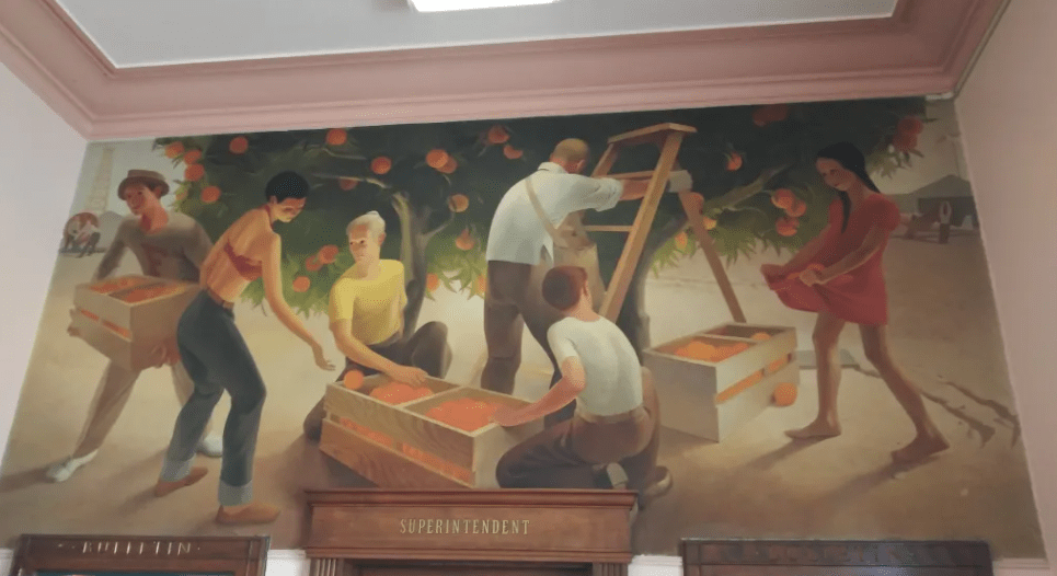
Police Station/Former City Hall (237 W Commonwealth Ave): The impressive Spanish Colonial Revival building is now home to Fullerton’s police department. Designed by architect George Stanley Wilson, the building was completed in 1942. One of the most distinctive features of the building is its extensive tile work.


“The History of California” Mural in the Police Station: A three-part mural for which the WPA’s Federal Art Project commissioned artist Helen Lundeberg to paint in 1941. The mural depicts everything from the landing of Juan Rodriguez Cabrillo in San Diego in 1542 to the birth of the aircraft and movie industries in Los Angeles in roughly chronological order. Here are some photos I recently took of the mural. Unfortunately, you have to make an appointment with the police department to see this public work of art:
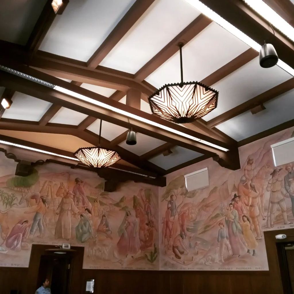
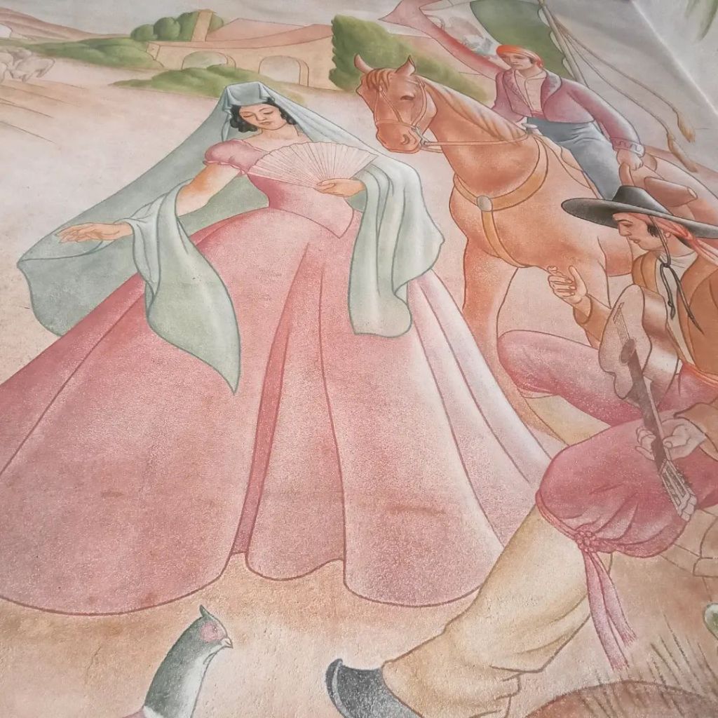


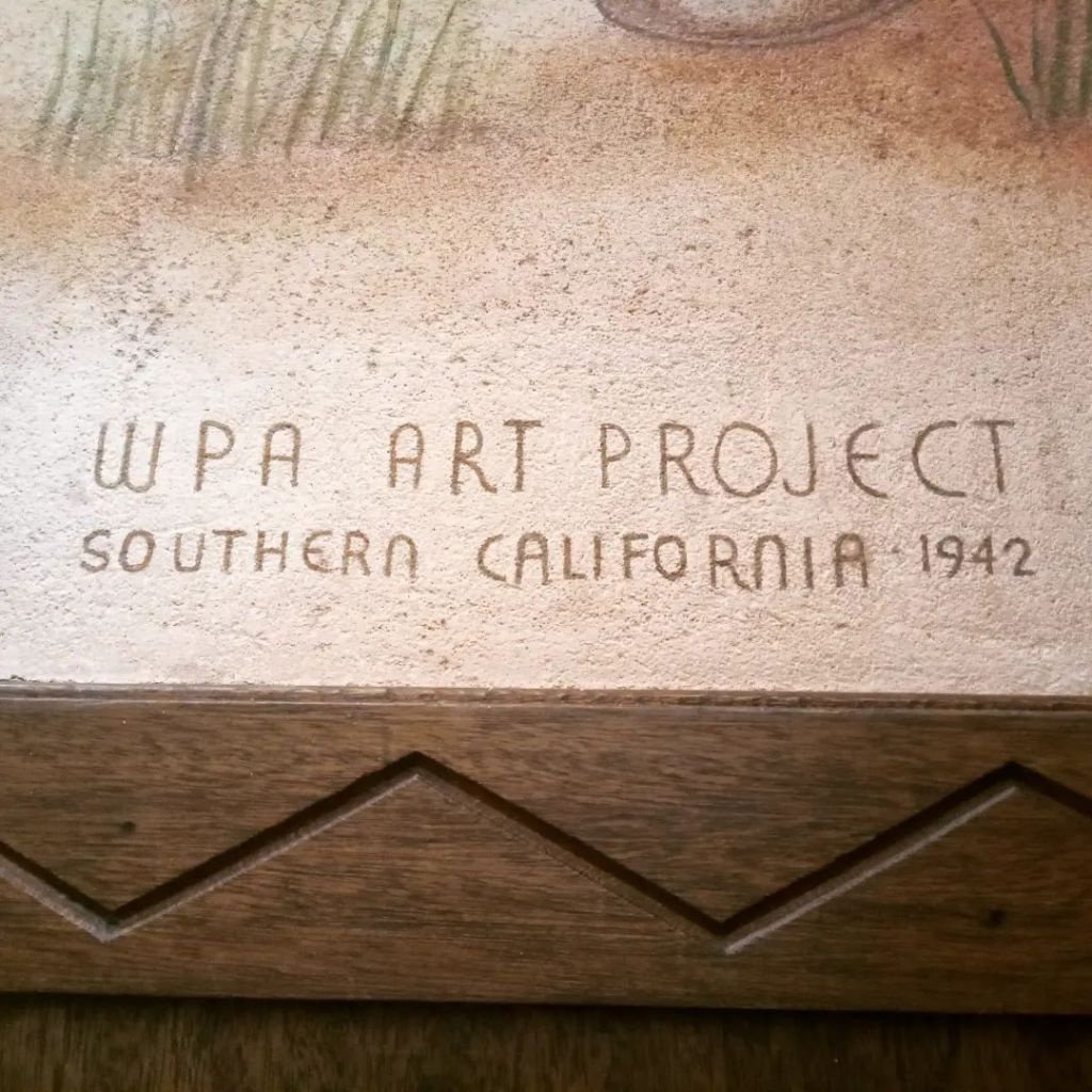
Hillcrest Park (1200 N Harbor Blvd): The amount of work done in Hillcrest Park during the New Deal was staggering, with projects being funded and constructed by the CWA, WPA, RFC, and SERA. Much of Hillcrest Park’s landscaping was done during this era, like the excavation of the “Big Bowl.” Perhaps the most iconic feature of Hillcrest Park is the Depression-era stonework that runs throughout the Park. Today, Hillcrest Park represents the finest example of a WPA-era park in Orange County and has enjoyed federal recognition since 2004, so the structures are safe.

Amerige Park (300 W Commonwealth Ave): A wooden grandstand and stone pilasters were built at the baseball field in 1934. The grandstand was destroyed by a fire in the 1980s, but the flagstone pilasters remain.

Pastoral California: The Story of a Mural
“Pastoral California,” the 75-foot long fresco mural on the side of the Auditorium at Fullerton Union High School was painted in 1934, during the Great Depression, painted over by order of the Board of Trustees in 1939, and restored 58 years later in 1997. The story of this mural, what it depicts, why it was painted over, and finally restored, is one worth reflecting upon.
In addition to building projects, the WPA also commissioned murals in cities across America, including Fullerton, in an effort to give people not just jobs, but a sense of hope and beauty in difficult times. Perhaps the most famous of these murals is “Pastoral California,” one of the two largest frescoes commissioned by the WPA.
Charles Kassler, who had studied art at Princeton, traveled extensively, and apprenticed under a fresco painter in France, completed “Pastoral California” in 1934. Kassler had only one hand. He’d lost the other in a high school chemistry accident. He was married to famous Mexican singer Luisa Espinel, who was the aunt of pop superstar Linda Ronstadt.
Kassler clearly did local history research before painting the mural. It depicts a Spanish/Mexican southern California. From the 1700s to 1821, California was controlled by Spain. From 1821 to 1848, it was controlled by Mexico. Around that time, the United States decided it was their “Manifest Destiny” to control California, so they took it through a war of conquest, the Mexican American War. Kassler, however, chose to depict not an Anglo-American California, but a Spanish/Mexican one.
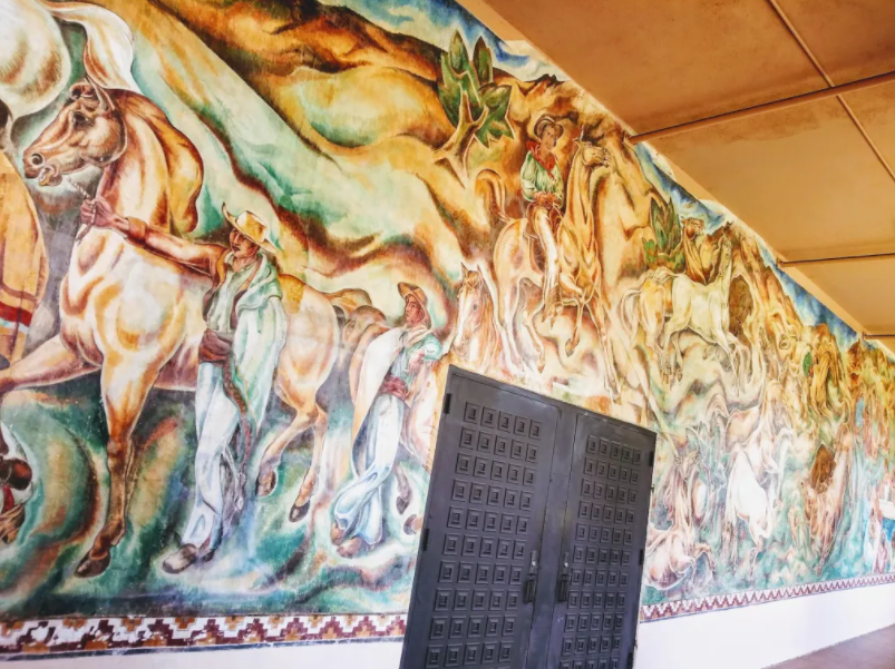
The mural depicts historical figures like Jose Antonio Yorba, a large landowner whom Yorba Linda is named after. In the background is Mission San Juan Capistrano. To the right is Pio Pico, the last Mexican governor of California. Most of the figures are Latinos doing everyday activities: washing clothes, riding horses, eating together.
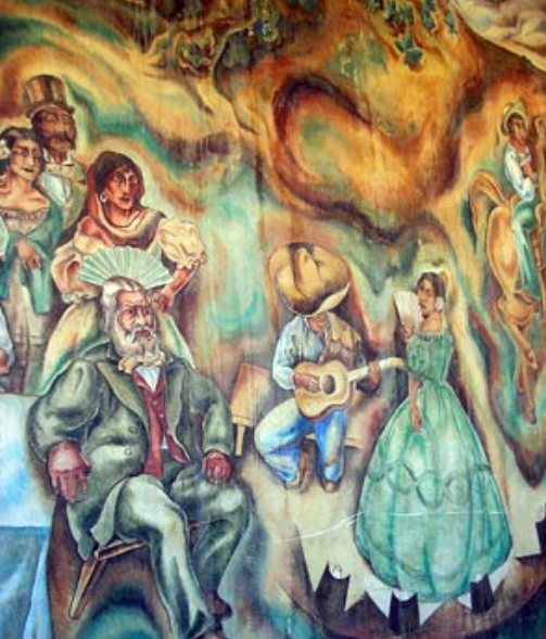
1930s LA art critic Merle Armitage praised the mural: “Kassler has adhered not only to the beautiful traditions of pastoral California, but at the same time has also borne in mind the splendid Spanish architecture, and, lastly, created a beautiful fresco of amazing vitality and freshness of viewpoint.”
Dr. H. Lynn Sheller taught English and History at Fullerton College in 1934, at the time “Pastoral California” was painted. “I watched him [Charles Kassler] put the mural up there,” Sheller recalled in an interview for the Fullerton College Oral History Program, “I would visit him day after day as he was working…the feature of a fresco is that the paint is mixed in with the plaster, thus it is supposed to be permanent.”
But not everyone was happy with Kassler’s mural.
An article from August 30, 1939 in the Fullerton News-Tribune entitled “High School Mural Doomed; Paint it Out, Trustees Order” reads:
“Fullerton Union high school’s much discussed and criticized mural which covers the outside west wall of the auditorium received its death sentence at the hands of district trustees last night who ordered the wall paint sprayed to cover the painting.
This mural is approximately 75 feet long by 15 feet high with its huge figures of horses and riders and other human forms depicting early California days has been a mooted [sic] point since its completion several [five] years ago by the artist Kassler as a federal art project.
Most occupants of the high school will shed no tears over the decision of the board; it was indicated today as the lurid colors and somewhat grotesque figures have apparently failed to capture popular fancy.”

C. Stanley Chapman, son of Fullerton’s first mayor, Charles C. Chapman, and a city council man himself, was one of the ones who “shed no tears.” In an interview for the Cal State Fullerton Oral History Program, Chapman said: “The [mural] down there at the school was almost as absurd [as the one in the post office]. They were painted by that WPA business and the painting did not go with the architecture of the school. It was a great relief when they did paint them out. They were not an artistic addition to the building by any means”
The college student interviewing Chapman replied that superintendent Louis Plummer disagreed with this assessment: “Mr. Plummer seemed to think they were nice although he did not say so. He simply quoted a long article from the Los Angeles Times art critic who said they were lovely and truly representative and that the colors were beautiful. Mr. Plummer ends that little discourse by saying, ‘and they were painted over,’ as though he was disappointed.”
Chapman repied, “Oh, yes, the colors were good. But I have forgotten what the theme was.”
The interviewer reminded him, “Mexican entertainment; with the horses, and the children playing.”
Chapman replied, “Oh, yes, Well, the colors were nice. I don’t know. I was never involved in the school board or anything like that.”
Why was the mural painted over? I have heard some speculate that it was because some of the women depicted in the mural had naked, exposed breasts. However, I have seen no evidence that there was any nudity in the mural. In the mural as it exists today, and in every photo I’ve seen, the women are clothed. Some of them have big breasts, but that hardly seems justification for painting over the whole mural.

“It wasn’t until we had a group of trustees in here who were negatively inclined, that it was painted over,” Sheller remembers. When asked why it was painted over, Sheller said, “Some people felt it was vulgar or gross in some way. It simply showed the Mexican women as they were probably attired at that time. They were very bosomy women. I don’t think that we would feel that there was anything wrong with it. I never felt there was.”
But others have a different view, one I believe makes more sense, given the social context of 1930s Fullerton.
“It was too Mexican, that’s why,” speculated Charles Hart, 75, who was a student at the high school and remembers the mural before it was covered up. “The school board didn’t want to leave the impression that this town was anything else but Anglos. Too extreme for them, I guess.”
Hart said this in a 1997 Los Angeles TImes article.
The decision to paint over this mural probably had to do with its subject matter. It celebrated Mexican culture at a time of heightened racism against Mexicans, and when Mexicans lived in segregated communities, attended segregated schools, and were often forcefully and illegally deported back to Mexico during the Great Depression.
I have written about this at some length in an article entitled “The Roots of Inequality: The Citrus Industry Prospered on the Back of Segregated Immigrant Labor.”
“Pastoral California” remained painted over for six decades years until, in 1997 it was restored, thanks to a massive community effort. I was actually attending Fullerton High School at the time. Some of my friends, art students, helped with the restoration. I remember thinking, even then: Why would anyone have painted over something so beautiful?
A Tale of Two Cities
In the 1920s, Fullerton experienced a housing boom, with numerous new subdivisions being built. With the advent of the Great Depression, much new construction stopped, leading to a housing shortage.
To help with the housing situation, the New Deal established entities like the Federal Housing Administration (FHA), which offered affordable home loans and other assistance to homeowners and home buyers.
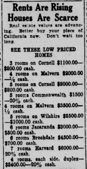
In the 1930s, Fullerton was really a “Tale of Two Cities” divided along racial lines. Most neighborhoods had racially restrictive housing covenants that prevented non-whites from renting our purchasing property.
There was really only one relatively small neighborhood–the Truslow/Valencia neighborhood where Latinos and African Americans could purchase homes.
The majority of Latinos living in Fullerton in the 1930s lived in citrus work camps. There was one near downtown at Balcom and Pomona (Campo Pomona), another one near Valencia Ave., and then there were several “colonias” (little communities) on the Bastanchury Ranch (that is, until the mass deportation of 1933).
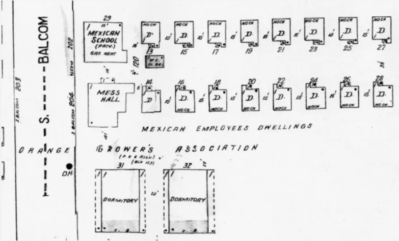
The presence of a large Mexican labor force in the Anglo-dominated towns of Orange County, including Fullerton, led to policies of segregation and second class citizenship for the Mexican workers and their families.
“Mexicans in citrus towns were invariably the pickers and packers; and consequently they were poor, segregated into colonies or villages, and socially ostracized, even though they were economically indispensable to the larger society,” historian Gilbert Gonzalez writes in Labor and Community: Mexican Citrus Worker Villages in a Southern California County, 1900-1950. “The class structure in rural areas has generally divided along lines of nationality. At the top, the growers, native-born white; at the bottom, the foreign-born migrants, or his or her children.”
Segregation and structural inequality also extended to education. In the camps, there were schools built exclusively for the Mexican children.
“Segregated schooling assumed a pedagogical norm that was to endure into the fifties and parallels in remarkable ways the segregation of African Americans across the United States,” Gonzalez writes. “By the mid-1920s, the segregated schooling process in the county expanded, matured, and solidified, was manifested in fifteen exclusively Mexican schools [throughout Orange County], together enrolling nearly four thousand pupils. All the Mexican schools except one were located in citrus growing areas of the county…Distinctions between Mexican and Anglo schools included differences in their physical quality.”
There were at least two “Mexican Schools” in Fullerton–one on the Bastanchury Ranch and another in Campo Pomona.
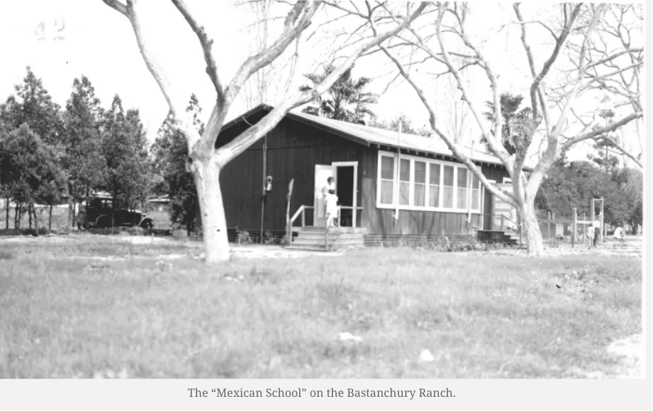

Unlike at the white schools, curriculum at the Mexican schools were generally limited to vocational subjects, and junior high was considered the end of schooling for most students, many of whom accompanied their parents in the groves and packinghouses.
One woman who taught at these segregated “Mexican Schools” was Arletta Kelly. In an interview for the CSUF Oral History Program, Kelly described her struggle to convince her colleagues that Mexican students had the same potential as whites.
“Some of my colleagues here would laugh at me and say, ‘Are you a wetback?’” she said.
In addition to educating children, teachers at the “Mexican schools” also taught “Americanization” classes to adults—to assimilate the workers to American society.
“Whereas the Americanization programs in the local villages appear unique, in reality they reflected a generalized expression for the eradication of national cultural differentiation across the United States,” Gonzalez writes.
Under the California Home Teachers Act of 1915, Americanization programs focused on the teaching of English.
Louis E. Plummer, superintendent of the Fullerton High School District, staunchly supported Americanization because in his view the persistence of “Little Italys, Little Chinas, Little Mexicos” stifled the development of a “homogeneous people.” In particular, the failure of Mexicans to live in a “model way” or as “first class citizens,” which was produced by “a hangover of lazy independence” made it imperative that rather than merely learning skills, Mexicans had to learn and live within the fundamental cultural norms of the United States. His perspective summarized much of the Americanization spirit in the larger community during the late 1800s and early 1900s.
“Many a surviving villager resident has not forgotten that in their youth the ‘Anglos never wanted to have anything to do with us except that we pick their oranges.’ Such was the nature of the dominant contours in the Mexican and Anglo social relations in the citrus towns,” Gonzalez writes.
Mass Deportation of Mexican Immigrants
With unemployment on the rise during the Great Depression, immigrants (as always) made a convenient scapegoat and there were calls to restrict immigration.
The Great Depression proved disastrous for the Bastanchury family, owners of “the largest orange grove in the world.” Unable to pay their debts, the Bastanchury Ranch went into receivership, and lost most of their property.
According to Druzilla Mackey, a teacher in the Mexican camp schools, “The American Community…felt that the jobs done so patiently by Mexicans for so many years should now be given to them. ‘Those’ Mexicans instead of ‘our’ Mexicans should ‘all be shipped right back to Mexico where they belong’…And so, one morning we saw nine train-loads of our dear friends roll away back to the windowless, dirt-floor homes we had taught them to despise.”

What she is referring to is a mass deportation of nearly all of the Mexican workers on the Bastanchury Ranch in the early 1930s. This deportation was part of a much larger deportation effort across the United States, which is described at length in the book Decade of Betrayal: Mexican Repatriation in the 1930s.
“Outside of the community, the Mexican became the scapegoat,” Gonzalez writes. “In 1931 and 1932, local and county governments caught up in the drive across the Untied States to deport Mexicans sought to cut budgets through repatriating Mexicans. Induced through threats of relief cutoff sweetened with an offer of free transportation, about 2,000 left Orange County.”
Many of those deported were actually American citizens. A few years ago, I had the privilege of interviewing Fullerton resident Manuel Rivas Maturino, who was born on the Bastanchury Ranch, and remembers the experience of “repatriation.”
“All of the Mexican camps on the ranch have been eliminated and all American labor is being used with 28 houses on the ranch now filled with regular employees, nearly all of whom have been continuously on the payroll since last April,” the News-Tribune reported in 1933. “Nine carloads of Mexicans, including 437 adults and children–mostly children–were deported from Orange county today to points on the Mexican border, where they were to re-enter their native country.”
Despite these mass deportations, local growers realized that they needed Mexican workers to harvest the orange crop, and so continued to utilize the labor of immigrants.
The 1936 Citrus War
Throughout the 1930s, many labor strikes occurred throughout California. Mrs. Reba Crawford Splivalo, state director of social welfare, told an audience of around 300 in the Fullerton high school auditorium in 1933: “I see in the sky the signs of rebellion. I am not crying ‘wolf, wolf.’ I am giving a warning. If the present economic situation is to survive the needs of the underprivileged must be met. Capital and labor must find a common meeting ground.”
In his book Endangered Dreams: The Great Depression in California, historian Kevin Starr writes, “Between January 1933 and June 1939, more than ninety thousand harvest, packaging, and canning workers went out on some 170-odd strikes.”
That was just agriculture. Major strikes in other industries, such as the 1934 West Coast waterfront strike, rocked California’s major coastal cities.
These strikes were massive and sometimes erupted into violent street fights between strikers and police. Late in 1934, streetcar workers in Los Angeles went on strike. Closer to home, dairy workers in Orange County went on strike.
Those organizing labor strikes were often accused of being communists.
In 1936, the sleepy agricultural towns of Orange County, including Fullerton, saw a labor strike unprecedented in its intensity–revealing long-simmering tensions.

“Warning to citrus growers that they might expect communistic activities in this district as soon as the valencia season opens and methods of combating the agitation was given by H.O. Easton, packinghouse manager, at the regular meeting of the chamber of commerce here yesterday,” the News-Tribune reported in 1935.
Easton argued that local cities should pass anti-picketing ordinances (Fullerton already had one).
“He told citrus growers that they should impress upon workers they hire that any agitation is the work of communists attempting to start trouble among men employed in this district,” the News-Tribune reported.
Special guards were requested to protect packinghouses.
The truth is that most rank-and-file workers were not communists. They just wanted better working conditions. However, some of the organizers were, in fact, communists.
“Charles McLauchlan of Anaheim, self-admitted worker in the interests of the communist party, was arrested late yesterday afternoon at Placentia by Chief of Police Gus Barnes and charged with violation of the city ordinance prohibiting distribution of circulars and handbills without a license,” the News-Tribune reported.
McLauchlan was accused of selling copies of the Western Worker, a labor newspaper, to Mexican citrus workers in Placentia. He was also selling copies of a booklet, The Fascist Menace in the U.S.A.
If the strike organizers were sometimes communists, the growers and the legal system that sided with them often acted like fascists, cracking down hard on those trying to organize to better their lot.
In 1935, there was talk of strike among the remaining Mexican workers, to improve pay and working conditions.
Ricardo G. Hill, Mexican consul at Los Angeles, addressed a crowd of 2,500 Mexican workers in Anaheim, urging them not to strike, and to wait until next picking season to attempt to form a union. Earlier in the day, Hill had met with local packinghouse managers who “said they would not recognize the rights of the Mexican pickers to organize and demand a minimum wage of $2.25 a day and that managers threatened to import Filipino workers to Orange County to do the work, if necessary.”
It’s ironic, though not surprising, that growers and packinghouse managers opposed worker efforts to organize for better wages and working conditions because organizing for a better return was exactly what the growers and packinghouses did. They pooled their resources in the form of the California Fruit Growers Exchange (or Sunkist) to fix prices and make the most money.
In his 1972 USC doctoral dissertation entitled The Orange County Citrus Strikes of 1935-1936: The Forgotten People in Revolt, Louis Reccow called it, “the largest and most violent citrus strike of the depression.”
In March strike leaders sent the growers of Orange County two lists of demands calling for better pay and working conditions as well as union recognition–demands which the growers ignored.
On June 11, as many as 2,500 workers went on strike.
The Fullerton News-Tribune characterized the strike leaders as outside agitators and communists. Police officers were organized to “protect” those who wanted to work from “threats of agitators.”
Sheriff Logan Jackson deputized hundreds of men. The American Legion and Veterans of Foreign Wars pledged their assistance to police and the growers.
During the strike, pickers who did not participate were escorted to work by armed guards.
“Police, deputy sheriffs and specially recruited deputies of police, sheriff and constables were in the field this morning keeping a constant watch for appearance of agitators,” the News-Tribune reported.
“Scab” crews and white students were hired to pick the oranges.
“From Placentia high school and Fullerton district junior college, scores of youths went today to orchards to take the place of the strikers,” the News-Tribune reported.
The first instance of “violence” occurred in Anaheim when striker Virginia Torres bit a police officer on the arm.
“Two hundred angry Mexican women spurned on the citrus picker’s strike today as the first riot call of the strike sent a score of officers into Anaheim early this morning to quell a disturbance led by the women,” the News-Tribune reported.
Torres and others were arrested.
Elsewhere, in Brea, strikers were arrested on flimsy grounds ranging from traffic violations to trespassing.
Charles McLaughlan was arrested on trespassing charges in the Mexican worker camp on Balcom in Fullerton. Not long after McLauchlan’s arrest, some striking orange pickers were evicted from their homes in the worker’s camp.
Conflict between strikers, scabs, and law enforcement sometimes flared into violence.
“During the month of July [1936], northern Orange County experienced a kind of civil war,” Reccow writes. “Increased picketing, violence, armed deputies by the score, vigilante attacks, mass arrests and trials, shoot-to-kill orders, calls for State interference, along with California State Federation of Labor and federal government involvement–all contributed to the situation.”
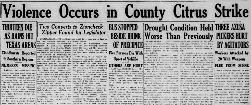
“With violence reported in several sectors of the citrus strike area of Orange county and with three Mexican pickers from Azusa in county hospital with a stab wound, lacerated face and smashed teeth, respectively, peace officers throughout the county and orange grove owners and packinghouse officials promised the future would find all picking areas guarded with sawed off shotguns and other weapons,” the News-Tribune reported.
“All Orange country was under heavy guard today as Sheriff Logan Jackson, following yesterday’s violence, began deputizing 170 additional special deputies to protect every picking crew and packinghouse in the county,” the News-Tribune reported.
The increased police presence did little to quell the conflict. In one day at the height of the strike, 159 Mexican strikers were arrested on charges of “rioting.”
As conflict and occasional violence continued, Sheriff Jackson issued a “Shoot to Kill” order to his men.
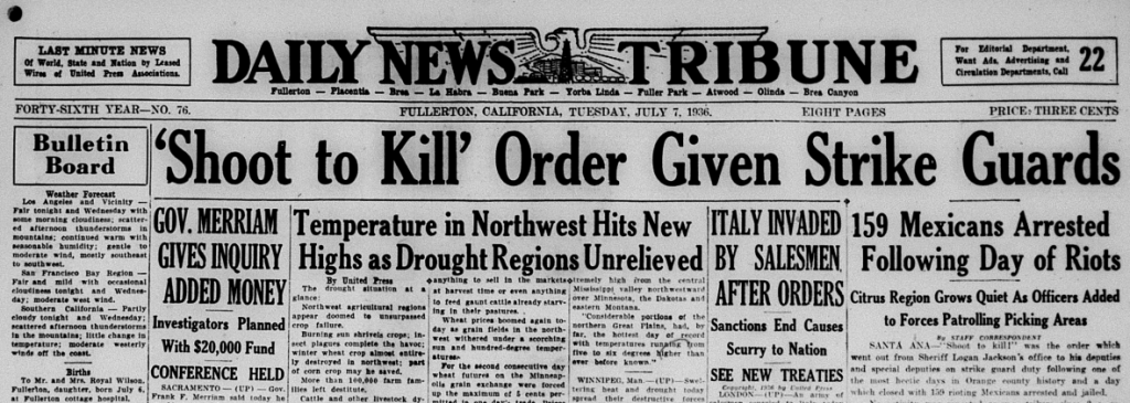
“New special deputies were being added rapidly to the sheriff’s office staff, which numbers 300 to 400 now, and 20 more California highway patrol officers were rushed here today from Los Angeles county to be added to 35 or 40 already on duty,” the News-Tribune reported.
In La Habra, 40 or 50 families were evicted from their homes on ranch property for participating in the strike.
In the conflict, the strikers had weapons like rocks and clubs. The police had tear gas guns, hand grenades, rifles, and shotguns.
Sometimes the police would arrest and jail Mexicans before any crime occurred.
“A strange parade it was from Placentia ave, at Pointsettia, near Anaheim, yesterday afternoon as California highway patrolmen and the sheriff intercepted 19 carloads of Mexicans, more than 100 in all, who said they were going to Orange for a meeting,” the News-Tribune reported. “The parade, enlarged by five more carloads intercepted in a neighboring road, ended at the jail.”
On July 8 the 119 Mexicans arrested on rioting charges were arraigned in the open courtyard behind the Fullerton courthouse under heavy guard from state highway patrol officers and deputy sheriffs armed with sub-machine guns and sawed off shotguns.
A couple weeks later this large group was again transported to Fullerton.
“The Odd Fellows Temple, selected by law officials as the site of the hearing for security reasons, soon resembled an armed fortress. Men armed with submachine guns, riot guns, revolvers, and clubs guarded all exits and entrances,” the News-Tribune reported.
Part of the reason the strike continued was because of the growers’ insistence that the strike was not a result of legitimate grievances, but rather part of some nefarious communist plot.
“Dr. W.H. Wickett of Fullerton, a member of the publicity committee of the growers organization, said today that the growers have definitely learned that the strike is not a walkout merely for the betterment of pickers but is directed and abetted by communist headquarters for the purpose of fomenting strife in the interests of communism,” the News-Tribune reported.
In fact, the workers’ demands, which were publicly sent to the growers well before the strike, had nothing to do with communism, and everything to do with improving pay and working conditions.
Whether growers like Wickett actually believed the strikers represented a communist threat or they were simply seeking to tarnish the strikers so as to avoid having to treat their workers better, is hard to say.
It wasn’t just the police who sought to disrupt and end the strikers’ activities. Vigilante activity also occurred.
“Wild disorder, repetition of which was promised for tonight at the same place, broke out last night about 9:15pm, near Santa Fe ave. and Melrose in the center of Placentia as 40 Americans of a vigilante committee swooped down upon a Mexican gathering and with guns, clubs and a score of tear gas bombs sent them scattering in ever direction,” the News-Tribune reported. “Reports…stated 20 to 30 Mexicans and a few of the white men were injured, cars were smashed and other damage done. Several Mexicans among the group, who had gathered on the Luis Varcas handball court for a meeting told officers they definitely recognized ‘Stuart Strathman as the supposed leader of the raid.’”
Strathman was a leading representative of the growers and packinghouses, with an office at the Chamber of Commerce.
No arrests or charges were made against any of the vigilantes.
Eventually, an agreement between the strikers and growers was reached–insuring higher wages and a few other benefits, but not union recognition.
Charges against all but 13 of the strikers charged with rioting were dismissed. Of those, 10 were found guilty and faced fines and imprisonment.
Reflecting on the strike, Reccow writes, “The strike offers a classic study in the use of anti-strike tactics: the deputizing of hundreds of growers, blacklisting, the eviction of workers from company homes, the cries that agitators and communists were responsible for the strike, vigilante attacks, the strict enforcement of an anti-picketing ordinance, the jailing of large numbers of strikers and the deportation of alien Mexican workers.”
Journalist Carey McWilliams wrote, “No one who has visited a rural county in California under these circumstances will deny the reality of the terror that exists. It is no exaggeration to describe this state of affairs as fascism in practice.”
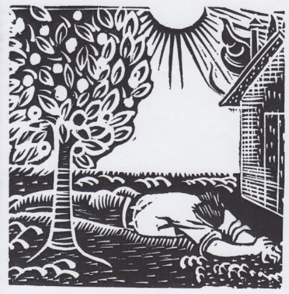
A Socialist for Governor?!
In the midst of economic hard times and labor agitation, noted author and socialist Upton Sinclair ran for governor of California. Sinclair, most famous for his 1905 novel The Jungle, which portrayed the filthy and inhumane conditions of the meatpacking industry, had spent his life writing numerous books highlighting various injustices and corruption in American life.
Sinclair had moved to Southern California in 1916 and, in addition to writing, also involved himself in politics, running for congress twice (in 1920 and 1922) as a Socialist. He founded California’s chapter of the American Civil Liberties Union (ACLU).
In 1934, he decided to run for governor of the Golden State, this time as a Democrat. He won the party’s nomination and faced off against Republican Frank Merriam. Sinclair’s program was called End Poverty in California (or, EPIC). He wrote a pamphlet called I, Governor of California, and How I Ended Poverty, which laid out his plans and was widely distributed.
During the campaign, Sinclair came to Fullerton and spoke before a crowd of over 1,200 in the FUHS auditorium. Today, Sinclair sounds a lot like Bernie Sanders.
“The trouble in America,” Sinclair began, “is that privilege entrenched itself in government and society and brought a condition where two percent of the people control 50 percent of the wealth. Wall Street tricks to control American finance by piling up wealth on one side and beating down wealth on the other made bums of twenty or thirty million people…”
Sinclair was particularly outraged with the practice of large agricultural interests destroying “surplus” crops to keep prices up.
“Limitation of production or the destruction of food or other wealth while millions of people are in need is the very apex of economic insanity,” Sinclair said.
This practice of destroying food for the benefit of big business while people starve is what gave the title to John Steinbeck’s 1939 novel The Grapes of Wrath, about farmworkers in California during the Great Depression:
“There is a crime here that goes beyond denunciation. There is a sorrow here that weeping cannot symbolize. There is a failure here that topples all our success. The fertile earth, the straight tree rows, the sturdy trunks, and the ripe fruit. And children dying of pellagra must die because a profit cannot be taken from an orange. And coroners must fill in the certificate- died of malnutrition- because the food must rot, must be forced to rot. The people come with nets to fish for potatoes in the river, and the guards hold them back; they come in rattling cars to get the dumped oranges, but the kerosene is sprayed. And they stand still and watch the potatoes float by, listen to the screaming pigs being killed in a ditch and covered with quick-lime, watch the mountains of oranges slop down to a putrefying ooze; and in the eyes of the people there is the failure; and in the eyes of the hungry there is a growing wrath. In the souls of the people the grapes of wrath are filling and growing heavy, growing heavy for the vintage.”
The backbone of Sinclair’s plan of ending poverty in California involved giving unemployed workers access to the means of production and letting them produce for themselves.
“The program…will offer land colonies and factories to the unemployed and a distributing system where the people can buy necessities at cost and thereby eliminate the middle man,” Sinclair said. “It will make production for and equal to consumption because the unemployed will produce for themselves only and will make the million in the state now leaning on charity self-supporting.”
The EPIC plan also called for a remedy to economic inequality through a revised and graduated tax system, with higher taxes on the wealthy.
Sinclair was clearly on the side of the workers. Meanwhile, the Republican Frank Merriam was on the side of business.
As is documented in his book I, Candidate for Governor, and How I Got Licked, despite his popularity, Sinclair faced formidable opposition from big business and mainstream media (including Hollywood), who ran a well-funded smear campaign against him.
The Fullerton Daily News-Tribune ran numerous articles and editorials portraying Sinclair as a dangerous radical who would bring ruin to California.
The California Real Estate association, unsurprisingly, came out against Sinclair, as did the Orange County Democratic party (just like the national Democratic Party did with Bernie Sanders in 2016).
Meanwhile, local leaders organized a parade in Merriam’s honor. And the Tribune published numerous articles which painted Merriam in a very positive light. Ultimately, Merriam defeated Sinclair. Poverty would, unfortunately, not end.
Those elected to Fullerton City Council throughout the 1930s were wealthy, white businessmen who tended to favor the status quo over any radical program proposed by Sinclair.
They were Billy Hale (orange grower), Ted Concoran (paper company owner), Thomas Gowen (rancher), Harry Maxwell (real estate developer), George Lillie (orange grower), Hans Kohlenberger (factory owner), Walter Muckenthaler (orange grower), Olie Cole, Carl Bowen, and William Montague.
It would be decades until a woman or person of color was elected to Fullerton City Council.
What Fullerton Needs Now is a Drink
Prohibition, which was enacted in 1919 with the ratification of the 18th amendment, was nearing its end. It would be repealed in 1933 by the 21st amendment. Prior to that, the Wright Act, which provided state enforcement of prohibition, was repealed by voters. Fullerton, being Fullerton, kept its local ordinances making alcohol illegal.
Even prior to the repeal, congress passed a law permitting the sale of beer with an alcohol content of 3.2 or less.
Things played out a bit contentiously in Orange County. After the passage of the Beer law, the OC District Attorney declared alcohol still illegal under a county ordinance.
“Orange county remains bone dry, regardless of the new beer bill passed by congress, District Attorney S.B. Kaufman declared in a formal opinion today,” the News-Tribune reported. “The county still had a dry ordinance and because the new beer law allowed for local control…Meanwhile, LA county board of supervisors repealed their local ordinance, thus allowing beer.”
The battle between “wet” and “dry” supporters played out locally, as Fullerton City Council considered rescinding its dry ordinance. City Council declined to take a position on the contentious matter, instead putting it to a vote of the people, who decided they needed a drink.
In short order, some Fullerton businesses began selling beer.

And with the passage of the 21st amendment, Prohibition was over.
Entertainment and Sports
To escape the troubles of life, folks went to movies at the Fox Theater.
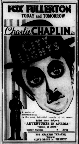
In 1931, Fullerton hosted its first Jacaranda Festival, showing off the purple flowers of the trees that still line Jacaranda Dr. and other streets. The Festival included a pageant at the high school with a cast of 300.

In 1934, Fullerton celebrated a Valencia Orange Festival, which drew 40,000 attendees.
Locals got some excitement in 1935 when the baseball movie “Alibi Ike” starring Joe E. Brown was filmed at Commonwealth Park.
Baseball games at Commonwealth (now Amerige) Park were hugely popular. The Portland Beavers did their spring training there.
In 1937, African American Fullerton author Ruby Berkley Goodwin published a book of dramatic sketches based upon Negro spirituals, in collaboration with composer William Grant Still, whose “Afro-American Symphony” was the first to be published by an African American.
In 1938, hometown hero Arky Vaughn, a professional baseball player, played a special benefit game at Amerige Park. He hit a home run!
Fullerton celebrated its 50-year anniversary with a huge three-day program, including “a colorful historical pageant including a cast of approximately 1,000 residents” which took place in the FUHS stadium and auditorium.

In addition to the pageant and baseball games, there was a coronation ball for the Golden Jubilee queen and “Miss Columbia,” Pearl McAulay Phillips and Mary Catherine Morgan.
The pageant, called “Conquest of the Years” featured scenes from local history, from Native Americans to the expedition of Don Gaspar de Portola, Spanish/Mexican hacienda days, Basque sheepherders, the appearance of town founders the Amerige brothers, to the first buildings, schools, and churches built.
“Conquest” feels like an appropriate sentiment for how Americans at this time saw their place in history. They were the latest proud beneficiaries of a series of conquests. Today, some Americans view this aspect of our history with ambivalence, perhaps not wanting to highlight the “conquest” part. But that is, unfortunately, the best way to describe how the US came into possession of so much land, which had previous owners.
Social clubs were popular in Fullerton, including Rotary, Kiwanis, Lions, Business and Professional Women’s Club, Fullerton Junior Chamber of Commerce, American Legion, 20-30 club, Ebell Club, YMCA, YWCA, Masons, Odd Fellows, and more.
